Download
3D Flyover
Add to list
More
36.1 km
~2 days
425 m
Multi-Day
The Nootka Island Trail is a 36.1 km trail that starts in Area A (Kyuquot/Nootka/Sayward), Strathcona Regional, British Columbia. Based on our data, the hike is graded as Easy. For information on how we grade trails, please read measuring the difficulty of a hiking trail on hiiker. Also, check our latest community posts for trail updates. This hike can be completed in approx 7 hrs 55 mins. Caution is advised on trail times as this depends on multiple variables. For more info read about how we calculate hike time.

Surfaces
Unknown
Ground
Frequently asked questions
How long does it take to hike the Nootka Island Trail?
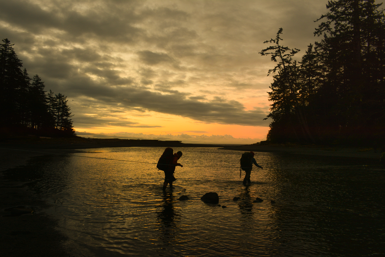
The Nootka Island Trail is 36.07 km long, and most backpackers allow about 4 to 5 days to complete it as a one-way coastal trip. The route is not especially long on paper, but progress can be slow because of beach travel, tidal timing, and rough shoreline sections around places like Calvin Falls, Beano Creek, and Friendly Cove.
Where do you start and finish the Nootka Island Trail?
The Nootka Island Trail is usually hiked between Louie Bay in the north and Yuquot, also known as Friendly Cove, in the south. Access is typically by floatplane, water taxi, or boat from places such as Gold River or Tahsis, because the trailheads are not reached by road.
Is the Nootka Island Trail difficult?
The Nootka Island Trail is listed at 36.07 km with 371 m of elevation gain, so the climbing itself is modest for a multi-day route. In practice, the challenge comes more from coastal terrain, including slippery rocks, mud, ladders, creek crossings, and sections that are safest or only practical at lower tides, so it often feels harder than the elevation profile suggests.
What is the best time of year to hike the Nootka Island Trail?
The usual hiking season for the Nootka Island Trail is May through September, when daylight is longer and coastal weather is generally more favorable. Even in summer, conditions on Nootka Island can change quickly, and tides matter on several sections, so timing the trip around both weather and tide windows is important.
Can you camp on the Nootka Island Trail?
Yes. The Nootka Island Trail is a multi-day route with established backcountry camping areas commonly used at places such as First Beach, Skuna Bay, Calvin Falls, and Beano Creek. Camping is part of the standard itinerary, since the trail is 36.07 km long and access points are remote.
Are dogs allowed on the Nootka Island Trail?
Dog rules for the Nootka Island Trail are not as clearly published as they are for many frontcountry parks, and the route crosses remote coastal terrain and Indigenous reserve lands near Yuquot. Because access and land-management conditions can change, dog access should be confirmed with the relevant local operators or land managers before travel rather than assumed.
Comments and Reviews
User comments, reviews and discussions about the Nootka Island Trail, British Columbia.
4.67
average rating out of 5
6 rating(s)