
Download
3D Flyover
Add to list
More
34.2 km
2 days
999 m
Multi Day
“A valley walk that deepens into thunderous waterfalls, hanging glaciers, and Mount Robson’s awe-filled north face.”
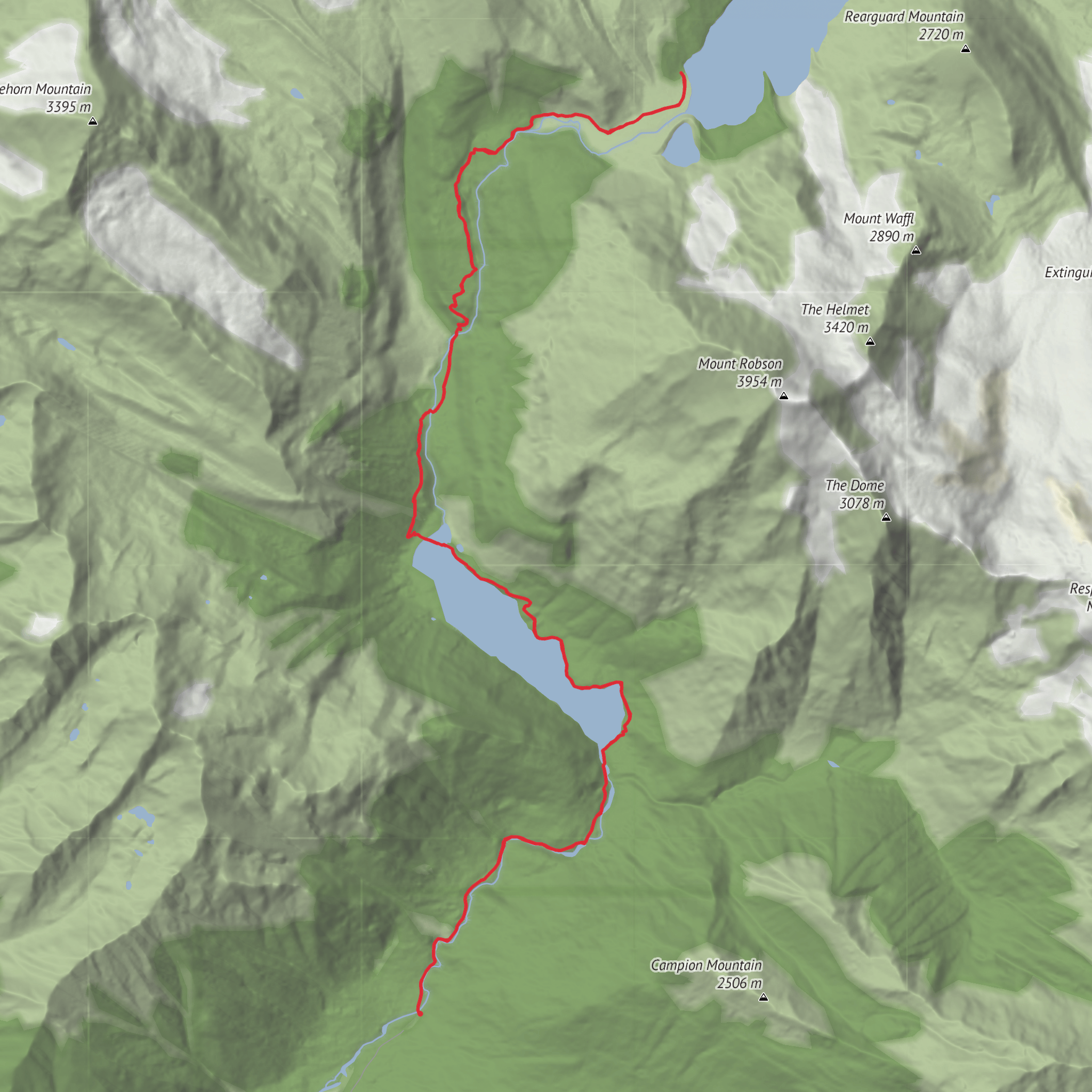
This classic Mount Robson outing follows the Robson River deep into one of the most dramatic valleys in the Canadian Rockies, building from an easy forest-and-lakeshore approach into a bigger alpine corridor of waterfalls, hanging glaciers, and enormous north-face mountain scenery. For a hike of around 34 km / 21 miles with roughly 1,000 m / 3,280 ft of elevation gain, it is often rated medium, but that rating depends heavily on whether you are doing it as a long day hike, an overnight, or a shorter out-and-back to one of the lower landmarks. The trail begins at the Berg Lake Trailhead at the end of Kinney Lake Road, near the Mount Robson Welcome Centre on Yellowhead Highway 16 in Mount Robson Provincial Park, British Columbia. BC Parks identifies the trailhead as being at the end of Kinney Lake Road near the park entrance and Welcome Centre. (bcparks.ca)
The opening kilometres are straightforward and well defined, making it easy to settle into a rhythm. From the trailhead, the route heads through cedar-hemlock and mixed mountain forest toward Kinney Lake, one of the first major landmarks at roughly 7 km / 4.3 miles. This lower section is the gentlest part of the route and is where many hikers get their first broad views back toward Mount Robson’s massive profile. The lake itself is a good early turnaround point for shorter hikers, but for anyone continuing farther, it marks the transition from a relatively mellow valley walk into a more committing mountain trail. Official and park mapping place Kinney Lake early on the route before the trail continues toward Whitehorn and the upper valley. (nrs.objectstore.gov.bc.ca)
What the route feels like
Beyond Kinney Lake, the trail becomes more scenic and more serious. The valley narrows, the grade becomes more sustained, and the route enters the famous Valley of a Thousand Falls, where side streams pour off cliffs and snowfields high above. This is where the hike starts to feel much bigger than its raw distance suggests. Expect a mix of rooty tread, rocky sections, and damp ground, especially after rain. The climb is not usually relentless in the way a steep summit trail is, but it is steady enough that pacing matters.
Around 11 km / 6.8 miles, the trail reaches the Whitehorn area after crossing the Robson River on a suspension bridge. Farther on, hikers encounter a string of major waterfall viewpoints including White Falls, Falls of the Pool, and the especially memorable Emperor Falls, where spray, noise, and cliffside exposure create one of the most dramatic moments on the entire route. These landmarks are consistently noted on park maps and route descriptions for the corridor. (nrs.objectstore.gov.bc.ca)
As the trail continues higher, the forest begins to open and the scenery shifts toward subalpine terrain. The upper valley delivers the signature views people come for: glacier-fed water, broad gravel flats, and the immense north face of Mount Robson, the highest peak in the Canadian Rockies. Near Berg Lake, the setting becomes distinctly alpine, with the lake sitting below ice and rock walls that often calve small bergs into the water, which is part of how the lake earned its name. The official geographical naming record notes the association with icebergs floating in the lake. (apps.gov.bc.ca)
Landmarks, nature, and wildlife
The scenery changes in layers rather than all at once. Lower down, expect dense forest, river noise, and occasional openings toward the valley walls. Around Kinney Lake, the water often reflects the surrounding peaks in calm conditions. In the middle section, waterfalls dominate the experience, especially during snowmelt and after wet weather. Higher up, the terrain feels colder, broader, and more glacial, with moraine-like features, braided watercourses, and long views toward icefields and cliffs.
Wildlife is one of the reasons hikers need to stay alert here. Mount Robson Provincial Park is home to black bears, grizzly bears, moose, mountain goats, and smaller mammals, and the Berg Lake corridor passes through prime habitat. That means food storage rules, clean camp habits, and noise awareness matter if you are staying overnight. Even on a day hike, it is wise to scan ahead on brushy corners and near berry patches. Weather can also change quickly in this valley; a warm start near the trailhead can turn into cold wind and rain higher up, and snow is possible in shoulder seasons. BC Parks also notes that the trail has undergone major rebuilding after severe flood damage, so hikers should always check current conditions and route updates before departure and carry offline navigation in HiiKER. (bcparks.ca)
Historically, this is one of the iconic mountain travel corridors in western Canada. Mount Robson Provincial Park was established in 1913 and is
AI Planner
Days planned around your pace, with somewhere to stay each night.
Surfaces
Ground
Unpaved
Unknown
Wood
Comments and Reviews
User comments, reviews and discussions about the Berg Lake Trail, British Columbia.
average rating out of 5
0 rating(s)

