Download
3D Flyover
Add to list
More
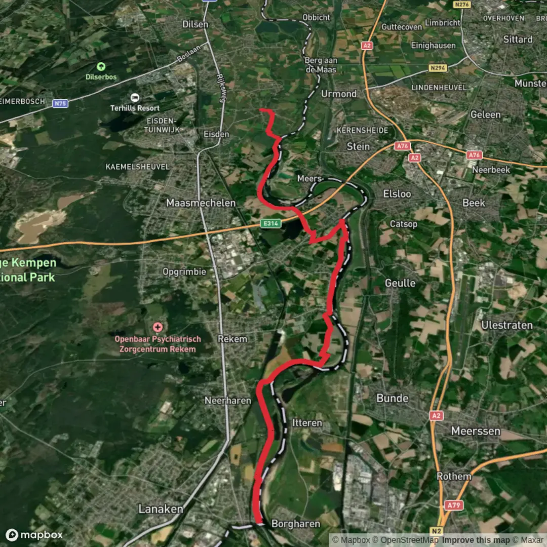
18.5 km
~3 hrs 42 min
0 m
Point-to-Point
“A big-sky Meuse floodplain wander of dikes, gravel lakes and rewilded paths—wind and mud may linger.”
Expect an almost perfectly flat, waterside ramble through the Meuse (Maas) floodplain landscape on the Belgian–Dutch border, with long open views, big skies, and a patchwork of gravel lakes, old river arms, willow scrub, and riparian woodland. At ~18 km (about 11.2 miles) with roughly ~0 m / ~0 ft of climbing, the effort level stays low; what makes the day “feel” longer is wind exposure on the dikes and the slower pace you’ll naturally take when the ground turns sandy, muddy, or tussocky in the wilder sections.
Getting to the start (car + public transport)
Because your start point is listed only as “near”, the most practical, well-known access for this landscape is via Leut (Maasmechelen, Belgian Limburg)—the village most commonly used as a gateway to Maesbempder Greend and the Meuse valley walks. A reliable landmark to aim for is Leut Church (Sint-Pieterskerk area / Kerkplein, Leut, 3630 Maasmechelen), which puts you close to the dikes and the roaming reserve. (If you’re building the route in HiiKER, place your start pin around Leut village center and adjust to the nearest trail/dike access.)
- By car: Drive to Leut (3630 Maasmechelen, Belgium) and park in/near the village center (look for signed public parking areas around Kerkplein/near the church). From there you can walk straight out to the river dikes within minutes.
- By public transport: Regional buses serve Leut (stop commonly shown as “Leut Kerk” on local line maps). From the stop, you’re already in the right place to begin the dike and floodplain network—no taxi needed.
What the terrain is like (and why “easy” still needs planning)
Most of the distance is on dike-top paths, farm tracks, and compacted gravel, so it’s straightforward walking with minimal elevation change. The “wild card” is the Maesbempder Greend / Mazenhoven roaming area, which is intentionally less structured: you may encounter unmarked, braided footpaths, short grassy sections, and occasional wet patches depending on season and river levels. Use HiiKER to keep your line clean through the roaming zone and to avoid accidentally drifting onto dead-end animal tracks.
Footwear: in dry spells, trail runners are fine; after rain or during high-water seasons, waterproof shoes/boots make the day much more comfortable because floodplain soils can hold water and turn slick.
The walk: river dikes, gravel lakes, and “rewilded” floodplain
From Leut you’ll quickly pick up the Meuse/ Maas corridor, where the river has shaped a broad floodplain for centuries. The first few kilometers (roughly 3–5 km / 1.9–3.1 mi) tend to feel very open: long straight dike lines, reeds and rough grassland below you, and frequent glimpses across to the Dutch side.
As you arc toward Maesbempder Greend, the scenery becomes more water-dominated. This area includes large and small gravel-pit ponds—reminders of historic gravel extraction—now reclaimed by nature with reedbeds, willow fringes, and clearings of herb-rich grassland. You’ll often see anglers’ spots and quiet bays, plus the telltale “stepped” shorelines of former quarrying.
A highlight is the sense of moving through a living floodplain system: old Meuse river arms (abandoned meanders), side channels, and low basins that can look completely different from one month to the next. In wetter periods, some low paths may be partially flooded; in drier periods, you’ll notice exposed gravel and sand bars.
Wildlife and what to look out for
This stretch of the Meuse valley is managed to keep the landscape dynamic and biodiverse, and it shows.
- Large grazers: In and around Maesbempder Greend/Maaswinkel you can encounter free-roaming Konik horses and Galloway cattle used for extensive grazing. Give them space, don’t try to pass between animals, and keep dogs leashed.
- Birdlife: Expect a strong mix of reedbed and scrub birds. Kingfishers are possible along suitable banks, and sand martins may use exposed riverbanks in places. In winter, the ponds and river attract more waterfowl.
- Beavers and wetland signs: This broader Maaswinkel–Maesbempder Greend floodplain is known for wetland habitat;

Surfaces
Asphalt
Dirt
Unknown
Gravel
Concrete
Unpaved
Comments and Reviews
User comments, reviews and discussions about the Meuse and Maesbempder Greend, Belgium.
average rating out of 5
0 rating(s)