
Download
3D Flyover
Add to list
More
179.0 km
9 days
4858 m
Multi Day
“A rewarding cross-country ramble through ravines, ridges, castles, and vineyards, with frequent steep surprises.”
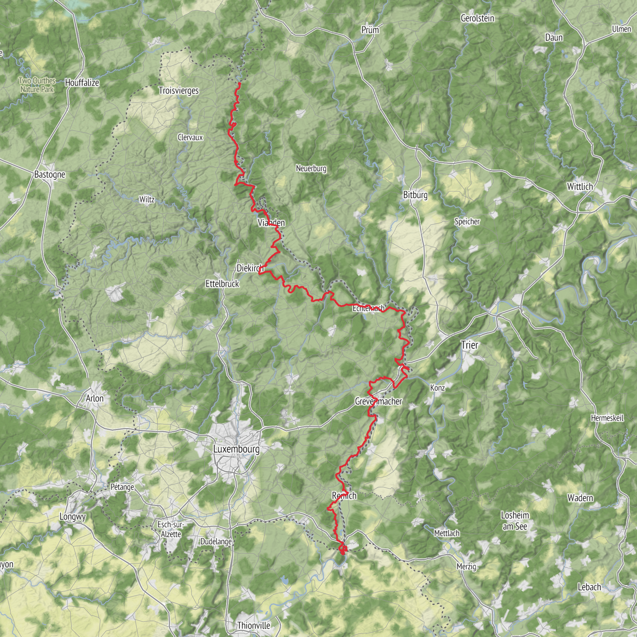
This Luxembourg section of the E2 is a medium-difficulty long-distance crossing of roughly 179 km (111 miles) with about 4,900 m (16,076 ft) of total ascent, linking some of the country’s most varied landscapes: the high Ardennes in the north, the deeply cut river valleys around Vianden, the wooded central uplands, the sandstone ravines of the Mullerthal, and the gentler vineyard country near the Moselle. The route is part of the wider E2 European long-distance path, which crosses Luxembourg on nationally waymarked trails rather than on a single isolated footpath. (en.wikipedia.org)
The northern end is generally associated with Ouren and the Monument de l’Europe at the Three Borders point, where Luxembourg, Belgium, and Germany meet, making that monument the nearest major landmark for the trail’s northern approach. Southbound, the route is commonly tied to Schengen on the Moselle, near the European Museum Schengen / Place de l’Europe area, one of Luxembourg’s best-known symbolic border landmarks. Because the E2 in Luxembourg follows existing national and regional trails, exact stage starts can vary slightly depending on the GPX you use in HiiKER, but those two places are the most practical reference points for planning transport and logistics. (hikeload.com)
Expect a route that feels more demanding than the “medium” label may suggest if you are not used to repeated short, steep climbs. The total distance is moderate for a multi-day trek, but Luxembourg’s terrain creates constant up-and-down walking rather than long flat cruising. Daily stages of about 20 to 30 km (12 to 19 miles) are realistic for many hikers, though the hillier northern and eastern sections can feel slower than the mileage suggests. Forest tracks, rural lanes, rocky paths, riverbank trails, and occasional village connectors all appear along the way. (visit-eislek.lu)
Terrain, pacing, and what the walk feels like
In the Éislek region of northern Luxembourg, the trail has a more rugged character. Around Ouren, Clervaux, Kautenbach, and Vianden, the landscape is shaped by the Ardennes: wooded ridges, narrow valleys, and frequent elevation changes. This is where much of the route’s climbing is concentrated, and where hikers should be prepared for muddy ground after rain, rooty woodland sections, and longer ascents out of river valleys. Kautenbach is especially useful as a planning point because it is a known hiking hub in Luxembourg’s trail network. (visit-eislek.lu)
Farther south and east, the route becomes more varied rather than easier. The Mullerthal section introduces Luxembourg’s famous “Little Switzerland” scenery, with sandstone outcrops, narrow rock passages, mossy forest, and stream-cut ravines. Footing can become uneven here, and progress often slows despite modest distances. In wet or leaf-covered conditions, these rocky sections deserve extra care. (visitluxembourg.com)
Approaching the Moselle near Schengen, the trail softens into a more open landscape of vineyards, river views, and milder gradients. This final stretch can feel noticeably less enclosed than the forested north and east, and in warm weather it may also feel hotter because of greater sun exposure on open slopes and valley edges. (visitluxembourg.com)
If you are planning the hike in stages, HiiKER is the best place to check the exact line of the route, stage breaks, and nearby services. For preparation, it is wise to treat the route as a backpacking walk with repeated hill work rather than as a simple lowland crossing.
Landmarks and regional character
One of the strongest features of this route is how much of Luxembourg’s identity it compresses into a relatively short distance. In the north, the Three Borders area at Ouren gives the walk an immediate international feel. The route then moves through landscapes tied to old frontier zones, river transport corridors, and fortified settlements. (caminosantiago.lu)
The Vianden area is one of the standout sections. Even when the trail alignment varies, the broader corridor is closely associated with the Our and Sûre valleys and with Vianden Castle, one of Luxembourg’s most important historic landmarks. The steep valley sides, forest cover, and castle setting make this one of the most visually dramatic parts of the country. The old transport routes through these valleys also help explain why so many settlements here developed in defensible positions. (caminosantiago.lu)
In and
AI Planner
Days planned around your pace, with somewhere to stay each night.
Surfaces
Asphalt
Unknown
Ground
Dirt
Paved
Unpaved
Gravel
Grass
Cobblestone
Concrete
Wood
Comments and Reviews
User comments, reviews and discussions about the E2 in Luxembourg, Belgium.
average rating out of 5
0 rating(s)



