
Download
3D Flyover
Add to list
More
58.9 km
6 days
4039 m
Multi Day
“A rugged alpine loop of limestone ridges, emerald lakes, and long, lung-testing climbs.”
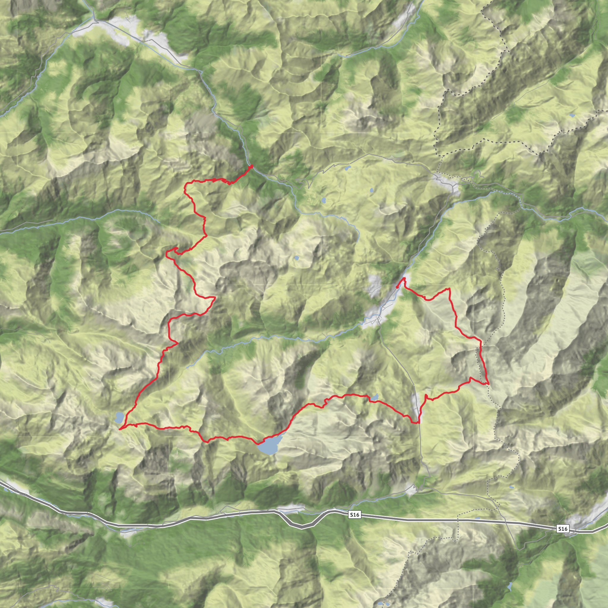
A demanding hut-to-hut circuit through Austria’s Lechquellen Mountains, this route packs roughly 59 km / 36.7 mi of walking and about 4,000 m / 13,120 ft of ascent into a compact high-alpine loop. Most itineraries break it into 5 to 6 stages between the Biberacher Hütte, Göppinger Hütte, Freiburger Hütte, Ravensburger Hütte, and optionally the Stuttgarter Hütte before finishing in Lech am Arlberg. The route stays largely above treeline, with a highest point around 2,500 m / 8,200 ft, and combines grassy alpine basins, limestone ridges, karst plateaus, glacially carved bowls, and several striking mountain lakes. (vorarlberg.travel)
The usual access hub is Lech am Arlberg, Vorarlberg, Austria, with the trail commonly approached from either Landsteg near Schröcken for the climb to Biberacher Hütte or from the Formarinsee / Freiburger Hütte side using the local bus network. Public transport is straightforward: international rail connections run to Langen am Arlberg or St. Anton am Arlberg, and from both stations regional buses continue to Lech-Zürs. From Lech’s Rüfiplatz bus hub, summer local buses connect toward Formarinsee, Spullersee, Zug Kirchle, and Älpele, which are the key access points for several stages. Drivers usually base themselves in Lech, where Parkhaus Anger, Lech am Arlberg is a commonly recommended parking option. (lechquellenrunde.com)
Because your hike-head field is incomplete, the nearest practical named starting landmarks are Biberacher Hütte, Formarinsee, or Landsteg near Schröcken, depending on direction and stage choice. If you are planning from digital mapping, it is worth aligning every transfer, hut, and bailout option in HiiKER before departure, especially because this circuit has multiple logical starts rather than one single trailhead. The route can be walked either clockwise or counterclockwise, though the classic line is often described from Biberacher Hütte onward. (lechquellenrunde.com)
What the route feels like on the ground
This is a difficult alpine walk rather than a casual long-distance ramble. The mileage is moderate, but the cumulative climbing is not. Daily stages often involve sustained ascents and descents on red-marked mountain paths, loose limestone footing, steep traverses, and occasional exposed-feeling terrain where balance and sure-footedness matter more than speed. Weather is a major factor: the route’s relatively modest maximum altitude for the Alps helps extend the season, but storms, wet rock, lingering snow on passes, and slippery descents can quickly raise the seriousness. Official route information specifically notes that sections near the Madloch can hold snow into early July and become slick in poor conditions. (vorarlberg.travel)
A common 6-stage structure is: - Landsteg to Biberacher Hütte - Biberacher Hütte to Göppinger Hütte
- Göppinger Hütte to Freiburger Hütte
AI Planner
Days planned around your pace, with somewhere to stay each night.
Surfaces
Unknown
Dirt
Gravel
Ground
Asphalt
Concrete
Wood
Paved
Cobblestone
Comments and Reviews
User comments, reviews and discussions about the Lechquellenrunde, Austria.
average rating out of 5
0 rating(s)



