Download
3D Flyover
Add to list
More
241.9 km
~13 days
14654 m
Multi-Day
“Trek the Austrian Alps on the Ötztal Trek, a scenic odyssey rich in history and natural splendor.”
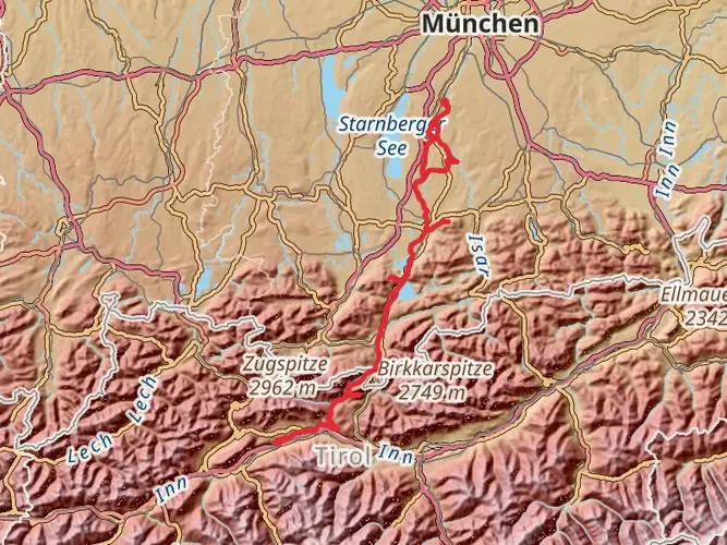
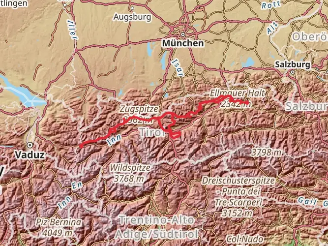
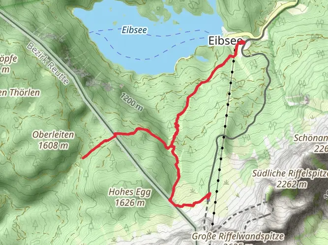
Embarking on the Ötztal Trek, hikers will traverse approximately 242 kilometers (150 miles) of stunning alpine terrain, with an elevation gain of around 14,600 meters (47,900 feet). This loop trail, nestled in the heart of the Austrian Alps near Bezirk Imst, offers a medium difficulty rating, making it accessible to hikers with a good level of fitness and experience in long-distance trekking.
Getting to the Trailhead
The journey begins near Bezirk Imst, which is reachable by both public transport and car. If arriving by train, the nearest station is in Ötztal Bahnhof, from where you can catch a bus to various starting points of the trek. Those driving can find parking in the vicinity of the trailhead, but it's advisable to check for the most current parking information and any restrictions that may apply.
Navigating the Trail
Hikers can rely on HiiKER for detailed maps and navigation assistance throughout the Ötztal Trek. The trail is well-marked, but due to its length and complexity, having a digital tool to reference for waypoints and daily planning is invaluable.
Landmarks and Natural Beauty
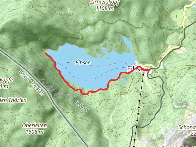
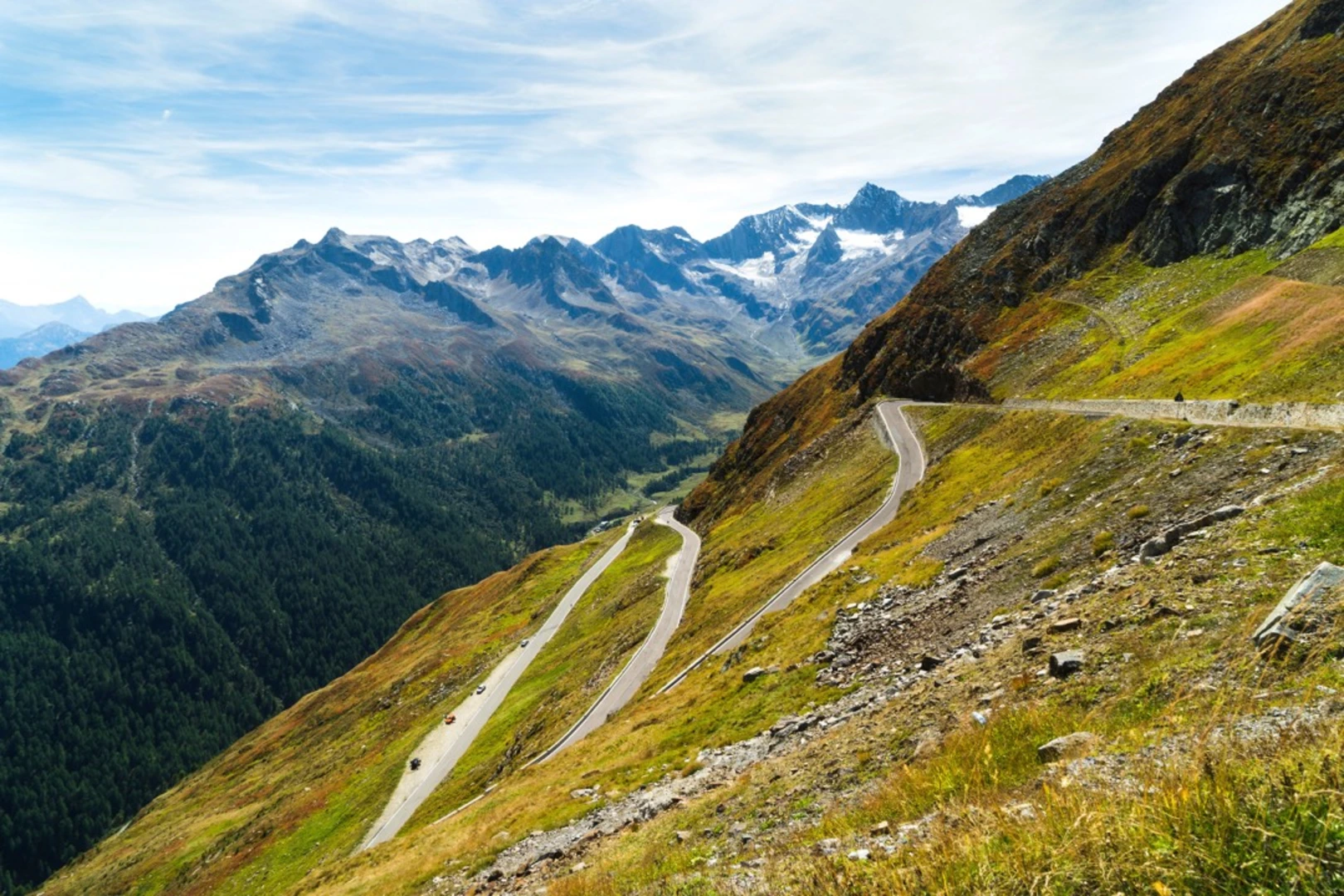
The Ötztal Trek is a journey through diverse landscapes, from lush meadows to rugged peaks, and includes several notable landmarks. One of the early highlights is the Stuibenfall, Tyrol's highest waterfall, which is a spectacular sight especially after recent rainfall. As the trail ascends, hikers will encounter the Hochoetz Alm, a traditional alpine pasture where one can witness local farming practices and possibly spot native wildlife such as chamois and marmots.
Historical Significance
The region is steeped in history, with the Ötztal Alps being home to Ötzi the Iceman, a well-preserved natural mummy from around 3300 BCE. While the actual discovery site is not directly on the trail, the area's rich past is palpable, and hikers can visit the Ötzi Village, an archaeological outdoor park, to learn more about the ancient cultures that once inhabited these mountains.
Wildlife and Flora
The Ötztal Trek is a haven for nature enthusiasts. The trail passes through several protected areas, including parts of the Ötztal Nature Park. Hikers can expect to see a variety of alpine flora, including edelweiss and alpine roses, particularly in the lower valleys during the summer months. The higher altitudes provide opportunities to observe birds of prey, such as golden eagles, soaring above.
Preparation and Planning
Given the trail's length and the significant elevation gain, hikers should be well-prepared with appropriate gear, including sturdy hiking boots, weather-appropriate clothing, and sufficient food and water supplies. It's also wise to plan for overnight stays in mountain huts or lodges, which are scattered along the route and offer a place to rest and refuel. Reservations are highly recommended, especially during peak hiking season.
Conclusion
The Ötztal Trek is a journey that offers a blend of natural beauty, physical challenge, and a glimpse into the historical tapestry of the Austrian Alps. With careful planning and respect for the mountain environment, hikers will find this trail to be a rewarding experience that showcases some of the best scenery that Austria has to offer.

Frequently asked questions
How long is the Ötztal Trek and how much climbing does the full route involve?
The full Ötztal Trek is 241.92 km long and packs in 14,654 m of elevation gain, so it is a serious high-alpine multi-day route rather than a short hut walk. It is graded Extra Difficult, which fits the scale of the distance, the cumulative climbing, and the sustained mountain terrain around the Ötztal Alps.
How many stages does the Ötztal Trek have, and can the Ötztal Trek be split into shorter sections?
The official Ötztal Trek is commonly organized into 22 stages, and the route is also grouped into several partial routes that can be hiked separately. That makes it realistic to tackle the trail in sections instead of committing to the entire 241.92 km loop in one trip, with entry and exit options available along the valley.
Can the Ötztal Trek be done in 3, 4, 5, or 6 days?
A complete thru-hike of the Ötztal Trek is far too long for 3 to 6 days, since the full route covers 241.92 km with 14,654 m of ascent. A 3-day to 6-day trip only makes sense as a shortened section hike, using one of the route’s stage groups or a selected hut-to-hut segment rather than the entire trek.
Where does the Ötztal Trek start, and how do hikers reach the Ötztal Trek by public transportation?
The trek is described as starting from Ötztal-Bahnhof at the entrance to the valley, with the route then circling through high alpine terrain toward places such as Gurgl and Vent before returning on the western side. Ötztal-Bahnhof is the key rail arrival point, and valley bus services connect onward to trail access points used for individual stages and section hikes.
Is there parking for the Ötztal Trek, and where do hikers usually leave a car?
Parking for the Ötztal Trek depends on which stage or access point is being used, because the route is a long multi-stage circuit rather than a single out-and-back trailhead. The Ötztal region has multiple parking options, and official stage information lists parking for individual sections, so most hikers choose a stage start such as an Ötztal valley lift or village access point rather than one universal lot.
Is the Ötztal Trek difficult?
Yes. The Ötztal Trek is rated Extra Difficult, and that matches the route’s 241.92 km length and 14,654 m of total ascent. It is a high-alpine hut-to-hut trek in the Austrian Alps, so the challenge comes not just from daily mileage but from repeated steep climbs, descents, and the cumulative effort over many stages.
Is there an official map for the Ötztal Trek, and how is the route usually navigated?
Yes. The Ötztal Trek has an official mapped stage structure, with the route broken into 22 stages and additional route variants across the Ötztal Alps. Because it is a long, complex multi-day trek with many access and exit points, most hikers navigate it stage by stage rather than treating it like a single simple loop.
Comments and Reviews
User comments, reviews and discussions about the Ötztal Trek, Austria.
4.57
average rating out of 5
7 rating(s)