
Download
3D Flyover
Add to list
More
42.5 km
~2 days
602 m
Loop
“Journey through Arkansas's scenic beauty and rich history on a captivating, moderately challenging trail.”
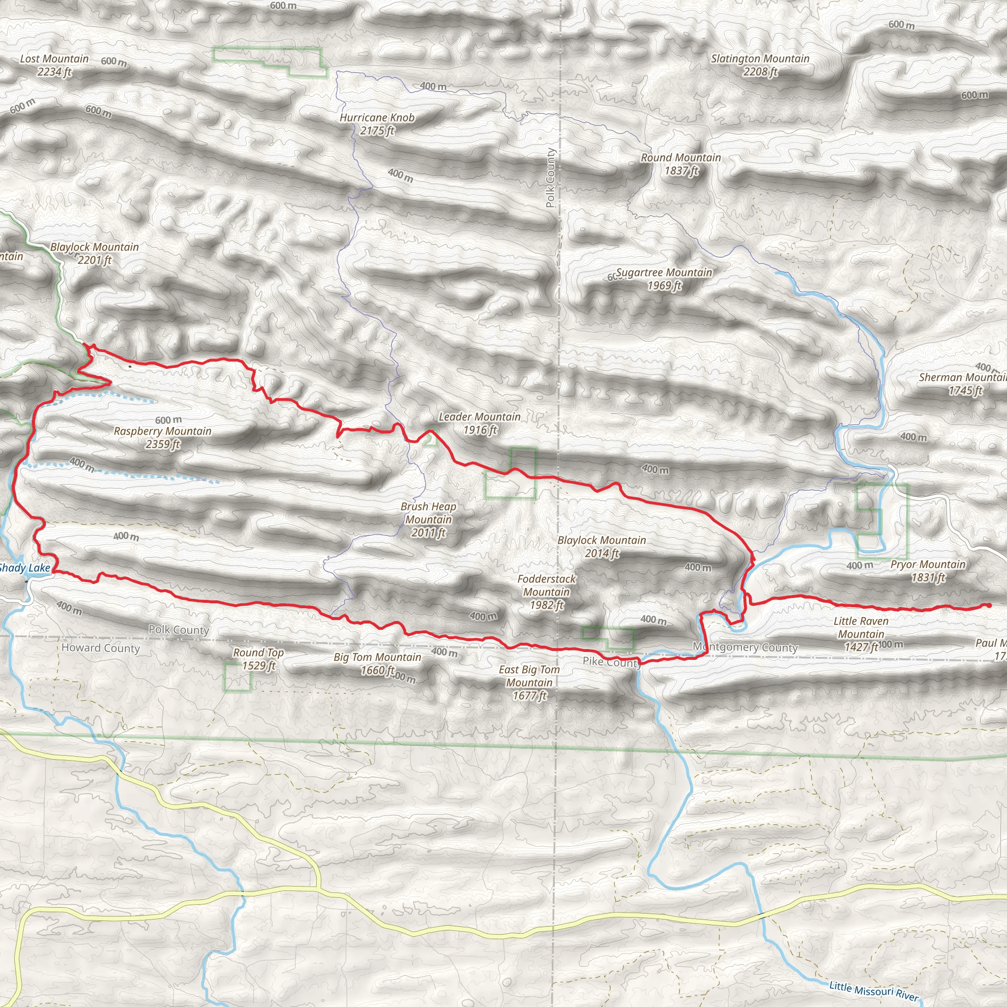
Nestled in the scenic landscapes of Montgomery County, Arkansas, the Blaylock Creek Road and Eagle Rock Trail Loop offers a captivating journey through diverse terrains and rich history. This 42 km (approximately 26 miles) loop trail presents a moderate challenge with an elevation gain of around 600 meters (about 1,970 feet), making it an ideal adventure for hikers seeking both physical exertion and natural beauty.
Getting There
To reach the trailhead, travelers can drive to Montgomery County, Arkansas. If you're coming by car, the trailhead is accessible via local roads, with parking available nearby. For those relying on public transport, the nearest significant town is Mount Ida, which can be reached by bus services from larger cities like Little Rock. From Mount Ida, a taxi or rideshare service can take you to the trailhead.
Trail Highlights
Blaylock Creek and Surrounding Flora
The trail begins near Blaylock Creek, a serene waterway that sets the tone for the natural wonders ahead. As you embark on your journey, you'll be surrounded by lush forests dominated by oak and pine trees. In spring and early summer, the trail is adorned with vibrant wildflowers, offering a colorful spectacle for nature enthusiasts.
Eagle Rock and Panoramic Views
Approximately halfway through the loop, hikers will encounter Eagle Rock, a prominent feature that provides breathtaking panoramic views of the Ouachita Mountains. This vantage point is a perfect spot for a rest and photo opportunity, with sweeping vistas that capture the rugged beauty of the region.
Wildlife and Nature
The trail is home to a variety of wildlife, including white-tailed deer, wild turkeys, and an array of bird species. Keep an eye out for the elusive black bear, which occasionally roams these parts. The diverse ecosystem supports a rich tapestry of life, making it a rewarding experience for wildlife enthusiasts.
Historical Significance
The area surrounding the trail is steeped in history, with roots tracing back to the indigenous Caddo people who once inhabited the region. The Ouachita Mountains have long been a source of natural resources and a site of cultural significance. As you hike, consider the historical context of the land and its past inhabitants.
Navigation and Safety
Given the trail's moderate difficulty, it's advisable to use a reliable navigation tool like HiiKER to stay on course. The trail is well-marked, but having a digital map can enhance your experience and ensure you don't miss any key landmarks. Be prepared for changes in weather, and carry sufficient water and snacks to sustain you throughout the hike.
Final Stretch
As you complete the loop, the trail descends back towards the starting point, offering a gentle conclusion to your adventure. The return journey provides a chance to reflect on the diverse landscapes and rich history you've encountered along the way.
AI Planner
Days planned around your pace, with somewhere to stay each night.
What to expect?
Activity types
Comments and Reviews
User comments, reviews and discussions about the Blaylock Creek Road and Eagle Rock Trail Loop, Arkansas.
average rating out of 5
0 rating(s)
