Download
3D Flyover
Add to list
More
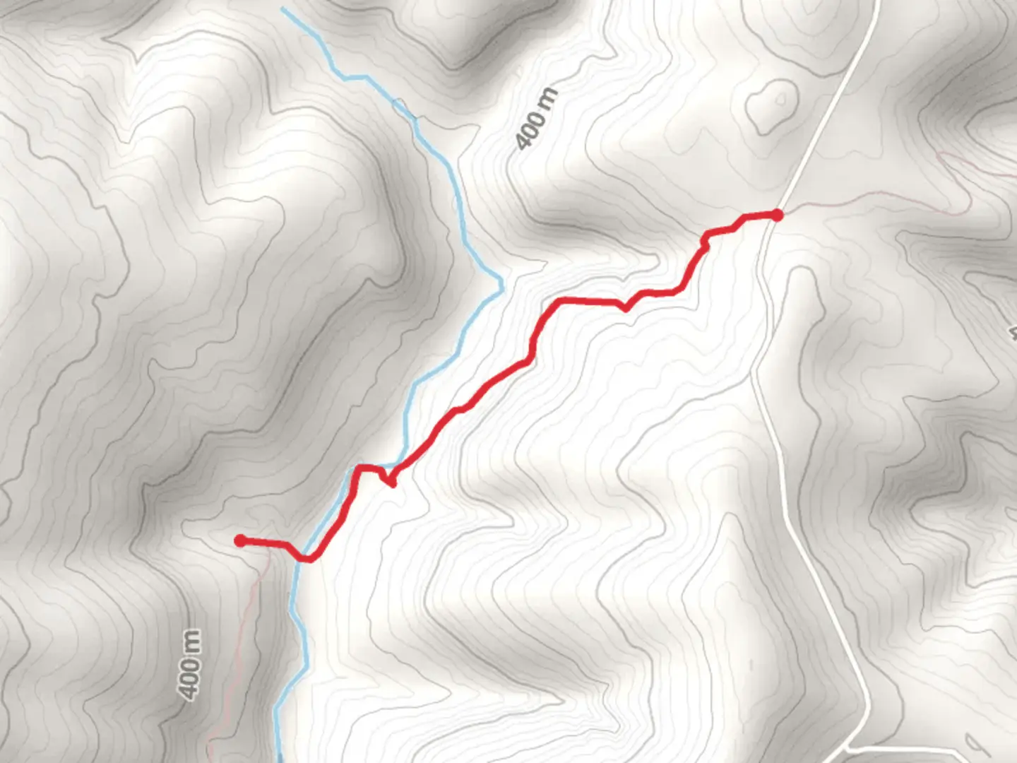
2.3 km
~33 min
54 m
Point-to-Point
“Explore the lush, wildlife-rich Cedar Creek Trail in the Ozarks for a serene, historical adventure.”
Nestled in the heart of the Ozark National Forest, the Cedar Creek via Ozark Highlands Trail offers a serene escape into nature. This point-to-point trail stretches approximately 2 kilometers (about 1.2 miles) with no significant elevation gain, making it accessible for hikers of varying skill levels. The trailhead is conveniently located near Johnson County, Arkansas, providing a perfect starting point for your adventure.
Getting There
To reach the trailhead, you can drive or use public transportation. If you're driving, head towards the Ozark National Forest, and look for signs directing you to the Cedar Creek area. The nearest significant landmark is the town of Clarksville, Arkansas, which is approximately 20 miles (32 kilometers) away. From Clarksville, take Highway 21 north and follow the signs to the trailhead. For those relying on public transport, buses run to Clarksville, from where you can arrange a taxi or rideshare to the trailhead.
Trail Highlights
As you embark on the Cedar Creek via Ozark Highlands Trail, you'll be greeted by the lush greenery of the Ozark National Forest. The trail meanders through dense woodlands, offering a peaceful and immersive experience. Keep an eye out for the diverse flora and fauna that call this region home. You might spot white-tailed deer, wild turkeys, and a variety of bird species, making it a delightful trail for wildlife enthusiasts.
Historical Significance
The Ozark Highlands Trail is steeped in history, with roots tracing back to the early settlers of the region. The trail itself is part of a larger network that was developed to showcase the natural beauty and cultural heritage of the Ozarks. As you hike, consider the footsteps of those who traversed these lands long before modern trails were established.
Navigation and Safety
While the trail is relatively straightforward, it's always wise to have a reliable navigation tool. The HiiKER app is an excellent choice for tracking your progress and ensuring you stay on course. The trail is well-marked, but having a digital map can provide peace of mind.
Points of Interest
Approximately halfway through the trail, you'll encounter Cedar Creek, a picturesque spot perfect for a short rest. The gentle babbling of the creek provides a soothing soundtrack to your hike. This area is ideal for a quick picnic or simply to enjoy the tranquility of nature.
As you continue, the trail offers glimpses of the surrounding hills and valleys, showcasing the rugged beauty of the Ozarks. The lack of significant elevation gain makes it an enjoyable walk, allowing you to focus on the natural beauty around you.
Final Tips
Before setting out, ensure you have adequate water, snacks, and appropriate footwear. The trail can be muddy after rain, so be prepared for varying trail conditions. Always check the weather forecast and inform someone of your plans if hiking alone. With these preparations, you're set for a rewarding hike through one of Arkansas's most beautiful landscapes.

What to expect?
Activity types
Comments and Reviews
User comments, reviews and discussions about the Cedar Creek via Ozark Highlands Trail, Arkansas.
average rating out of 5
0 rating(s)