
Download
3D Flyover
Add to list
More
85.6 km
~3 days
633 m
Loop
“Explore Arizona's Brass Cap Point and Beahive Loop for breathtaking views and rich historical insights.”
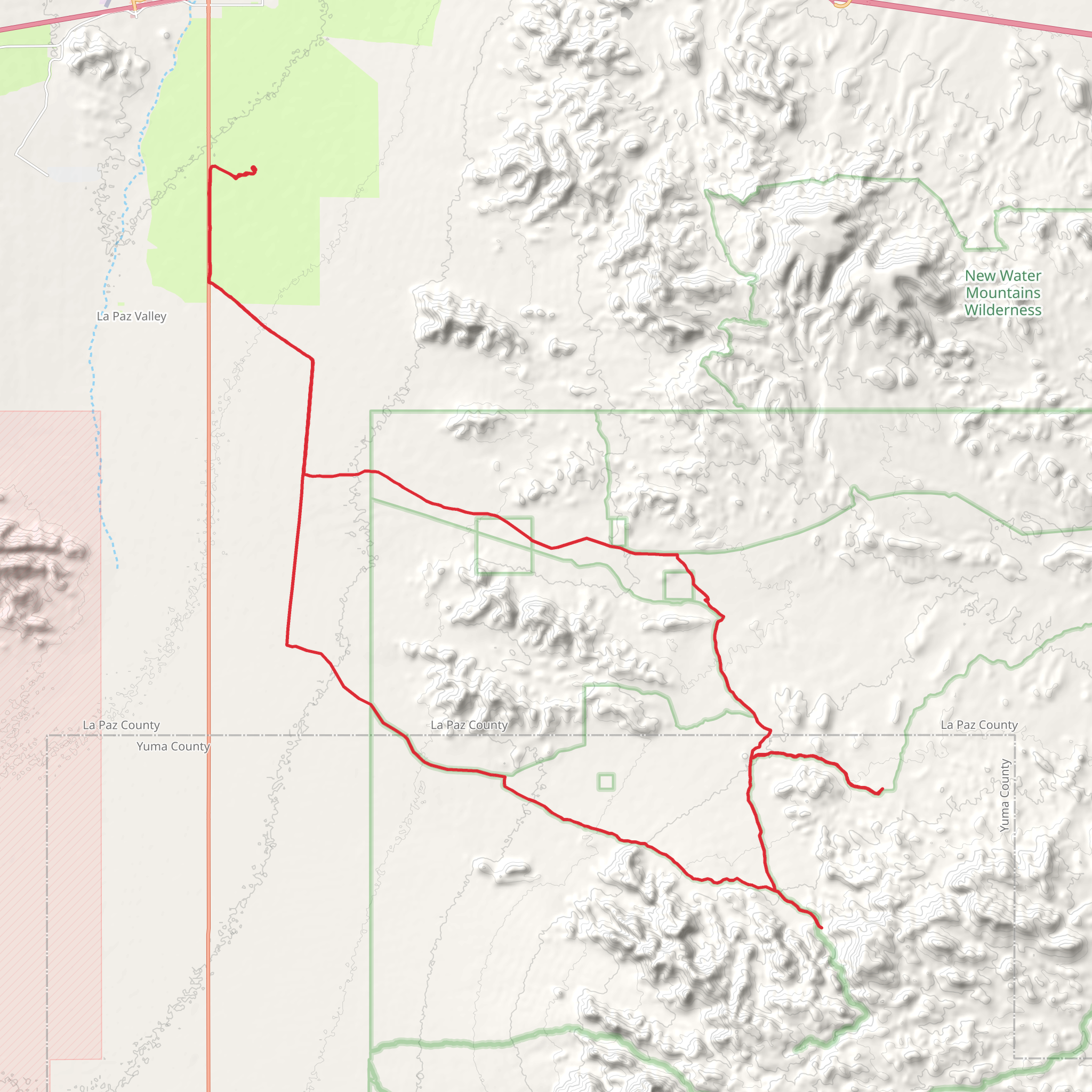
Nestled in the rugged landscapes of La Paz County, Arizona, the Brass Cap Point and Beahive Loop offers an inviting adventure for hikers of all levels. This 86 km (approximately 53 miles) loop trail is characterized by its gentle elevation gain of around 600 meters (about 1,970 feet), making it an accessible journey through the diverse terrain of the region.
Getting There
The trailhead is conveniently located near La Paz County, Arizona. For those traveling by car, the nearest major landmark is the town of Parker, Arizona. From Parker, head southeast on AZ-95 S for about 30 miles until you reach the vicinity of the trailhead. Public transport options are limited in this remote area, so driving is the most practical way to reach the starting point.
Trail Overview
The Brass Cap Point and Beahive Loop is a well-marked path that guides hikers through a variety of landscapes, from arid desert plains to rocky outcrops. The trail's easy difficulty rating makes it suitable for families and those looking for a leisurely hike without the challenge of steep climbs.
Significant Landmarks
As you embark on this loop, you'll encounter several noteworthy landmarks. One of the highlights is Brass Cap Point, a vantage point offering panoramic views of the surrounding desert and distant mountain ranges. This spot is perfect for a rest and some photography, capturing the vastness of the Arizona landscape.
Another key feature along the trail is the Beahive, a unique rock formation that resembles a beehive. This natural wonder is a testament to the geological forces that have shaped the region over millennia. It's a great place to pause and appreciate the intricate patterns etched into the rock by wind and water.
Nature and Wildlife
The trail is home to a variety of flora and fauna, typical of the Sonoran Desert ecosystem. Keep an eye out for saguaro cacti, ocotillo, and creosote bushes, which dot the landscape. Wildlife enthusiasts may spot desert dwellers such as jackrabbits, lizards, and the occasional roadrunner. Birdwatchers will also enjoy the chance to see species like the cactus wren and Gambel's quail.
Historical Significance
The region surrounding the Brass Cap Point and Beahive Loop holds historical significance, with evidence of Native American habitation dating back thousands of years. Petroglyphs and ancient artifacts have been discovered in the area, offering a glimpse into the lives of the indigenous peoples who once thrived here. As you hike, take a moment to reflect on the rich cultural history embedded in the landscape.
Navigation and Preparation
For navigation, the HiiKER app is an excellent tool to ensure you stay on track throughout the loop. The trail is well-marked, but having a digital map can provide additional peace of mind. Given the desert environment, it's crucial to carry plenty of water, wear sun protection, and start your hike early in the day to avoid the midday heat. Always check the weather forecast and trail conditions before setting out.
Embarking on the Brass Cap Point and Beahive Loop is a journey through both natural beauty and historical intrigue, offering a rewarding experience for those who venture into this captivating corner of Arizona.
AI Planner
Days planned around your pace, with somewhere to stay each night.
What to expect?
Comments and Reviews
User comments, reviews and discussions about the Brass Cap Point and Beahive Loop, Arizona.
average rating out of 5
0 rating(s)
