Download
3D Flyover
Add to list
More
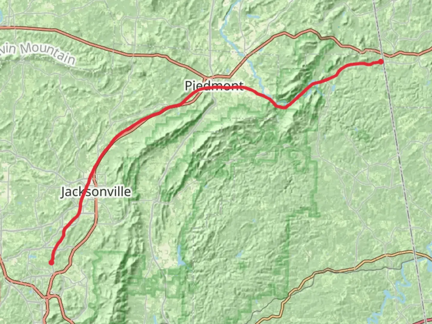
52.6 km
~2 days
298 m
Point-to-Point
“Explore Alabama's scenic and historic Chief Ladiga Trail, an accessible 33-mile journey through nature and time.”
The Chief Ladiga Trail stretches approximately 33 miles (53 kilometers) and offers a relatively flat journey with an elevation gain of around 656 feet (200 meters), making it an accessible route for cyclists and hikers of various skill levels. This point-to-point trail is nestled near Calhoun County, Alabama, and is known for its scenic beauty and historical significance.
Getting to the Trailhead
To reach the starting point of the Chief Ladiga Trail, you can drive to the trailhead located near the Michael Tucker Park in Anniston, Alabama. For those relying on public transportation, options may be limited, so it's advisable to check local transit routes for any available services to the Anniston area. Once in Anniston, you may need to arrange for a taxi or rideshare to the park.
Trail Experience
As you embark on the Chief Ladiga Trail, you'll find yourself on a paved path that was once a corridor for the Norfolk Southern Railroad. The trail is enveloped by a canopy of trees, providing ample shade and a serene atmosphere. The path is well-maintained, making it suitable for both walking and biking.
Historical Significance
The trail is named after a famous Muscogee (Creek) Nation chief, and it holds historical importance as it passes through several small towns that were once bustling with railroad activity. The Chief Ladiga Trail is also part of the larger Silver Comet Trail, which continues into Georgia, forming a continuous path that is over 90 miles long.
Landmarks and Nature
Approximately 7 miles (11 kilometers) from the start, you'll reach the town of Weaver, where you can take a short detour to explore local shops and restaurants. Continuing on, the trail meanders through the Dugger Mountain Wilderness, about 14 miles (22.5 kilometers) from the beginning, where you can enjoy the diverse flora and fauna of the region.
As you approach the halfway mark near Jacksonville, around 16.5 miles (26.5 kilometers) in, you'll find the Jacksonville State University campus, which is a good spot for a rest and perhaps a picnic. The trail then continues through a more rural landscape, offering peaceful views of northeastern Alabama's countryside.
Wildlife
The surrounding woodlands and fields are home to a variety of wildlife, including deer, rabbits, and numerous bird species. Birdwatchers will appreciate the opportunity to spot local and migratory birds throughout the seasons.
Navigation
For those looking to navigate the trail with ease, HiiKER is a useful tool to download maps and plan your journey. It provides detailed information on the trail's route, including waypoints and points of interest.
Preparation and Planning
Before setting out, ensure you have enough water and snacks, as there are stretches of the trail with limited access to facilities. Also, check the weather forecast and dress appropriately, as conditions can change. Remember to carry a basic first aid kit and a charged phone for emergencies.
Whether you're looking for a leisurely day hike, a long-distance bike ride, or a multi-day adventure, the Chief Ladiga Trail offers a unique experience steeped in natural beauty and history.

What to expect?
Activity types
Comments and Reviews
User comments, reviews and discussions about the Chief Ladiga Trail, Alabama.
average rating out of 5
0 rating(s)