8.3 km
~2 hrs 25 min
469 m
“This moderately challenging 8 km trail near Tooele County offers stunning views and rich historical insights.”
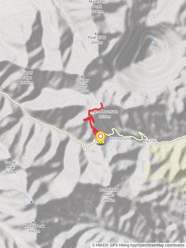
Starting near Tooele County, Utah, this 8 km (approximately 5 miles) out-and-back trail offers a moderately challenging hike with an elevation gain of around 400 meters (about 1,312 feet). The trailhead is accessible by car, and the nearest significant landmark is the Tooele Army Depot. If you're using public transport, the closest bus stop is in Tooele City, from where you can take a taxi or rideshare service to the trailhead.
Trail Overview
The trail begins with a gentle ascent through a mix of sagebrush and juniper trees, typical of the Great Basin region. As you progress, the path becomes steeper, offering panoramic views of the surrounding valleys and the Oquirrh Mountains. The first significant landmark you'll encounter is a small, seasonal stream about 1.5 km (0.9 miles) into the hike. This is a good spot to take a short break and enjoy the natural surroundings.
Copper Pit Overlook
At around the 4 km (2.5 miles) mark, you'll reach the Copper Pit Overlook. This vantage point provides stunning views of the historic Bingham Canyon Mine, one of the largest open-pit copper mines in the world. The mine has been operational since 1906 and is a significant part of Utah's mining history. Take some time here to appreciate the scale of human engineering and the natural beauty of the area.
Flora and Fauna
The trail is home to a variety of wildlife, including mule deer, jackrabbits, and occasionally, golden eagles. Keep an eye out for these creatures, especially in the early morning or late afternoon. The flora is equally diverse, with wildflowers such as Indian paintbrush and lupine blooming in the spring and early summer.
Navigation and Safety
For navigation, it's highly recommended to use the HiiKER app, which provides detailed maps and real-time updates. The trail is well-marked, but having a reliable navigation tool will ensure you stay on course. Be prepared for sudden weather changes, as the region can experience rapid shifts in temperature and wind conditions.
Getting There
If you're driving, take Interstate 80 to Exit 99 for Tooele. From there, follow State Route 36 south for about 15 miles until you reach the turnoff for the Tooele Army Depot. The trailhead is located just past the depot entrance. Parking is available, but it can fill up quickly on weekends, so an early start is advisable.
Final Stretch
The return journey follows the same path, allowing you to enjoy the views from a different perspective. The descent is easier on the legs but still requires caution, especially on loose gravel sections. Make sure to pack enough water, as there are no reliable water sources along the trail.
This hike offers a rewarding blend of natural beauty, historical significance, and moderate physical challenge, making it a must-do for anyone visiting the Tooele County area.
Reviews
User comments, reviews and discussions about the West Mountain voa Copper Pit Overlook Road, Utah.
5.0
average rating out of 5
26 rating(s)


