Download
Preview
Add to list
More
13.5 km
~4 hrs 40 min
1190 m
Out and Back
“Embark on a breathtaking journey through history and nature, ascending Kelsey Peak for majestic vistas.”
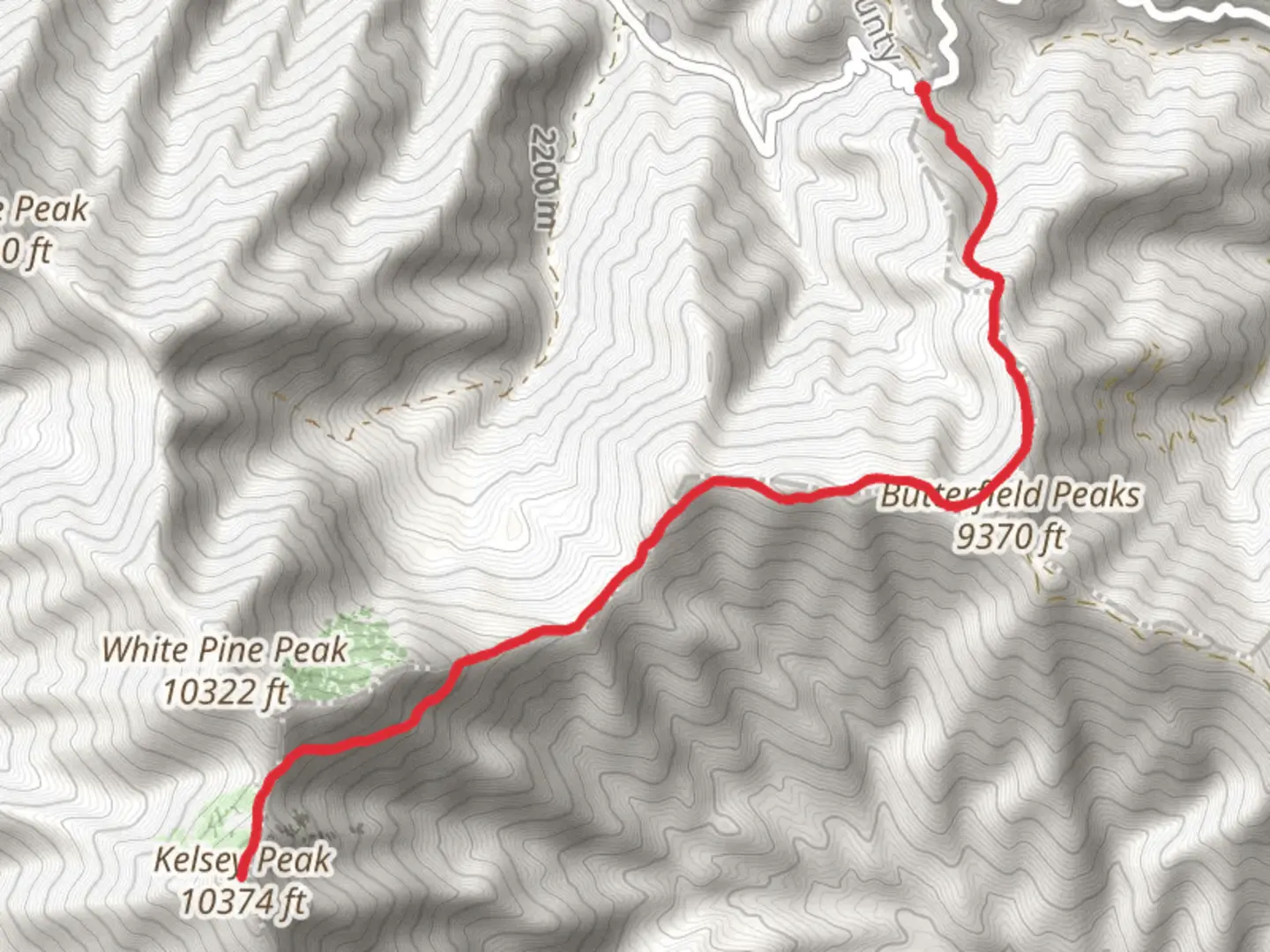
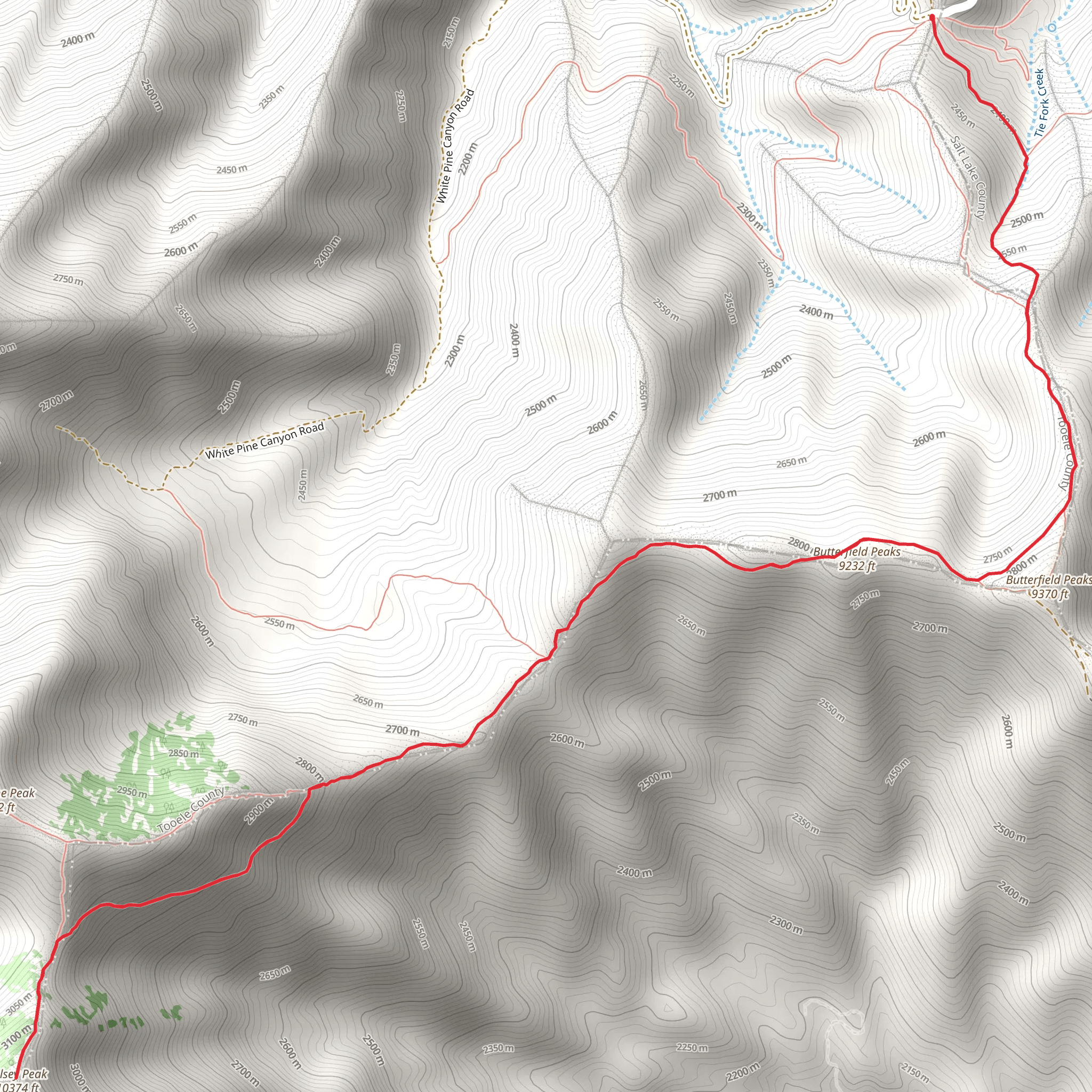
The Kelsey Peak trail via Butterfield Canyon Road offers a moderately challenging hike that takes you through the rugged terrain of the Oquirrh Mountains near Tooele County, Utah. Spanning approximately 13 kilometers (about 8 miles) round trip, the trail presents an elevation gain of roughly 1100 meters (around 3600 feet), providing hikers with a rewarding workout and stunning panoramic views.
Getting to the Trailhead
To reach the trailhead, you can drive to the mouth of Butterfield Canyon, which is accessible from the town of Herriman. From Herriman, take the Main Street west until it turns into Herriman Highway, and continue to follow it as it becomes Butterfield Canyon Road. The road is typically open from late spring to late fall, and it's important to check the conditions before you go, as it can be closed due to snow or other inclement weather. There is no direct public transportation to the trailhead, so a personal vehicle or a taxi service is required.
The Hike Itself
As you begin your hike, the first section of the trail is a steady climb through a forested area, where you'll be surrounded by a mix of deciduous and coniferous trees. The sound of Butterfield Creek may accompany you as you ascend, especially during the spring melt. Keep an eye out for local wildlife, including deer, moose, and various bird species that inhabit the area.
After about 2 kilometers (1.2 miles), the trail opens up to reveal the first of several expansive views of the Salt Lake Valley. Here, the path becomes steeper and rockier, so good hiking boots are recommended. As you continue to climb, the vegetation thins, and the landscape transitions to scrub oak and sagebrush.
Historical Significance
The Oquirrh Mountains have a rich history, with mining activities dating back to the 19th century. As you hike, you may notice remnants of this past, including old mine shafts and equipment. The region was an important source of minerals, particularly during World War II, and the mining industry significantly shaped the development of nearby communities.
Reaching Kelsey Peak
The final push to Kelsey Peak is the most strenuous part of the hike, with a series of switchbacks leading to the summit. At the peak, approximately 6.5 kilometers (4 miles) from the start, you'll be rewarded with 360-degree views of the surrounding mountains, the Great Salt Lake, and the Utah desert. The summit is a great spot to rest and enjoy a snack before beginning your descent.
Safety and Navigation
Due to the trail's rocky terrain and steep sections, it's important to be prepared with plenty of water, sun protection, and layers for changing weather conditions. The trail is best hiked from late spring to early fall to avoid snow and ice. For navigation, HiiKER is a useful tool to track your progress and ensure you stay on the correct path.
Wildlife and Flora
Throughout the hike, you'll have the opportunity to observe a variety of plant life, from wildflowers to hardy mountain shrubs. The area is also home to a diverse range of animals; besides the deer and moose, you might spot smaller mammals like marmots and pikas. Always keep a respectful distance from wildlife and follow Leave No Trace principles to protect their natural habitat.
Conclusion
By the time you return to the trailhead, you will have completed a challenging and scenic hike that offers a glimpse into the natural beauty and historical significance of the Oquirrh Mountains. Remember to check the weather, wear appropriate gear, and carry sufficient supplies to ensure a safe and enjoyable experience on the Kelsey Peak trail.
What to expect?
Activity types
Comments and Reviews
User comments, reviews and discussions about the Kelsey Peak from Butterfield Canyon Road, Utah.
4.36
average rating out of 5
11 rating(s)
