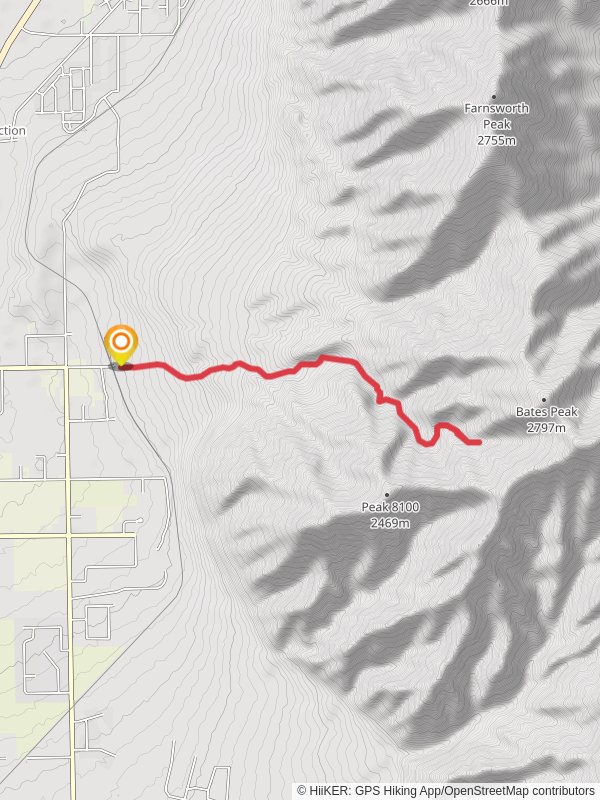
13.1 km
~4 hrs 4 min
875 m
“Bates Canyon Trail offers a rewarding hike with stunning views, historical landmarks, and diverse wildlife.”
Starting near Tooele County, Utah, the Bates Canyon Trail offers a rewarding out-and-back hike that spans approximately 13 kilometers (8 miles) with an elevation gain of around 800 meters (2,625 feet). This trail is rated as medium difficulty, making it suitable for moderately experienced hikers looking for a bit of a challenge.### Getting There
To reach the trailhead, you can drive or use public transport. If you're driving, head towards the nearest significant landmark, the Tooele Army Depot. From there, follow local roads to the trailhead. For those using public transport, the nearest bus stop is in Tooele City, from where you can take a taxi or rideshare service to the trailhead.### Trail Overview
The Bates Canyon Trail begins with a gentle ascent through a mix of sagebrush and juniper trees. As you progress, the trail becomes steeper, winding through a series of switchbacks that offer stunning views of the surrounding Tooele Valley. At around the 3-kilometer (1.9-mile) mark, you'll encounter a small creek, which is a great spot to take a short break and enjoy the natural surroundings.### Significant Landmarks and Nature
One of the most notable landmarks along the trail is the Bates Canyon Waterfall, located approximately 5 kilometers (3.1 miles) from the trailhead. This seasonal waterfall is particularly impressive in the spring when snowmelt increases its flow. The area around the waterfall is lush with vegetation, including wildflowers like Indian paintbrush and lupine.As you continue your ascent, you'll pass through a mixed forest of aspen and pine trees. This section of the trail is home to a variety of wildlife, including mule deer, wild turkeys, and occasionally, black bears. Keep your eyes peeled and make sure to carry bear spray as a precaution.### Historical Significance
The region around Bates Canyon has a rich history. The trail itself was used by early settlers and miners in the 19th century. Remnants of old mining equipment can still be found near the trail, offering a glimpse into the area's past. Additionally, the trail passes close to several Native American petroglyphs, which are worth a short detour to explore.### Navigation and Safety
Given the trail's moderate difficulty and elevation gain, it's essential to be well-prepared. Make sure to bring plenty of water, especially during the hotter months. The trail is well-marked, but it's always a good idea to have a reliable navigation tool like HiiKER to ensure you stay on track. Weather can change rapidly in this region, so pack layers and be prepared for sudden shifts in temperature.### Final Stretch
The final stretch of the trail offers panoramic views of the Great Salt Lake and the surrounding mountains. This section is particularly rewarding and makes the effort well worth it. Once you reach the end of the trail, take some time to soak in the views before heading back the way you came.Whether you're a seasoned hiker or someone looking to challenge themselves, the Bates Canyon Trail offers a mix of natural beauty, historical intrigue, and a good workout.
Reviews
User comments, reviews and discussions about the Bates Canyon Trail, Utah.
5.0
average rating out of 5
18 rating(s)
Loading reviews...


