2.8 km
~55 min
215 m
“Explore a moderately challenging 3 km trail near Tooele County Courthouse, rich in nature and history.”
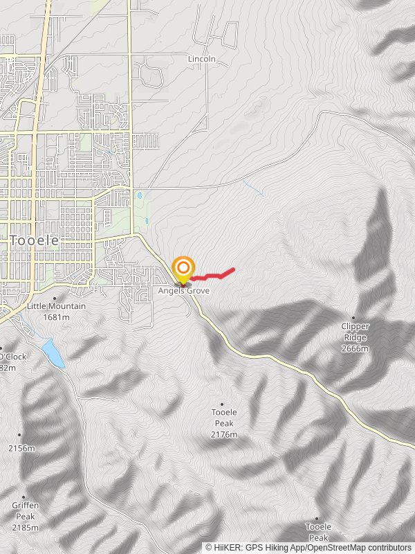
Starting near Tooele County, Utah, this 3 km (approximately 1.86 miles) out-and-back trail offers a moderate challenge with an elevation gain of around 200 meters (656 feet). The trailhead is conveniently located near the Tooele County Courthouse, making it easily accessible for both locals and visitors.### Getting There
To reach the trailhead, you can drive or use public transportation. If driving, head towards the Tooele County Courthouse, located at 47 S Main St, Tooele, UT 84074. There is ample parking available nearby. For those using public transport, the nearest bus stop is at Main St & Vine St, just a short walk from the courthouse.### Trail Overview
The trail begins with a gentle ascent through a mix of sagebrush and juniper, typical of the Great Basin region. As you progress, the path becomes steeper, offering a good workout for your legs. The first 0.5 km (0.31 miles) is relatively easy, with a gradual incline that allows you to warm up before tackling the steeper sections.### Significant Landmarks and Nature
At around the 1 km (0.62 miles) mark, you'll encounter a small, picturesque creek. This is a great spot to take a short break and enjoy the sound of flowing water. The trail then continues to climb, and you'll notice the vegetation changing as you gain elevation. Keep an eye out for mule deer and various bird species, including hawks and eagles, which are commonly seen in this area.### Historical Significance
Tooele County has a rich history dating back to the early 19th century. The region was originally inhabited by the Goshute tribe before being settled by Mormon pioneers in the mid-1800s. As you hike, you'll pass by remnants of old mining operations, a nod to the area's past as a mining hub. These historical markers provide a fascinating glimpse into the lives of those who once worked and lived in this rugged landscape.### Navigation and Safety
Given the moderate difficulty of the trail, it's advisable to use a reliable navigation tool like HiiKER to stay on track. The trail is well-marked, but having a digital map can be reassuring, especially if you're unfamiliar with the area. Make sure to bring plenty of water, as the arid climate can be dehydrating, and wear sturdy hiking boots to navigate the rocky terrain.### Final Stretch
The final 0.5 km (0.31 miles) of the trail is the most challenging, with a steep incline that will test your endurance. However, the effort is well worth it. At the summit, you'll be rewarded with panoramic views of Tooele Valley and the surrounding mountains. This is an excellent spot for photography, so don't forget your camera.After soaking in the views, retrace your steps back to the trailhead. The descent is much quicker but still requires caution due to the steep sections.
Reviews
User comments, reviews and discussions about the The Tooele T Walk, Utah.
5.0
average rating out of 5
11 rating(s)
Loading reviews...


