15.0 km
~4 hrs 26 min
868 m
Download
Preview
Add to list
More
“Embark on a thrilling alpine journey from Weitalm to Ruhpolding, revealing stunning vistas and rich history.”
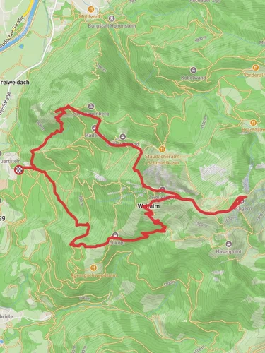
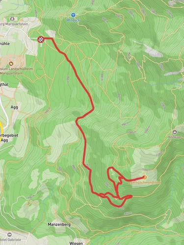
Nestled in the picturesque Bavarian Alps, the trail from Weitalm to Ruhpolding via Hochfelln offers a challenging yet rewarding hiking experience. Spanning approximately 15 kilometers (about 9.3 miles) with an elevation gain of around 800 meters (approximately 2,625 feet), this point-to-point trail is best suited for experienced hikers seeking a demanding adventure.
Getting There
The trailhead is conveniently located near Traunstein, Germany. For those traveling by car, Traunstein is accessible via the A8 motorway, with ample parking available near the trail's starting point. If you prefer public transport, Traunstein is well-connected by train, with regular services from Munich and Salzburg. From Traunstein, local buses can take you closer to the trailhead, or you can opt for a short taxi ride.
Trail Overview
The journey begins at Weitalm, a charming alpine pasture that sets the stage for the adventure ahead. As you embark on the trail, you'll be greeted by lush meadows and dense forests, offering a serene escape from the hustle and bustle of everyday life. The initial section of the trail is a steady ascent, gradually increasing in difficulty as you approach the Hochfelln summit.
Hochfelln Summit
Reaching the Hochfelln summit is a highlight of this hike. Standing at 1,674 meters (5,492 feet), the peak offers breathtaking panoramic views of the surrounding Chiemgau Alps and, on clear days, even the distant peaks of the Austrian Alps. The summit is marked by a cross and a small chapel, providing a perfect spot for a well-deserved rest and photo opportunity.
Flora and Fauna
The trail is a haven for nature enthusiasts, with diverse flora and fauna to observe along the way. In spring and summer, the meadows burst into color with wildflowers, while the forests are home to a variety of wildlife, including deer and alpine birds. Keep an eye out for the elusive chamois, often seen navigating the rocky terrain with ease.
Historical Significance
The region surrounding the trail is steeped in history. The Chiemgau Alps have long been a site of human settlement, with archaeological finds dating back to the Bronze Age. The area was also a strategic location during World War II, with remnants of old bunkers and fortifications occasionally visible along the trail.
Navigation and Safety
Given the trail's difficulty, it's crucial to be well-prepared. Ensure you have sturdy hiking boots, sufficient water, and weather-appropriate clothing. The trail is well-marked, but it's advisable to use the HiiKER app for navigation to stay on track and avoid any potential detours. Weather conditions can change rapidly in the mountains, so check forecasts and be prepared for sudden changes.
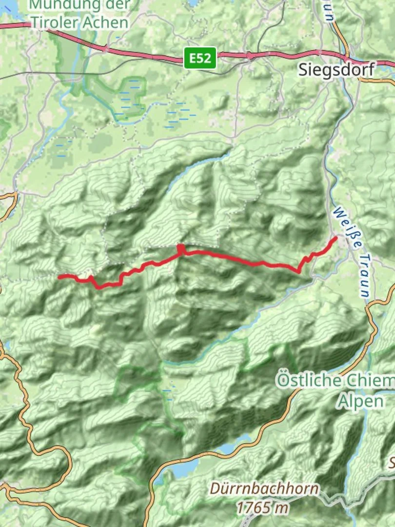
Descending to Ruhpolding
The descent towards Ruhpolding is equally scenic, with the trail winding through verdant valleys and past crystal-clear streams. As you approach Ruhpolding, the landscape transitions to rolling hills and charming Bavarian villages, offering a gentle conclusion to your hike. Ruhpolding itself is a delightful town, known for its traditional Bavarian architecture and hospitality, making it an ideal place to relax and reflect on your hiking adventure.

Reviews
User comments, reviews and discussions about the Weitalm to Ruhpolding Walk via Hochfelln, Germany.
0.0
average rating out of 5
0 rating(s)