Download
Preview
Add to list
More
237.3 km
~16 days
9199 m
Multi-Day
“Embark on the SalzAlpenSteig for an exhilarating fusion of Alpine vistas, wildlife, and historical intrigue.”
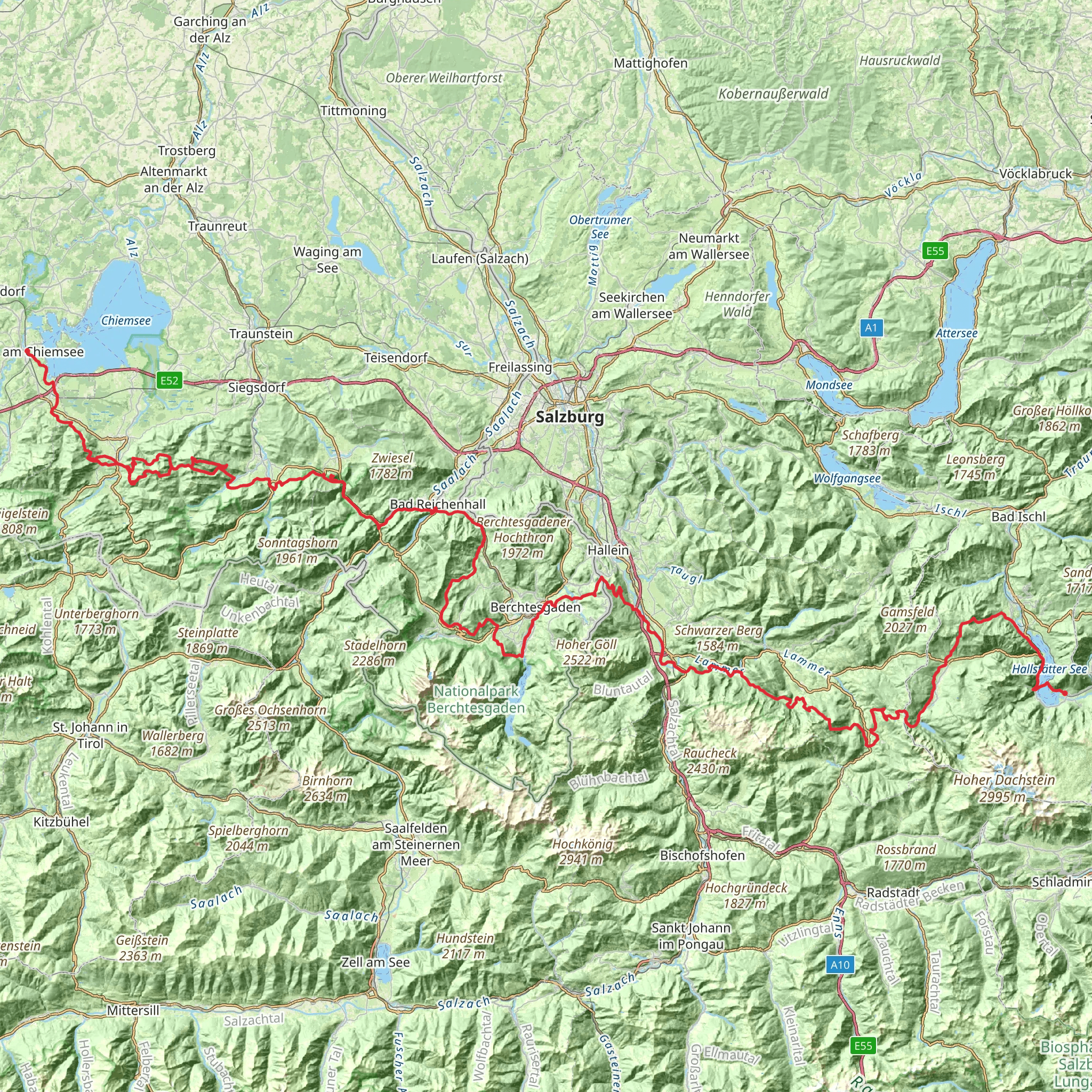
Embarking on the SalzAlpenSteig trail, hikers will traverse approximately 237 kilometers (about 147 miles) of diverse landscapes, with an elevation gain of around 9200 meters (approximately 30,184 feet). This point-to-point trail begins near the charming town of Rosenheim, Germany, and is considered difficult due to its length and elevation changes.
Getting to the Trailhead To reach the starting point of the SalzAlpenSteig, travelers can use public transportation or drive. Rosenheim is well-connected by train, with frequent services from Munich, Salzburg, and other major cities. Upon arrival at the Rosenheim train station, hikers can take a local bus or taxi to the trailhead. For those driving, parking is available near the trailhead, which is situated on the outskirts of Rosenheim.
The Journey Through Nature and History As hikers set out from the vicinity of Rosenheim, they will quickly find themselves enveloped by the picturesque foothills of the Bavarian Alps. The trail meanders through lush forests, alpine pastures, and alongside crystal-clear lakes, offering a feast for the senses. The path ascends into the mountains, providing stunning panoramic views and challenging terrain.
Wildlife is abundant in this region, with the possibility of spotting deer, chamois, and a variety of bird species. The flora along the trail changes with the elevation, from deciduous woodlands to coniferous forests and alpine meadows bursting with wildflowers in the spring and summer months.
Cultural and Historical Landmarks The SalzAlpenSteig is not only a journey through nature but also a passage through time. The trail's name, which translates to "Salt Alps Path," hints at its historical significance. This area was once a vital part of the salt trade, which played a crucial role in the economic development of the region. Hikers will encounter old salt mines, historical salt processing sites, and ancient trade routes that have been used for centuries.
One of the significant landmarks along the trail is the town of Berchtesgaden, located roughly at the halfway point. Here, hikers can explore the local history museum and the infamous Eagle's Nest, a mountaintop retreat built for Adolf Hitler, which now serves as a restaurant and tourist site.
Navigation and Preparation Given the trail's length and varying terrain, it is essential for hikers to be well-prepared. The use of a reliable navigation tool like HiiKER can help in planning the journey, tracking progress, and staying on the correct path. Hikers should carry a detailed map of the trail, which can be downloaded from HiiKER, and ensure they have adequate supplies, including water, food, and appropriate clothing for changing weather conditions.
Accommodation and Resupply Points The SalzAlpenSteig is dotted with guesthouses, inns, and mountain huts where hikers can rest and resupply. It is advisable to book accommodation in advance, especially during the peak hiking season. Resupply points are available in the towns and villages along the trail, allowing hikers to replenish their provisions.
Conclusion The SalzAlpenSteig offers a challenging yet rewarding experience for seasoned hikers. With its combination of natural beauty, wildlife encounters, and historical insights, this trail is a journey that transcends mere physical exertion, inviting travelers to immerse themselves in the heart of the Alpine region's heritage.
Comments and Reviews
User comments, reviews and discussions about the SalzAlpenSteig, Germany.
4.5
average rating out of 5
2 rating(s)

