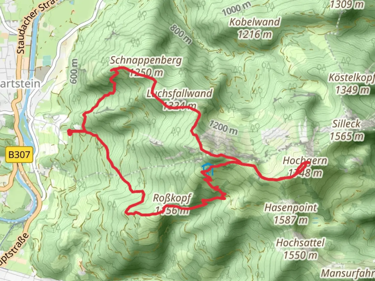
Hochlerch, Zwölferspitz and Hochgern via Maximiliansweg and SalzAlpenSteig
Download
Preview
Add to list
More
12.5 km
~4 hrs 46 min
1359 m
Loop
“Discover a thrilling alpine trek with breathtaking vistas, rich history, and vibrant wildlife in Bavaria's Hochgern loop.”
Nestled in the picturesque Bavarian Alps, the trail that encompasses Hochlerch, Zwölferspitz, and Hochgern via Maximiliansweg and SalzAlpenSteig offers a challenging yet rewarding adventure for seasoned hikers. This loop trail spans approximately 13 kilometers (about 8 miles) with an elevation gain of around 1300 meters (approximately 4265 feet), making it an extra difficult trek that demands preparation and endurance.### Getting ThereThe trailhead is conveniently located near Traunstein, Germany. For those traveling by car, Traunstein is accessible via the A8 motorway, with ample parking available near the trailhead. If you prefer public transport, Traunstein is well-connected by train, with regular services from Munich and Salzburg. From Traunstein station, local buses or taxis can take you to the starting point of the hike.### Trail OverviewThe journey begins with a steady ascent through lush forests, where the air is filled with the scent of pine and the sounds of chirping birds. As you climb, the trail opens up to reveal breathtaking views of the surrounding valleys and distant peaks. The first significant landmark is the Hochlerch summit, offering panoramic vistas that are particularly stunning at sunrise.Continuing along the Maximiliansweg, the path becomes more rugged and steep, demanding careful navigation. This section is characterized by rocky outcrops and narrow ridges, where sure-footedness is essential. The Zwölferspitz, the next peak on the route, provides a perfect spot for a brief rest and a chance to soak in the alpine scenery.### Nature and WildlifeThe trail is a haven for nature enthusiasts, with diverse flora and fauna. In spring and summer, the meadows are adorned with wildflowers, while the forests are home to deer, foxes, and a variety of bird species. Keep an eye out for the elusive golden eagle soaring above the peaks.### Historical SignificanceThe region is steeped in history, with the SalzAlpenSteig trail tracing ancient salt trading routes that date back to the Middle Ages. This historical significance adds a layer of intrigue to the hike, as you walk in the footsteps of traders who once transported salt across these rugged landscapes.### Reaching HochgernThe final ascent to Hochgern is the most demanding, with a steep climb that tests your stamina. However, the effort is rewarded with unparalleled views from the summit, where you can see the Chiemsee lake shimmering in the distance. This is an ideal spot for a well-deserved break and a chance to reflect on the journey.### Navigation and SafetyGiven the trail's difficulty, it's crucial to be well-prepared. Ensure you have sturdy hiking boots, sufficient water, and weather-appropriate clothing. The trail can be challenging to navigate, so using a reliable navigation tool like HiiKER is recommended to stay on course. Weather conditions can change rapidly in the mountains, so check forecasts and be prepared for sudden shifts.This trail offers an unforgettable experience for those seeking adventure and a deep connection with nature. With its combination of challenging terrain, stunning landscapes, and historical intrigue, it promises a hike that will linger in your memory long after you've descended back to the trailhead.

Comments and Reviews
User comments, reviews and discussions about the Hochlerch, Zwölferspitz and Hochgern via Maximiliansweg and SalzAlpenSteig, Germany.
4.8
average rating out of 5
5 rating(s)