10.0 km
~3 hrs 0 min
608 m
“Explore the rugged Durlachkopf Loop for breathtaking views and a taste of Bavarian history.”
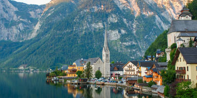
Nestled in the picturesque Bavarian Alps, the Durlachkopf Loop via Unternbergalm offers a challenging yet rewarding hiking experience. This 10 km (approximately 6.2 miles) loop trail, with an elevation gain of around 600 meters (about 1,970 feet), is located near Traunstein, Germany. Known for its rugged terrain and breathtaking views, this trail is best suited for experienced hikers seeking an adventure in the heart of nature.### Getting ThereTo reach the trailhead, you can drive or use public transportation. If driving, head towards Traunstein, a charming town in Bavaria, and follow signs to the trailhead located near the Unternbergalm. For those using public transport, take a train to Traunstein station, and from there, a local bus or taxi can take you closer to the starting point. The trailhead is conveniently located near the Unternbergalm, a well-known alpine pasture, making it easily accessible.### Trail HighlightsAs you embark on the Durlachkopf Loop, you'll traverse through dense forests, open meadows, and rocky paths. The trail is marked by its steep ascents and descents, providing a rigorous workout and testing your hiking skills. Along the way, you'll encounter a variety of flora and fauna native to the Bavarian Alps. Keep an eye out for deer, foxes, and a diverse array of bird species that inhabit the area.#### UnternbergalmApproximately 3 km (1.9 miles) into the hike, you'll reach the Unternbergalm, a traditional alpine hut offering a glimpse into the region's pastoral lifestyle. This is a great spot to take a break and enjoy the panoramic views of the surrounding mountains. The Unternbergalm is also a historical site, reflecting the centuries-old tradition of alpine farming in Bavaria.#### Durlachkopf SummitContinuing on, the trail leads you to the summit of Durlachkopf, the highest point of the loop. At an elevation of about 1,500 meters (4,921 feet), the summit provides stunning vistas of the Chiemgau Alps and beyond. On a clear day, you can see as far as the Austrian border, making the challenging climb worthwhile.### Navigation and SafetyGiven the trail's difficulty, it's crucial to be well-prepared. Use the HiiKER app for accurate navigation and to stay on track. The trail can be slippery, especially after rain, so sturdy hiking boots with good grip are essential. Weather in the Alps can change rapidly, so pack layers and rain gear. Ensure you have enough water and snacks, as there are limited facilities along the route.### Historical SignificanceThe region around Traunstein has a rich history, with evidence of human settlement dating back to the Bronze Age. The trail itself passes through areas that have been used for centuries by shepherds and farmers. Hiking here not only offers a physical challenge but also a journey through the cultural and historical tapestry of Bavaria.Embarking on the Durlachkopf Loop via Unternbergalm is a memorable experience, offering both natural beauty and a touch of Bavarian heritage. Whether you're drawn by the challenge or the scenery, this trail promises an unforgettable adventure in the Alps.

Reviews
User comments, reviews and discussions about the Durlachkopf Loop via Unternbergalm, Germany.
0.0
average rating out of 5
0 rating(s)
Loading reviews...