Download
Preview
Add to list
More
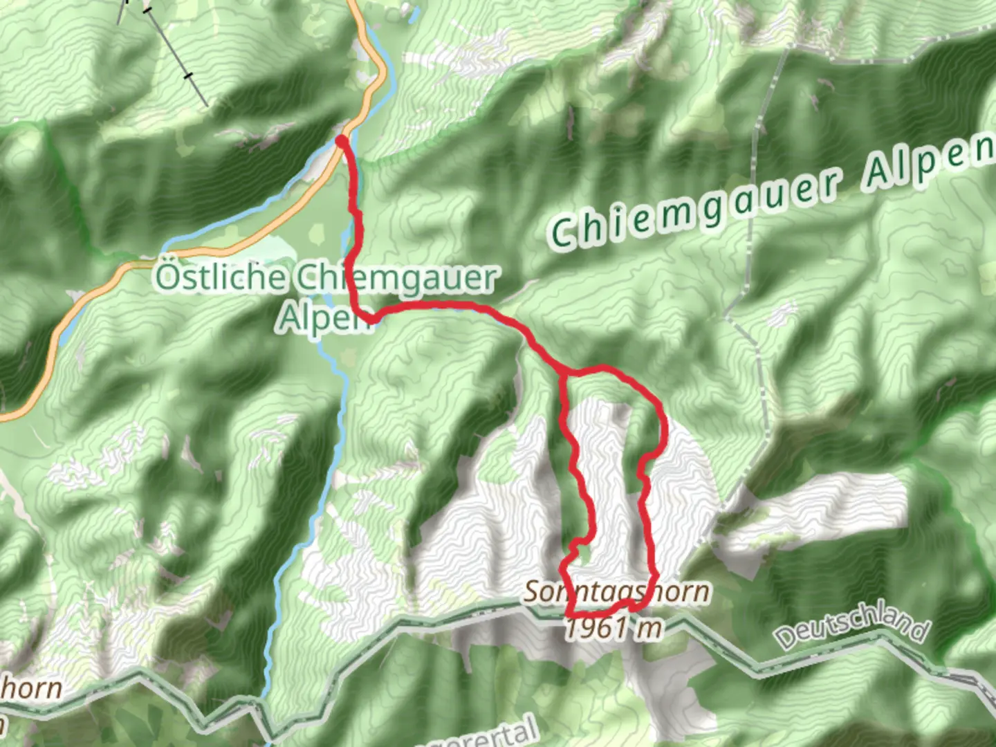
17.4 km
~5 hrs 49 min
1403 m
Loop
“Embark on a challenging alpine adventure with stunning vistas and rich biodiversity in the Chiemgau Alps.”
Nestled near Traunstein, Germany, the Reifelbergscharte and Sonntagshorn Loop offers a challenging yet rewarding hiking experience. This 17 km (approximately 10.5 miles) loop trail boasts an elevation gain of around 1400 meters (about 4593 feet), making it a demanding trek suitable for experienced hikers. The trailhead is conveniently located near the picturesque town of Traunstein, which is accessible by both car and public transport. For those traveling by train, Traunstein is well-connected to major cities like Munich. From Traunstein, local buses or a short taxi ride can take you to the trailhead in Laubau.
Trail Overview
The loop begins with a steady ascent through lush forests, where the scent of pine fills the air and the sounds of chirping birds accompany your journey. As you climb, the trail opens up to reveal stunning vistas of the surrounding Chiemgau Alps. The first significant landmark is the Reifelbergscharte, a mountain pass that offers panoramic views of the valleys below. This section of the trail is approximately 5 km (3.1 miles) from the start, with an elevation gain of about 700 meters (2297 feet).
Sonntagshorn Summit
Continuing from Reifelbergscharte, the trail leads you to the Sonntagshorn, the highest peak in the Chiemgau Alps at 1961 meters (6434 feet). This section is particularly steep and rocky, requiring careful footing and a good level of fitness. The summit rewards hikers with breathtaking 360-degree views, stretching across the German and Austrian Alps. On clear days, you can see as far as the Berchtesgaden National Park and the distant peaks of the Hohe Tauern range.
Flora and Fauna
The trail is rich in biodiversity, with alpine meadows teeming with wildflowers such as gentians and edelweiss during the warmer months. Keep an eye out for local wildlife, including chamois and marmots, which are often spotted along the higher elevations. Birdwatchers will delight in the presence of golden eagles and peregrine falcons soaring above.
Historical Significance
The region holds historical significance, with remnants of old shepherd paths and alpine huts that tell stories of past generations who lived and worked in these mountains. The Chiemgau Alps have long been a natural border between Bavaria and Austria, and the trails here have been used for centuries by traders and travelers.
Navigation and Safety
Given the trail's difficulty, it's essential to be well-prepared. Ensure you have sturdy hiking boots, sufficient water, and weather-appropriate clothing. The trail can be navigated using the HiiKER app, which provides detailed maps and real-time updates. Weather conditions can change rapidly in the mountains, so check forecasts before setting out and be prepared for sudden changes.
The descent from Sonntagshorn takes you through a series of switchbacks, gradually leading you back into the forested areas and eventually returning to the trailhead in Laubau. This loop trail offers a comprehensive alpine experience, combining physical challenge with the serene beauty of the Chiemgau Alps.

Comments and Reviews
User comments, reviews and discussions about the Reifelbergscharte and Sonntagshorn Loop from Laubau, Germany.
average rating out of 5
0 rating(s)