5.0 km
~1 hrs 34 min
343 m
“Explore the Ruine Ramburg Walk, a scenic 5 km trail blending natural beauty and medieval history.”
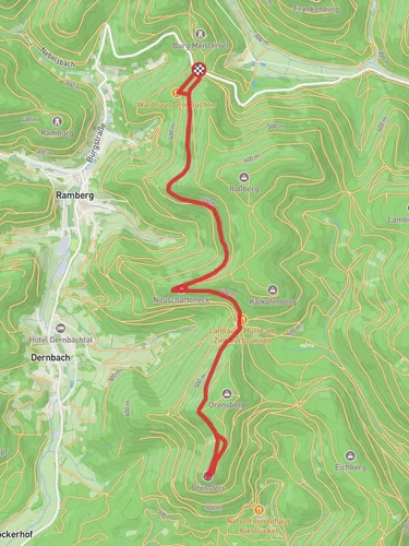
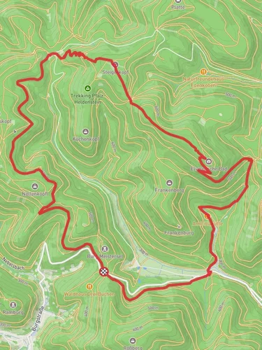
Starting near the picturesque Südliche Weinstraße in Germany, this 5 km (approximately 3.1 miles) out-and-back trail offers a delightful mix of natural beauty and historical intrigue. With an elevation gain of around 300 meters (about 984 feet), the Ruine Ramburg Walk is rated as medium difficulty, making it suitable for moderately experienced hikers.
### Getting There
To reach the trailhead, you can either drive or use public transport. If you're driving, set your GPS to the Südliche Weinstraße region, specifically near the town of Ramberg. For those using public transport, the nearest significant landmark is the town of Annweiler am Trifels. From Annweiler, you can take a local bus or taxi to Ramberg, which is just a short ride away.
### Trail Navigation
For navigation, it's highly recommended to use the HiiKER app, which provides detailed maps and real-time updates. The trail is well-marked, but having a reliable navigation tool will ensure you stay on the right path.
### The Hike
#### Initial Ascent
The trail begins with a gentle ascent through a dense forest of oak and beech trees. The first kilometer (0.6 miles) is relatively easy, with a gradual incline that allows you to warm up. As you continue, the path becomes steeper, gaining about 150 meters (492 feet) in elevation over the next 1.5 km (0.9 miles).
#### Midway Point
Around the 2.5 km (1.5 miles) mark, you'll reach a plateau where the forest opens up to reveal stunning views of the surrounding Palatinate Forest. This is a great spot to take a break, hydrate, and enjoy the scenery. Keep an eye out for local wildlife such as deer and various bird species that inhabit this area.
### Historical Significance
#### Ruine Ramburg
The highlight of this trail is undoubtedly the Ruine Ramburg, an ancient castle ruin dating back to the 12th century. Located approximately 3 km (1.9 miles) from the trailhead, the ruins offer a glimpse into medieval history. The castle was once a strategic fortification and has witnessed numerous historical events, including battles and sieges. Today, it stands as a testament to the region's rich past, with remnants of its walls and towers still visible.
### Final Stretch
After exploring the ruins, the trail continues for another 1 km (0.6 miles) before reaching the turnaround point. The return journey follows the same path, allowing you to revisit the scenic spots and perhaps notice details you missed on the way up.
### Flora and Fauna
The Palatinate Forest is known for its biodiversity. Along the trail, you'll encounter a variety of plant species, including wildflowers and ferns. The forest is also home to several types of fungi, which can be fascinating to observe, especially after a rain.
### Safety and Preparation
Given the moderate difficulty of the trail, it's advisable to wear sturdy hiking boots and bring plenty of water. The trail can be slippery after rain, so take extra caution during wet conditions. Always check the weather forecast before heading out and let someone know your hiking plans.
### Final Tips
While the trail is well-marked, having the HiiKER app will provide additional peace of mind. Also, consider bringing a small first-aid kit and some snacks to keep your energy levels up. Enjoy the hike and the rich history that the Ruine Ramburg Walk has to offer!
Reviews
User comments, reviews and discussions about the Ruine Ramburg Walk, Germany.
5.0
average rating out of 5
2 rating(s)


