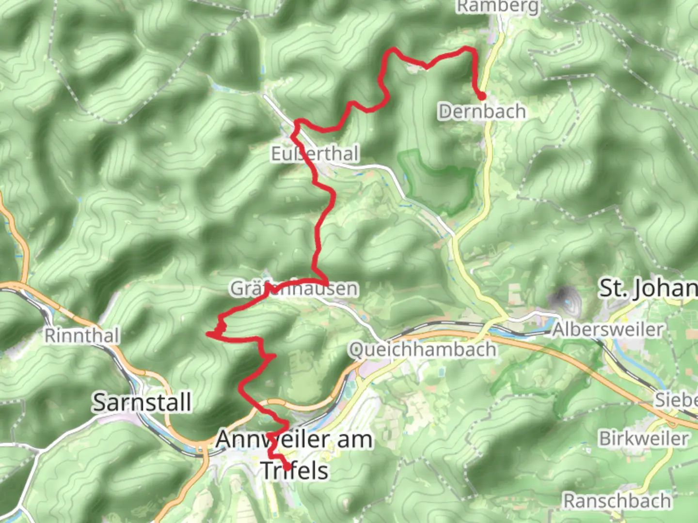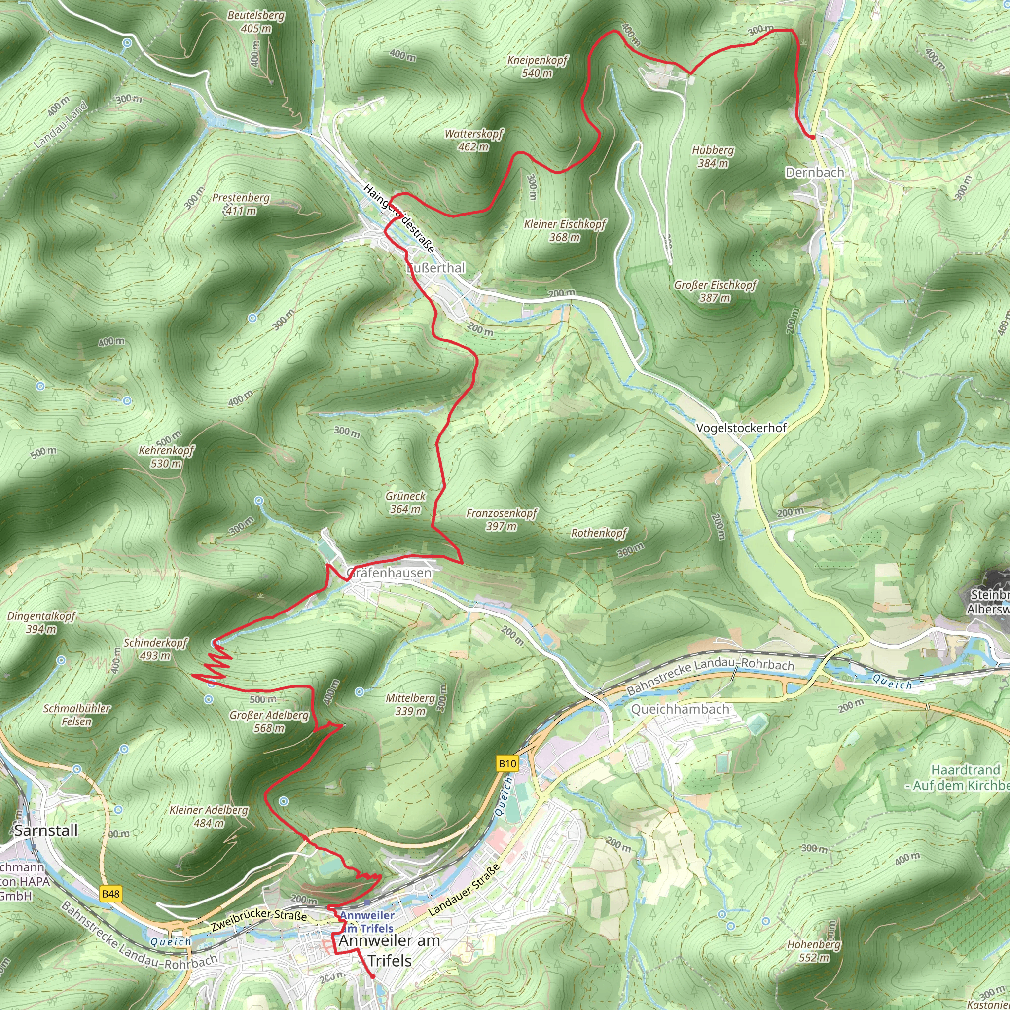
Dernbach to Markward von Annweiler via Pfaelzerwald Weisser Punkt
Download
Preview
Add to list
More
14.9 km
~4 hrs 32 min
944 m
Point-to-Point
“Explore a 15 km trail in Pfälzerwald, rich in natural beauty and historical intrigue.”
Starting near the picturesque region of Südliche Weinstraße in Germany, this 15 km (approximately 9.3 miles) point-to-point trail offers a delightful mix of natural beauty and historical intrigue. With an elevation gain of around 900 meters (approximately 2,950 feet), this medium-difficulty hike is perfect for those looking to challenge themselves while soaking in the rich cultural and natural heritage of the Pfälzerwald region.
Getting There To reach the trailhead, you can either drive or use public transport. If driving, head towards the Südliche Weinstraße district, where ample parking is available near the starting point. For those using public transport, the nearest significant landmark is the town of Annweiler am Trifels. From there, local buses or a short taxi ride can bring you to the trailhead.
Trail Overview The trail begins near the charming village of Dernbach, known for its traditional German architecture and serene landscapes. As you set off, you'll immediately be enveloped by the lush greenery of the Pfälzerwald, one of Germany's largest contiguous forest areas. The initial part of the trail is relatively gentle, allowing you to ease into the hike.
Key Landmarks and Elevation At around the 3 km (1.9 miles) mark, you'll encounter the first significant elevation gain. The trail starts to ascend more steeply, leading you through dense forest areas rich with native flora and fauna. Keep an eye out for deer and various bird species that inhabit this region.
By the time you reach the 7 km (4.3 miles) point, you'll have climbed approximately 450 meters (1,475 feet). Here, you'll come across the ruins of an old castle, a testament to the region's medieval history. Take a moment to explore and imagine the lives of those who once inhabited these ancient walls.
Historical Significance The Pfälzerwald region is steeped in history, with numerous castles and ruins dotting the landscape. The trail itself follows part of the historic Weisser Punkt route, which has been used for centuries by locals and travelers alike. This area was also significant during the Roman era, and you may come across remnants of Roman roads and settlements.
Final Stretch As you continue, the trail offers a mix of ascents and descents, with the final significant climb occurring around the 12 km (7.5 miles) mark. This section is particularly rewarding, offering panoramic views of the surrounding forest and distant hills. The elevation gain here is about 300 meters (985 feet), bringing the total to around 900 meters (2,950 feet) for the entire hike.
Wildlife and Nature The Pfälzerwald is home to a diverse range of wildlife. In addition to deer, you might spot wild boar, foxes, and a variety of bird species. The forest is also rich in plant life, with numerous species of trees, shrubs, and wildflowers adding to the natural beauty of the trail.
Navigation Given the dense forest and multiple intersecting paths, it's advisable to use a reliable navigation tool like HiiKER to stay on track. The trail is generally well-marked, but having a digital map can provide additional peace of mind.
Ending Point The trail concludes near the historic town of Annweiler am Trifels, home to the famous Trifels Castle where Richard the Lionheart was once imprisoned. This makes for a fitting end to a hike rich in both natural beauty and historical significance. From here, you can easily access public transport or find parking if you've arranged for a car pickup.
This trail offers a perfect blend of physical challenge, natural beauty, and historical exploration, making it a must-do for any avid hiker visiting the Pfälzerwald region.
Comments and Reviews
User comments, reviews and discussions about the Dernbach to Markward von Annweiler via Pfaelzerwald Weisser Punkt, Germany.
4.5
average rating out of 5
2 rating(s)
