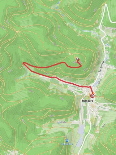
Kalkofenberg, Dreimärker Hütte and Ruine Neuscharfeneck Loop
11.7 km
~3 hrs 27 min
671 m
“The Kalkofenberg, Dreimärker Hütte, and Ruine Neuscharfeneck Loop offers a 12 km hike rich in natural beauty and history.”
Starting near Südliche Weinstraße, Germany, the Kalkofenberg, Dreimärker Hütte and Ruine Neuscharfeneck Loop is a captivating 12 km (7.5 miles) loop trail with an elevation gain of approximately 600 meters (1,970 feet). This medium-difficulty trail offers a blend of natural beauty, historical landmarks, and diverse wildlife, making it a rewarding experience for hikers.
### Getting There To reach the trailhead, you can either drive or use public transport. If driving, set your GPS to Südliche Weinstraße, Germany. For those using public transport, the nearest significant landmark is the town of Annweiler am Trifels. From Annweiler am Trifels, you can take a local bus or taxi to the trailhead.
### Trail Overview The trail begins with a gentle ascent through dense forests, offering a serene start to your hike. As you progress, the path becomes steeper, leading you to the first significant landmark, the Kalkofenberg. This section covers approximately 3 km (1.9 miles) with an elevation gain of around 200 meters (656 feet). The Kalkofenberg offers panoramic views of the surrounding landscape, making it a perfect spot for a short break.
### Dreimärker Hütte Continuing from Kalkofenberg, the trail leads you to the Dreimärker Hütte, a rustic mountain hut located about 5 km (3.1 miles) into the hike. This section involves a moderate climb, adding another 150 meters (492 feet) to your elevation gain. The Dreimärker Hütte is an excellent place to rest and enjoy a packed lunch. The hut is often frequented by local wildlife, including deer and various bird species, so keep your eyes peeled.
### Ruine Neuscharfeneck The next segment of the trail takes you to the Ruine Neuscharfeneck, a historical castle ruin dating back to the 13th century. This part of the hike is approximately 2 km (1.2 miles) with an elevation gain of 100 meters (328 feet). The ruins offer a glimpse into the region's medieval past and provide stunning views of the Palatinate Forest. Take some time to explore the ruins and imagine the history that unfolded within these ancient walls.
### Return Loop From Ruine Neuscharfeneck, the trail loops back towards the starting point. This final section is about 2 km (1.2 miles) and involves a descent of around 150 meters (492 feet). The path winds through lush forests and open meadows, offering a peaceful end to your hike.
### Navigation and Safety For navigation, it is highly recommended to use the HiiKER app, which provides detailed maps and real-time updates. Ensure you have adequate water, snacks, and appropriate clothing for changing weather conditions. The trail is well-marked, but always stay vigilant for trail markers to avoid getting lost.
### Historical Significance The region around Südliche Weinstraße is rich in history, with numerous castles and ruins that tell the story of its medieval past. The Ruine Neuscharfeneck, in particular, is a testament to the area's strategic importance during the Middle Ages. The castle was once a formidable fortress, and its ruins now serve as a reminder of the region's storied history.
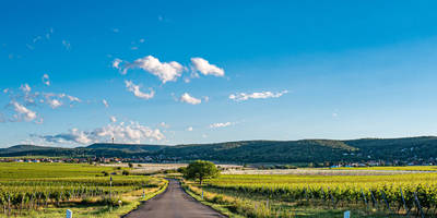
This trail offers a perfect blend of natural beauty, historical intrigue, and moderate physical challenge, making it an ideal choice for hikers looking to explore the Palatinate Forest.
Reviews
User comments, reviews and discussions about the Kalkofenberg, Dreimärker Hütte and Ruine Neuscharfeneck Loop, Germany.
4.0
average rating out of 5
3 rating(s)


