Gerolzhofen to Steigerwald via Neuer See and Hochstrasse Gerolzhofen
5.9 km
~1 hrs 23 min
131 m
“Embark on a scenic 6 km hike from Gerolzhofen to Steigerwald, blending natural beauty and rich history.”
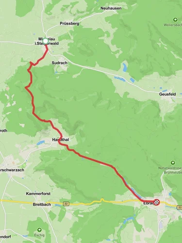
Starting near Schweinfurt, Germany, the trail from Gerolzhofen to Steigerwald via Neuer See and Hochstrasse Gerolzhofen offers a delightful 6 km (approximately 3.7 miles) journey through a region rich in natural beauty and historical significance. With an elevation gain of around 100 meters (328 feet), this point-to-point trail is rated as medium difficulty, making it accessible for most hikers with a moderate level of fitness.
### Getting There To reach the trailhead, you can either drive or use public transport. If driving, head towards Gerolzhofen, which is well-connected by road. For those using public transport, take a train to Schweinfurt and then a local bus to Gerolzhofen. The nearest significant landmark to the trailhead is the Gerolzhofen town center, which is easily navigable.
### Trail Overview The trail begins in the charming town of Gerolzhofen, known for its medieval architecture and historical significance. As you set off, you'll quickly find yourself immersed in the serene landscapes of the Franconian countryside. The first section of the trail takes you towards Neuer See, a picturesque lake surrounded by lush greenery. This is an excellent spot for a short break or a picnic, approximately 2 km (1.2 miles) into your hike.
### Neuer See to Hochstrasse Gerolzhofen Continuing from Neuer See, the trail gradually ascends towards Hochstrasse Gerolzhofen. This section offers panoramic views of the surrounding valleys and forests, making the climb well worth the effort. The elevation gain here is gentle but steady, adding up to around 100 meters (328 feet) over the course of the hike. Keep an eye out for local wildlife, including deer and various bird species, which are commonly spotted in this area.
### Historical Significance As you hike, you'll be traversing a region steeped in history. The Steigerwald area has been inhabited since prehistoric times and has a rich cultural heritage. The Hochstrasse Gerolzhofen itself was historically a significant trade route, connecting various towns and villages in the region. Along the way, you might come across remnants of old stone markers and ancient pathways that hint at the trail's historical importance.
### Navigation and Safety For navigation, it's highly recommended to use the HiiKER app, which provides detailed maps and real-time updates. The trail is well-marked, but having a reliable navigation tool ensures you stay on the right path. Make sure to wear sturdy hiking boots, carry sufficient water, and pack some snacks. Weather in this region can be unpredictable, so it's wise to bring a light rain jacket and check the forecast before setting out.
### Final Stretch to Steigerwald The final stretch of the trail leads you into the Steigerwald, a vast forested area known for its biodiversity and natural beauty. This part of the hike is relatively flat, allowing you to enjoy the tranquil surroundings without much physical exertion. The endpoint of the trail is near the Steigerwald Nature Park, a perfect place to explore further or simply relax and take in the serene environment.
This trail offers a perfect blend of natural beauty, moderate physical challenge, and historical intrigue, making it a rewarding experience for any hiker.
Reviews
User comments, reviews and discussions about the Gerolzhofen to Steigerwald via Neuer See and Hochstrasse Gerolzhofen, Germany.
0.0
average rating out of 5
0 rating(s)


