Download
Preview
Add to list
More
10.7 km
~2 hrs 39 min
311 m
Point-to-Point
“Embark on an 11-kilometer scenic journey through Steigerwald's lush forest, rich history, and moderate challenges.”
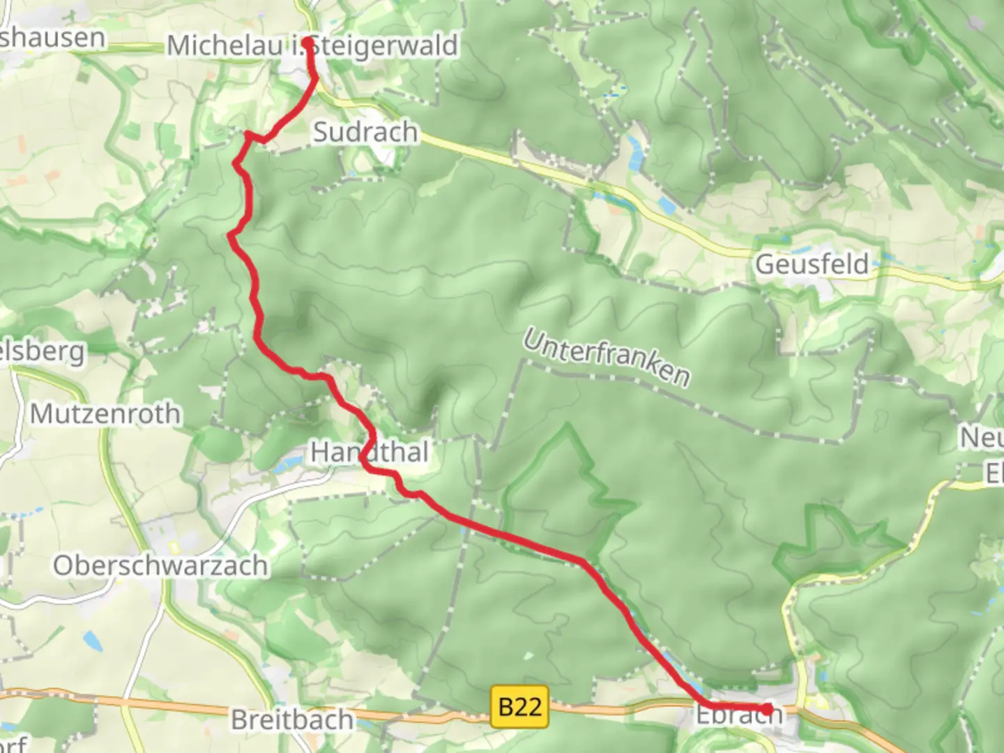
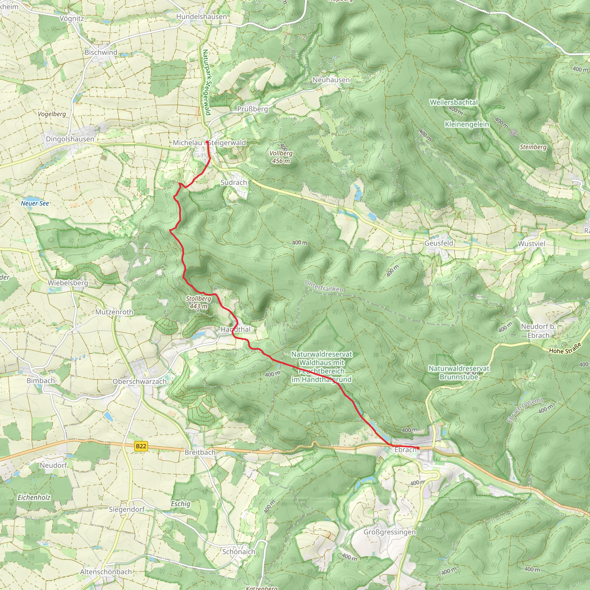
Starting near Schweinfurt, Germany, the trail from Michelau im Steigerwald to Ebrach via Steigerwald offers a delightful journey through the heart of the Steigerwald forest. This point-to-point trail spans approximately 11 kilometers (around 7 miles) with an elevation gain of about 300 meters (approximately 984 feet), making it a moderately challenging hike suitable for those with a reasonable level of fitness.
Getting There To reach the trailhead, you can either drive or use public transport. If driving, head towards Michelau im Steigerwald, which is easily accessible from Schweinfurt. For those relying on public transport, take a train or bus to Schweinfurt and then a local bus towards Michelau im Steigerwald. The nearest significant landmark to the trailhead is the St. Michael's Church in Michelau.
Trail Highlights and Landmarks As you set off from Michelau im Steigerwald, the trail quickly immerses you in the lush greenery of the Steigerwald forest. The first few kilometers are relatively gentle, allowing you to ease into the hike. Around the 3-kilometer (1.9-mile) mark, you'll encounter the first notable elevation gain as the trail begins to ascend through dense woodland.
One of the significant landmarks along the way is the Steigerwald Nature Park, renowned for its rich biodiversity. Keep an eye out for native wildlife such as deer, wild boar, and a variety of bird species. The forest is also home to ancient beech trees, some of which are over 300 years old, providing a majestic canopy overhead.
Historical Significance The Steigerwald region is steeped in history. As you hike, you'll pass by remnants of medieval settlements and ancient trade routes that once connected various parts of Bavaria. Around the halfway point, near the 5.5-kilometer (3.4-mile) mark, you might notice the ruins of an old watchtower, a relic from the times when the area was a strategic point for monitoring trade and travel.
Navigation and Terrain The trail is well-marked, but it's always wise to have a reliable navigation tool. Using HiiKER can help ensure you stay on track and provide real-time updates on your progress. The terrain varies from well-trodden paths to more rugged sections, particularly as you approach the higher elevations. Good hiking boots are recommended to navigate the occasional rocky patches and uneven ground.
Final Stretch to Ebrach As you descend towards Ebrach, the trail offers stunning views of the surrounding countryside. The final few kilometers are relatively easier, allowing you to enjoy the scenery as you approach the end of your hike. Ebrach itself is a charming town with historical significance, home to the Ebrach Abbey, a former Cistercian monastery dating back to the 12th century.
Practical Tips - **Water and Snacks:** Ensure you carry enough water and some high-energy snacks, as there are limited facilities along the trail. - **Weather:** Check the weather forecast before setting out, as conditions can change rapidly in the forest. - **Clothing:** Dress in layers to accommodate the varying temperatures, especially if hiking in spring or autumn.
This trail offers a perfect blend of natural beauty, historical intrigue, and moderate physical challenge, making it a rewarding experience for any hiker.
Comments and Reviews
User comments, reviews and discussions about the Michelau im Steigerwald to Ebrach via Steigerwald, Germany.
5.0
average rating out of 5
1 rating(s)
