18.6 km
~1 day 1 hrs
1768 m
Download
Preview
Add to list
More
“Embark on a breathtaking, challenging hike through Oberallgäu's stunning alpine landscapes and rich history.”
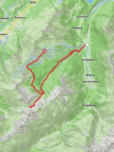
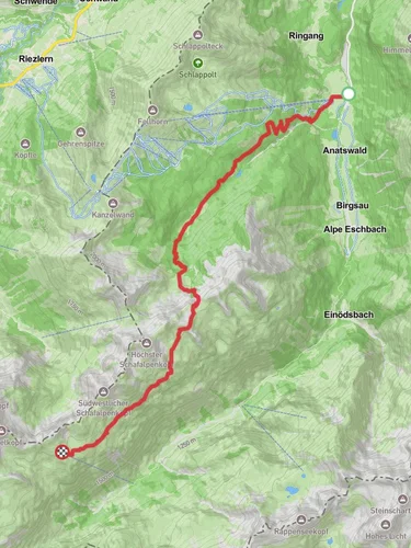
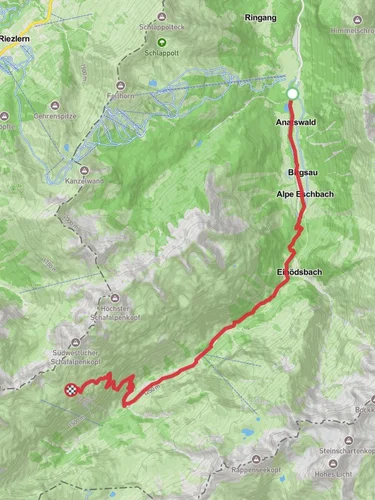
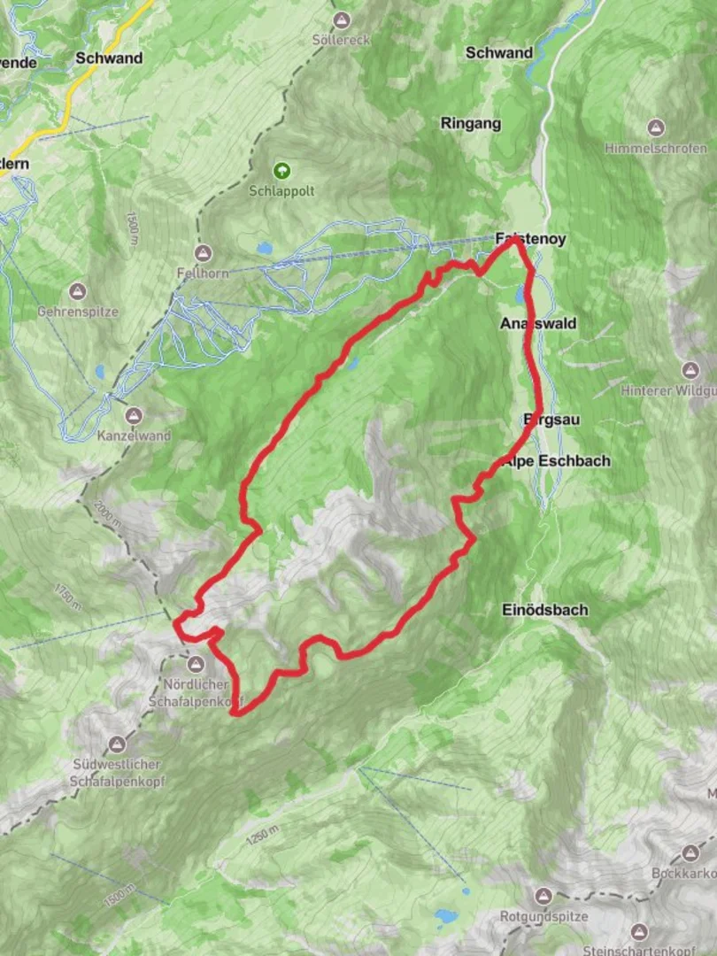
Nestled in the picturesque region of Oberallgäu, Germany, the Faistenoy, Diensthutte and Fiderescharte Loop offers an exhilarating adventure for seasoned hikers. This challenging loop spans approximately 19 kilometers (about 11.8 miles) and features a significant elevation gain of around 1,700 meters (approximately 5,577 feet), making it an extra difficult trek that demands preparation and endurance.
Getting There
The trailhead is conveniently located near Oberallgäu, a region renowned for its stunning alpine landscapes. For those traveling by public transport, the nearest major town is Oberstdorf, which is well-connected by train from major German cities. From Oberstdorf, local buses can take you closer to the trailhead. If you're driving, there are parking facilities available near the starting point, but it's advisable to arrive early, especially during peak hiking seasons.
Trail Overview
The loop begins with a steep ascent, immediately immersing hikers in the breathtaking beauty of the Allgäu Alps. As you climb, you'll traverse lush meadows and dense forests, home to a variety of wildlife including deer and marmots. The initial section of the trail is marked by a series of switchbacks that gradually lead you to higher altitudes.
Faistenoy to Diensthutte
Approximately 5 kilometers (3.1 miles) into the hike, you'll reach the Diensthutte, a historic mountain hut that offers a glimpse into the region's past. This area was once a vital stop for shepherds and travelers navigating the rugged terrain. The hut provides a perfect spot for a brief rest and to take in the panoramic views of the surrounding peaks.
Diensthutte to Fiderescharte
Continuing onward, the trail becomes more challenging as you approach the Fiderescharte, a mountain pass that sits at an elevation of about 2,200 meters (7,218 feet). This section is characterized by rocky paths and steep inclines, requiring careful footing and a good level of fitness. The effort is rewarded with awe-inspiring vistas of the Allgäu Alps, stretching as far as the eye can see.
Navigational Tips
Given the complexity of the terrain, it's crucial to have reliable navigation tools. The HiiKER app is highly recommended for its detailed maps and real-time trail updates. Weather conditions in the Alps can change rapidly, so it's essential to check forecasts and be prepared for sudden shifts.
Flora and Fauna
The trail is a haven for nature enthusiasts, offering a diverse array of flora and fauna. In the spring and summer months, the meadows burst into color with wildflowers, while the forests provide a habitat for numerous bird species. Keep an eye out for the elusive golden eagle soaring above the peaks.
Historical Significance
The Allgäu region is steeped in history, with evidence of human settlement dating back to prehistoric times. The trail itself has been used for centuries, serving as a vital link between communities in the Alps. The remnants of old shepherd paths and stone markers are a testament to the area's rich cultural heritage.
Final Descent
The descent back to the trailhead is equally demanding, with steep declines that require caution. As you make your way down, you'll pass through serene alpine valleys and babbling brooks, offering a peaceful conclusion to this challenging yet rewarding hike.
This loop is not for the faint-hearted, but for those who undertake it, the Faistenoy, Diensthutte and Fiderescharte Loop promises an unforgettable journey through one of Germany's most stunning alpine landscapes.

Reviews
User comments, reviews and discussions about the Faistenoy, Diensthutte and Fiderescharte Loop, Germany.
0.0
average rating out of 5
0 rating(s)