7.3 km
~1 hrs 51 min
238 m
“The Rothaarweg and Heiklimatour trail blends lush forests, historical landmarks, and diverse wildlife for an enriching 7-kilometer hike.”
Starting near Hochsauerlandkreis, Germany, the Rothaarweg and Heiklimatour is a scenic loop trail that spans approximately 7 kilometers (4.35 miles) with an elevation gain of around 200 meters (656 feet). This medium-difficulty trail offers a blend of natural beauty, historical landmarks, and diverse wildlife, making it an enriching experience for hikers.
### Getting There To reach the trailhead, you can drive or use public transport. If driving, set your GPS to Hochsauerlandkreis, Germany, and look for parking near the trailhead. For those using public transport, take a train to Winterberg station, which is the nearest significant landmark. From Winterberg, you can catch a local bus or taxi to the trailhead.
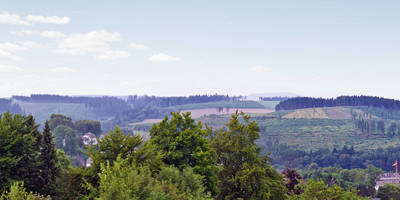
### Trail Highlights #### Nature and Wildlife The trail meanders through dense forests and open meadows, offering a rich tapestry of flora and fauna. Keep an eye out for native wildlife such as deer, foxes, and a variety of bird species. The forested sections are particularly lush, with towering beech and oak trees providing ample shade.
#### Elevation and Terrain The trail features a moderate elevation gain of 200 meters (656 feet), making it accessible for hikers with a reasonable level of fitness. The terrain is varied, with some steep sections and rocky paths, so sturdy hiking boots are recommended. The highest point of the trail offers panoramic views of the surrounding Hochsauerlandkreis region, a reward well worth the climb.
### Historical Significance The Rothaarweg and Heiklimatour is steeped in history. The trail passes near several ancient landmarks, including remnants of old trade routes and medieval settlements. One notable site is the ruins of a medieval watchtower, located approximately 3 kilometers (1.86 miles) into the hike. This tower once served as a lookout point to protect the region from invaders.
### Navigation For navigation, it is advisable to use the HiiKER app, which provides detailed maps and real-time updates. The trail is well-marked, but having a reliable navigation tool ensures you stay on track and can explore any interesting detours with confidence.
### Points of Interest #### Scenic Overlooks Around the 5-kilometer (3.1 miles) mark, you'll find a scenic overlook that offers breathtaking views of the Rothaar Mountains. This is an excellent spot for a rest and some photography.
#### Flora and Fauna The trail is particularly beautiful in spring and autumn. In spring, wildflowers carpet the meadows, while autumn brings a riot of colors as the leaves change. The diverse plant life includes rare species of orchids and ferns, making it a botanist's delight.
### Practical Information - Water and Snacks: There are no facilities along the trail, so bring sufficient water and snacks. - Weather: The weather can be unpredictable, so check the forecast and dress in layers. - Safety: Mobile reception can be spotty in some areas, so inform someone of your plans before you set out.
This trail offers a perfect blend of natural beauty, historical intrigue, and moderate physical challenge, making it a must-visit for any hiking enthusiast exploring the Hochsauerlandkreis region.
Reviews
User comments, reviews and discussions about the Rothaarweg and Heiklimatour, Germany.
5.0
average rating out of 5
2 rating(s)


