7.0 km
~1 hrs 45 min
216 m
“Experience the enchanting 7 km Mollseifen Rundweg and Astenweg trail, blending nature, history, and moderate challenge.”
Starting near Hochsauerlandkreis, Germany, the Mollseifen Rundweg and Astenweg trail offers a delightful 7 km (4.35 miles) loop with an elevation gain of approximately 200 meters (656 feet). This medium-difficulty trail is perfect for those looking to experience the natural beauty and historical richness of the region.
### Getting There To reach the trailhead, you can drive or use public transport. If driving, set your GPS to Hochsauerlandkreis, Germany, and look for parking near the village of Mollseifen. For public transport, take a train to Winterberg station, which is the nearest major hub. From Winterberg, you can catch a local bus or taxi to Mollseifen, which is about 10 km (6.2 miles) away.
### Trail Navigation For navigation, it is highly recommended to use the HiiKER app, which provides detailed maps and real-time updates. The trail is well-marked, but having a reliable navigation tool will ensure you stay on track.
### Trail Highlights The trail begins in the quaint village of Mollseifen, known for its traditional half-timbered houses. As you start your hike, you'll pass through lush forests and open meadows, offering a mix of shaded and sunny sections. The first significant landmark is the Mollseifen Chapel, located about 1 km (0.62 miles) from the start. This charming chapel dates back to the 18th century and is a great spot for a short break.
### Flora and Fauna As you continue, you'll notice the rich biodiversity of the area. The trail is home to various species of birds, including woodpeckers and finches. Keep an eye out for deer and foxes, which are commonly seen in the early morning or late afternoon. The flora is equally impressive, with a mix of deciduous and coniferous trees, wildflowers, and ferns.
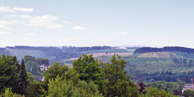
### Elevation Gain Around the 3 km (1.86 miles) mark, you'll start to experience the elevation gain. The ascent is gradual but steady, taking you through a series of switchbacks. This section offers stunning views of the surrounding valleys and hills. Make sure to take short breaks to enjoy the scenery and catch your breath.
### Historical Significance The trail also has historical significance. During World War II, the area around Mollseifen was a strategic location. You'll come across several old bunkers and trenches, remnants of the war. These historical landmarks are a poignant reminder of the region's past and offer a unique perspective on the area's history.
### Astenweg Section As you approach the Astenweg section, approximately 5 km (3.1 miles) into the hike, you'll find yourself on a ridge offering panoramic views. This is one of the most scenic parts of the trail, with vistas stretching as far as the eye can see. The ridge is also a great spot for birdwatching, so bring your binoculars if you're an avid birder.
### Final Stretch The final 2 km (1.24 miles) of the trail take you downhill back towards Mollseifen. This section is relatively easy and allows you to cool down after the more strenuous parts of the hike. You'll pass through more meadows and forests, eventually looping back to where you started.
### Practical Tips - Wear sturdy hiking boots, as the trail can be uneven in places. - Bring plenty of water and snacks, especially if you plan to take your time exploring the historical sites. - Check the weather forecast before you go; the trail can be slippery after rain. - Use the HiiKER app for navigation to ensure you stay on the correct path.
This trail offers a perfect blend of natural beauty, historical landmarks, and moderate physical challenge, making it a rewarding experience for hikers of all levels.
Reviews
User comments, reviews and discussions about the Mollseifen Rundweg and Astenweg, Germany.
4.0
average rating out of 5
3 rating(s)


