11.6 km
~5 hrs 31 min
1916 m
Download
Preview
Add to list
More
“Thrill-seekers will revel in the breathtaking alpine adventure from Tiroler Zugspitzbahn to Zugspitze's summit.”
Nestled in the heart of the Austrian Alps, the hike from Tiroler Zugspitzbahn to the summit of Zugspitze offers an exhilarating adventure for seasoned hikers. This challenging trail spans approximately 12 kilometers (about 7.5 miles) and boasts an elevation gain of around 1,900 meters (approximately 6,234 feet), making it an endeavor suited for those with a high level of fitness and experience in alpine hiking.
Getting There
The trailhead is conveniently located near Bezirk Reutte, Austria. For those traveling by car, you can reach the starting point by heading towards the Tiroler Zugspitzbahn cable car station, which is well-signposted from the main roads in the region. If you prefer public transport, take a train to Garmisch-Partenkirchen and then a bus to the Tiroler Zugspitzbahn station. The journey offers stunning views of the surrounding mountains, setting the stage for the adventure ahead.
Trail Overview
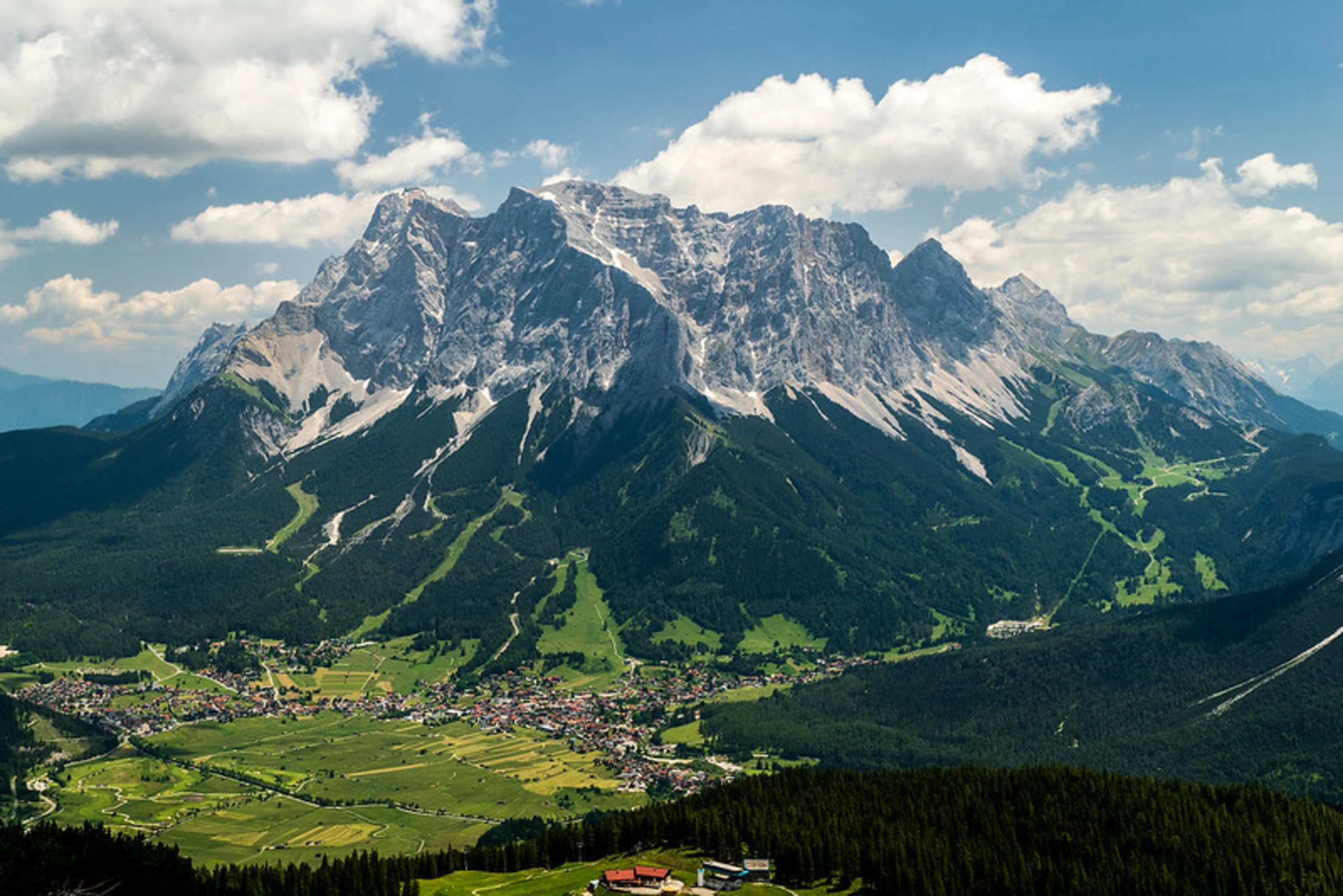
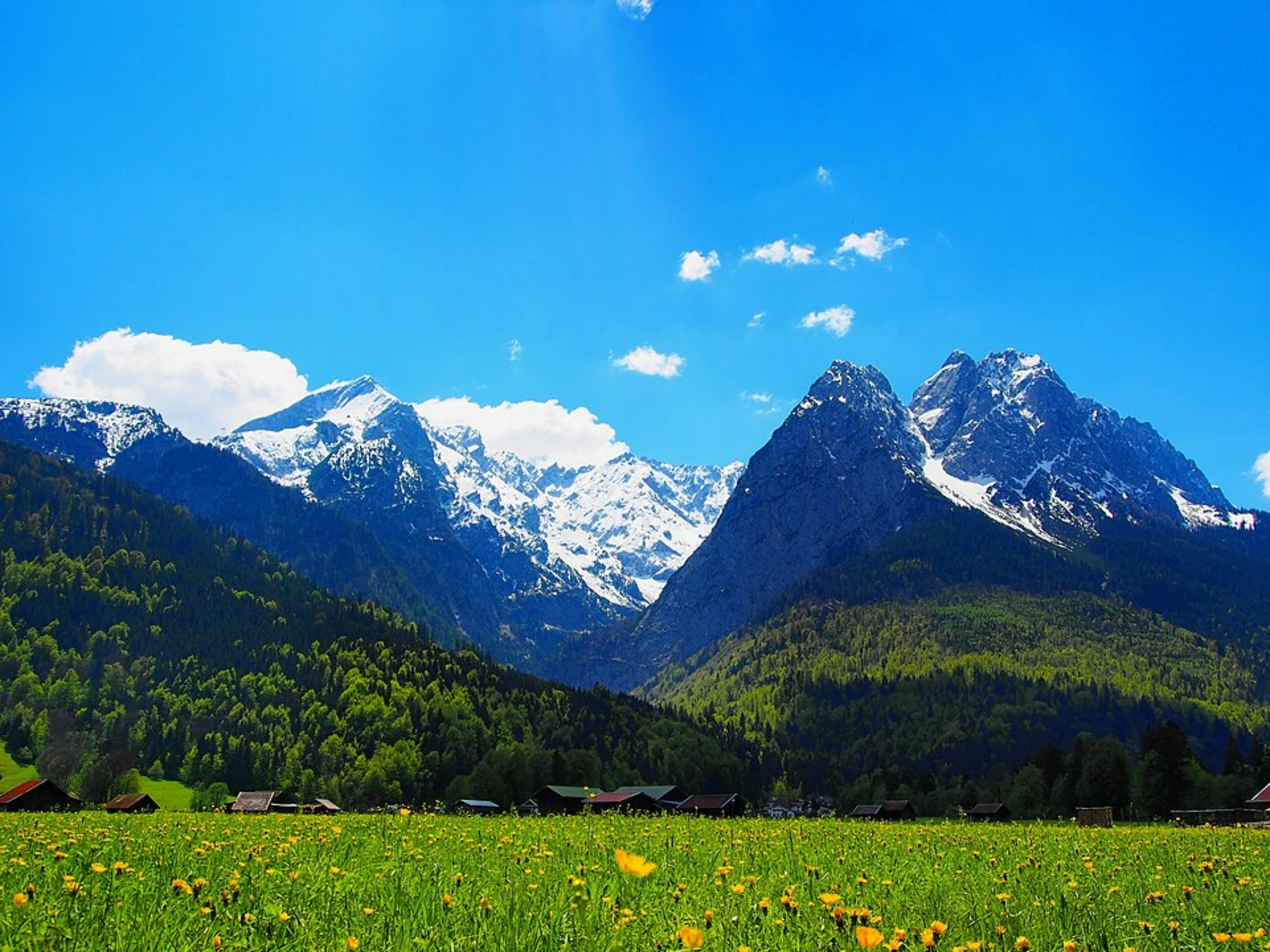
The hike begins at the base of the Tiroler Zugspitzbahn, where you'll immediately be greeted by the majestic beauty of the Tyrolean Alps. As you ascend, the trail winds through lush alpine meadows, where wildflowers bloom in vibrant colors during the warmer months. Keep an eye out for local wildlife, including marmots and chamois, which are often spotted in this region.
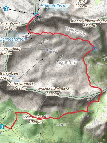
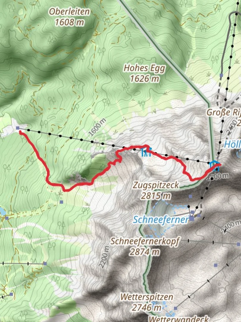
Key Landmarks and Sections
Ehrwalder Alm: Approximately 3 kilometers (1.9 miles) into the hike, you'll reach the Ehrwalder Alm, a picturesque alpine pasture. This is a great spot to take a short break and enjoy the panoramic views of the surrounding peaks. The elevation gain to this point is about 500 meters (1,640 feet).
Gatterl Pass: Continuing onward, the trail becomes steeper as you approach the Gatterl Pass, located around 6 kilometers (3.7 miles) from the start. This section is particularly demanding, with rocky terrain and a significant elevation gain. The pass itself sits at an elevation of approximately 2,020 meters (6,627 feet) and serves as a natural border between Austria and Germany.
Zugspitzplatt: After crossing the Gatterl Pass, the trail leads to the Zugspitzplatt, a high-altitude plateau known for its lunar-like landscape. This area is historically significant, as it was once a site for mining activities. The plateau offers a unique perspective of the surrounding glaciers and peaks.
Final Ascent
The final push to the summit is the most challenging part of the hike. The trail becomes narrow and exposed, requiring careful navigation and sure-footedness. The use of HiiKER is recommended to ensure you stay on the correct path. As you ascend, the views become increasingly breathtaking, with the entire Zugspitze massif unfolding before you.
Summit Experience
Reaching the summit of Zugspitze, the highest peak in Germany at 2,962 meters (9,718 feet), is a rewarding experience. From the top, you'll be treated to a 360-degree panorama of the Alps, stretching across four countries: Germany, Austria, Switzerland, and Italy. The summit area is equipped with a viewing platform and a small restaurant, where you can relax and savor the achievement of conquering this formidable trail.
Historical Significance
The Zugspitze region holds a rich history, with the first recorded ascent dating back to 1820. Over the years, it has become a symbol of alpine exploration and adventure. The Tiroler Zugspitzbahn, constructed in the early 20th century, played a crucial role in making the mountain more accessible to visitors from around the world.
Embarking on the Zugspitze hike from Tiroler Zugspitzbahn is not just a test of physical endurance but also an opportunity to immerse yourself in the natural beauty and historical significance of the Tyrolean Alps.

Reviews
User comments, reviews and discussions about the Zugspitze Hike from Tiroler Zugspitzbahn, Austria.
0.0
average rating out of 5
0 rating(s)