16.7 km
~7 hrs 19 min
2382 m
Download
Preview
Add to list
More
“Embark on a thrilling ascent through breathtaking landscapes and rich history to Germany's highest peak.”
Nestled in the Bavarian Alps, the Zugspitze Hike via Eibsee is a challenging yet rewarding adventure that takes you to the highest peak in Germany. Starting near the picturesque town of Garmisch-Partenkirchen, this trail offers a blend of natural beauty, historical intrigue, and physical challenge.
Getting There
To reach the trailhead, travelers can take a train to Garmisch-Partenkirchen from Munich, which is approximately a 1.5-hour journey. From Garmisch-Partenkirchen, local buses or a short taxi ride will take you to the Eibsee, the starting point of the hike. If driving, follow the signs to Eibsee, where parking is available.
Trail Overview
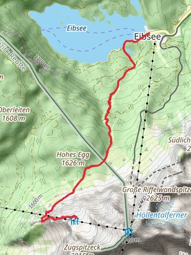
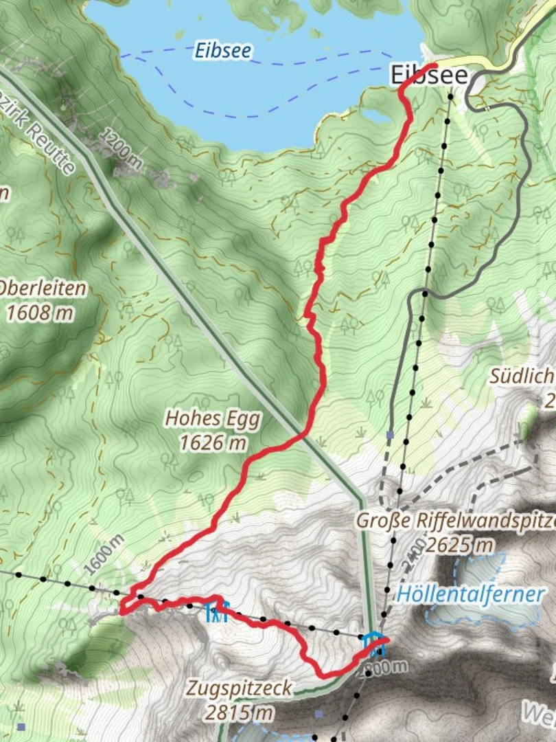
The hike spans approximately 17 kilometers (about 10.5 miles) with a significant elevation gain of around 2300 meters (approximately 7546 feet). This extra difficult trail demands a high level of fitness and experience in alpine hiking. The route is well-marked, but it's advisable to use HiiKER for navigation to ensure you stay on track.
Key Sections and Landmarks
Eibsee to Höllental Valley
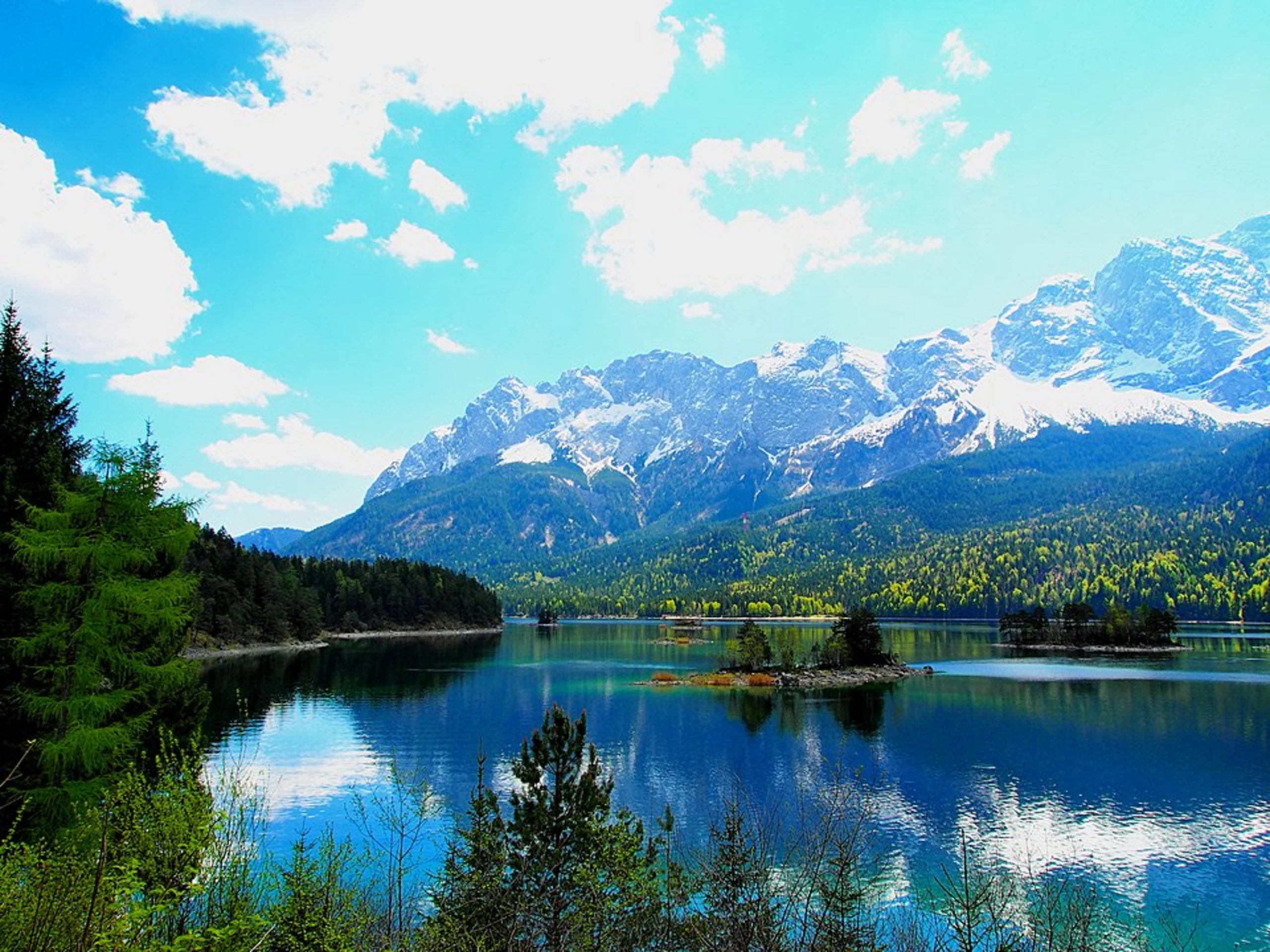
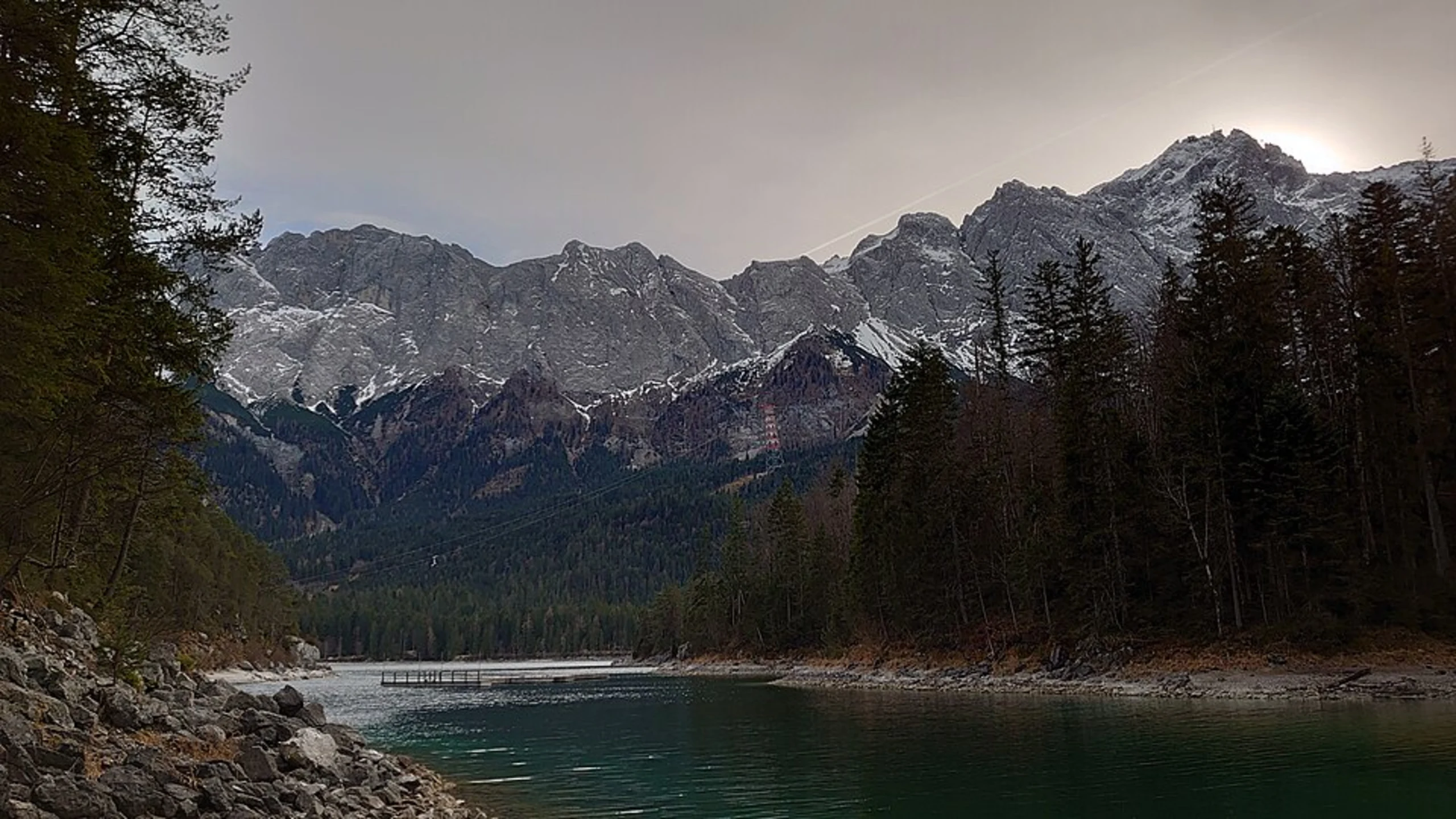
The journey begins at the serene Eibsee, a glacial lake known for its crystal-clear waters and stunning reflections of the surrounding mountains. As you ascend, the trail leads you through dense forests and into the Höllental Valley. This section is approximately 5 kilometers (3.1 miles) with an elevation gain of about 500 meters (1640 feet). The valley is renowned for its dramatic cliffs and the rushing waters of the Hammersbach stream.
Höllentalanger Hut and Glacier
Continuing through the valley, you'll reach the Höllentalanger Hut, a popular rest stop for hikers. This is an ideal place to take a break and enjoy the alpine scenery. From here, the trail becomes more challenging as you approach the Höllentalferner Glacier. This section covers roughly 4 kilometers (2.5 miles) with an elevation gain of 800 meters (2625 feet). Crampons and ice axes may be necessary, depending on the season and conditions.
Final Ascent to Zugspitze
The final push to the summit is the most demanding part of the hike. Covering the remaining 8 kilometers (5 miles) with an elevation gain of 1000 meters (3281 feet), this section involves steep climbs and exposed ridges. The views from the top are breathtaking, offering panoramic vistas of the Alps and beyond.
Nature and Wildlife
The Zugspitze region is home to diverse flora and fauna. Hikers may encounter alpine ibex, marmots, and a variety of bird species. The area is also rich in wildflowers, particularly in the summer months, adding vibrant colors to the rugged landscape.
Historical Significance
The Zugspitze has a storied history, with the first recorded ascent in 1820 by Josef Naus. The region played a significant role during World War II, serving as a strategic location due to its elevation and proximity to the Austrian border. Today, it remains a symbol of natural beauty and human perseverance.
This hike is not only a test of endurance but also an opportunity to immerse oneself in the stunning landscapes and rich history of the Bavarian Alps. Proper preparation, including checking weather conditions and ensuring you have the necessary equipment, is essential for a safe and enjoyable experience.

Reviews
User comments, reviews and discussions about the Zugspitze Hike via Eibsee, Germany.
0.0
average rating out of 5
0 rating(s)