11.2 km
~5 hrs 9 min
1758 m
Download
Preview
Add to list
More
“Embark on a breathtaking alpine adventure to Germany's highest peak, offering stunning views and challenging terrain.”
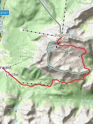
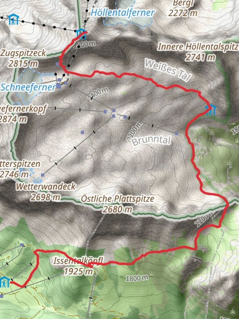
Starting your adventure near Bezirk Reutte, Austria, the Zugspitze Hike from Ehrwalder Alm is a challenging yet rewarding trek that takes you to the highest peak in Germany. This trail spans approximately 11 kilometers (about 6.8 miles) and involves a significant elevation gain of around 1,700 meters (5,577 feet), making it an extra difficult hike suitable for experienced hikers.
Getting There
To reach the trailhead, you can drive to the Ehrwalder Alm, which is accessible via the B187 road from Reutte. For those relying on public transport, take a train to Ehrwald Zugspitzbahn station, and from there, a local bus or taxi can take you to the Ehrwalder Alm cable car station, where the hike begins.
Trail Overview
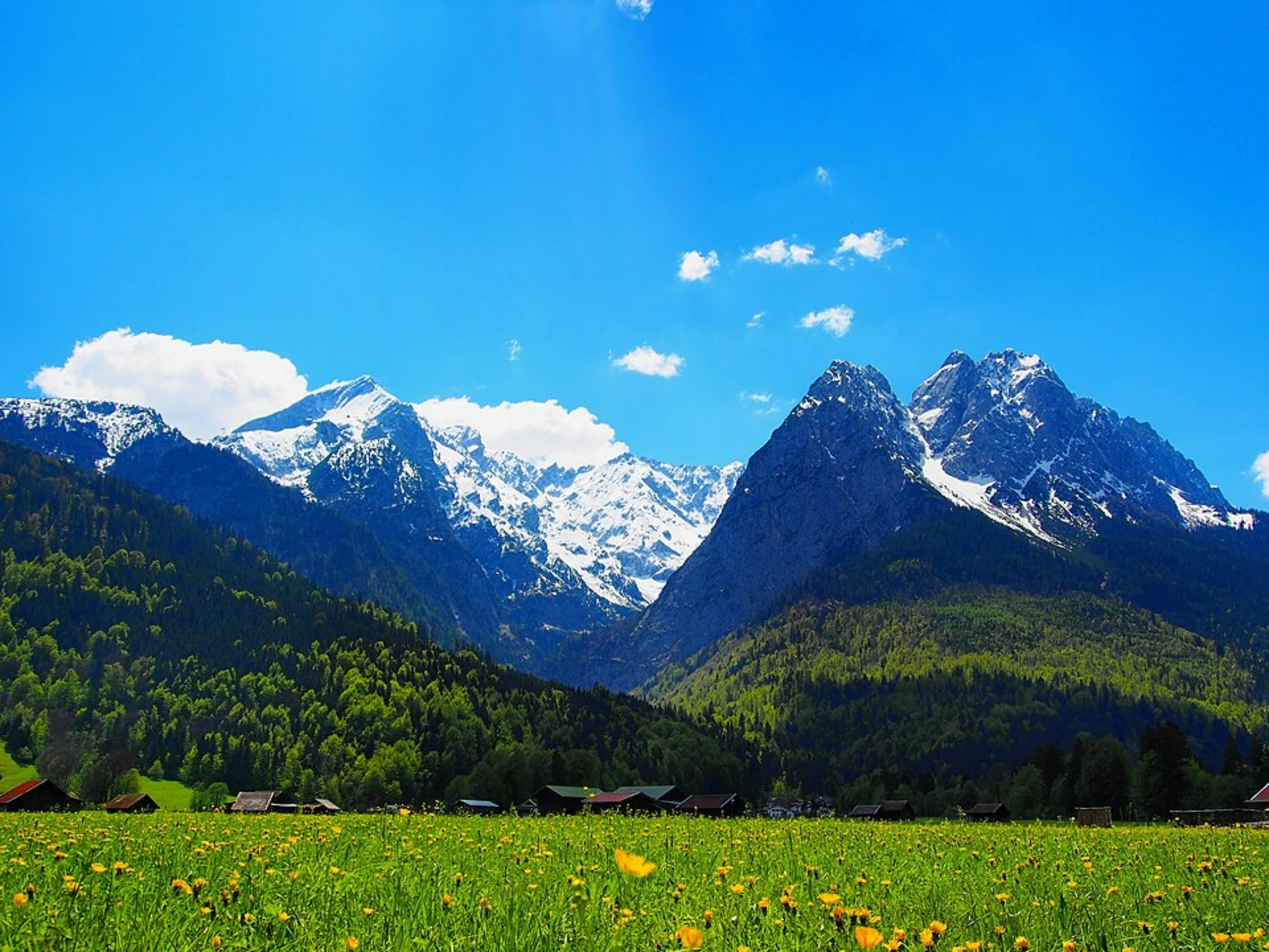
The hike begins at the Ehrwalder Alm, a picturesque alpine meadow that offers stunning views of the surrounding mountains. As you set off, the trail quickly ascends through lush forests and rocky terrain. The initial section is steep, with a mix of switchbacks and rocky paths, so sturdy hiking boots are essential.
Key Landmarks and Sections
Seebensee and Coburger Hut
Approximately 3 kilometers (1.9 miles) into the hike, you'll reach the beautiful Seebensee, a turquoise alpine lake that reflects the surrounding peaks. This is a perfect spot for a short break and some photos. Continuing on, the trail leads you to the Coburger Hut, a mountain refuge where you can rest and enjoy a meal. The hut is situated at an elevation of about 1,917 meters (6,289 feet) and offers panoramic views of the Mieminger Range.
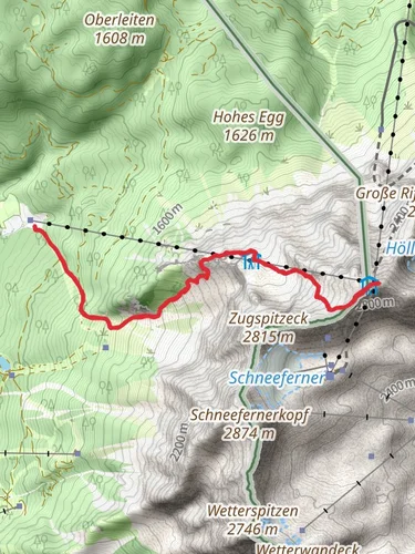
Gatterl and Knorr Hut
After leaving the Coburger Hut, the trail becomes more challenging as you approach the Gatterl, a mountain pass that marks the border between Austria and Germany. This section involves some scrambling and is exposed in places, so caution is advised. Once you cross into Germany, the path leads you to the Knorr Hut, located at an elevation of 2,051 meters (6,729 feet). This is another opportunity to rest and refuel before the final ascent.
Final Ascent to Zugspitze
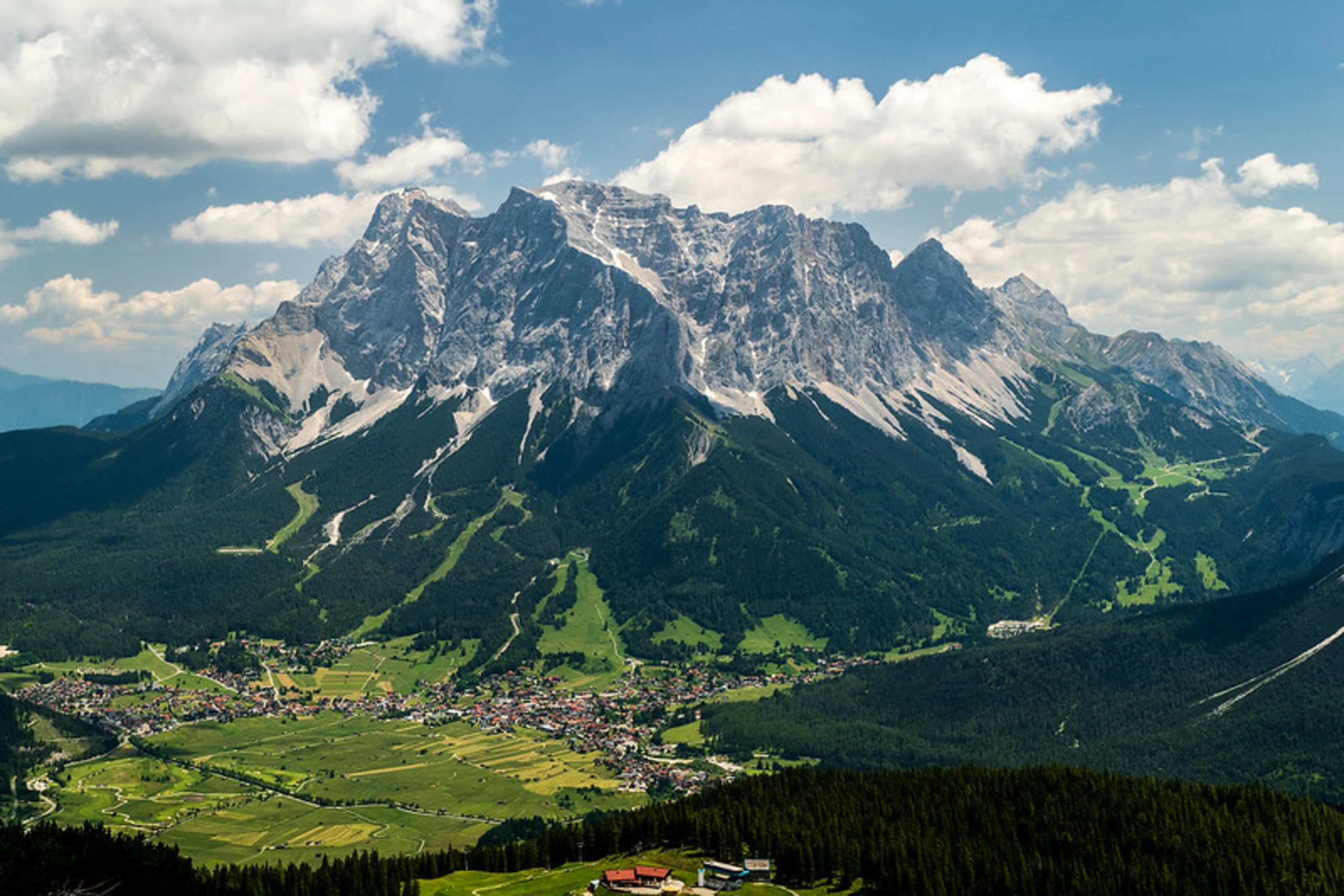
The last stretch to the summit of Zugspitze is the most demanding. The trail becomes steeper and more rugged, with some sections requiring the use of fixed cables for support. As you climb, the views become increasingly breathtaking, with the expansive vistas of the Alps unfolding around you. Upon reaching the summit at 2,962 meters (9,718 feet), you'll be rewarded with a 360-degree view that spans four countries: Germany, Austria, Italy, and Switzerland.
Nature and Wildlife
Throughout the hike, keep an eye out for the diverse alpine flora and fauna. You may encounter marmots, chamois, and a variety of bird species. The region is also known for its rich botanical diversity, with numerous wildflowers dotting the landscape in the warmer months.
Historical Significance
The Zugspitze region holds historical significance as a strategic location during World War II. The mountain's rugged terrain and remote location made it a challenging area for military operations. Today, it stands as a symbol of peace and natural beauty, attracting hikers and nature enthusiasts from around the world.
Navigation and Safety
Given the trail's difficulty, it's crucial to be well-prepared. Use HiiKER to download offline maps and track your progress. Weather conditions can change rapidly in the mountains, so check forecasts and be prepared for sudden changes. Carry sufficient water, snacks, and layers of clothing to adapt to varying temperatures.
Embarking on the Zugspitze Hike from Ehrwalder Alm is a test of endurance and skill, but the stunning landscapes and sense of accomplishment make it an unforgettable experience for those who undertake it.

Reviews
User comments, reviews and discussions about the Zugspitze Hike from Ehrwalder Alm, Austria.
0.0
average rating out of 5
0 rating(s)