
Download
3D Flyover
Add to list
More
28.5 km
~7 hrs 8 min
860 m
Loop
“Experience the breathtaking landscapes and historical richness of Teton County on this moderately challenging 29 km loop trail.”
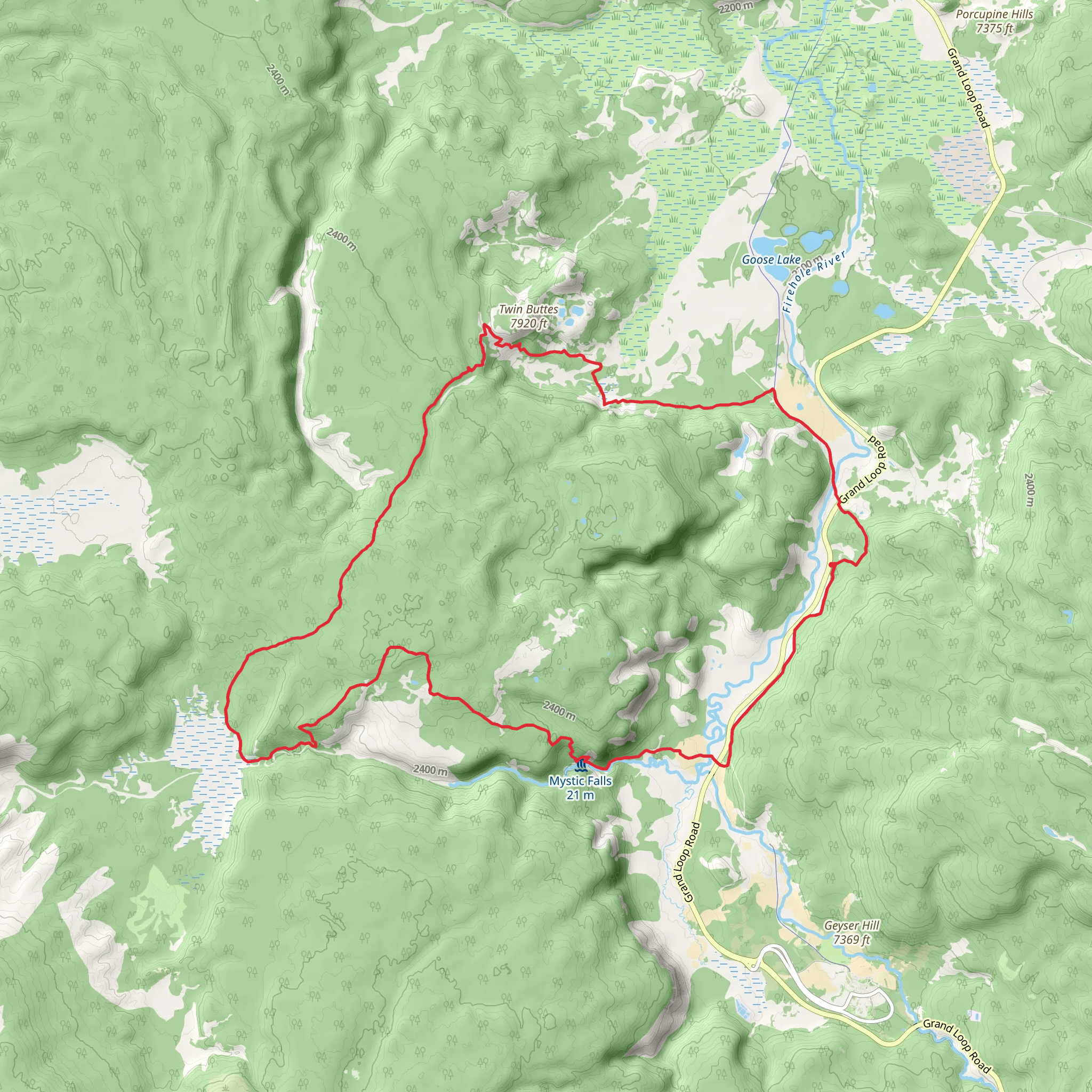
Starting your adventure near Teton County, Wyoming, the Powerline, Fairy Creek, and Fairy Falls Loop Trail offers a captivating journey through some of the most picturesque landscapes in the region. This 29 km (approximately 18 miles) loop trail features an elevation gain of around 800 meters (2,625 feet), making it a moderately challenging hike suitable for those with a reasonable level of fitness.
Getting There
To reach the trailhead, you can drive or use public transport. If driving, head towards the nearest significant landmark, which is the town of Jackson, Wyoming. From Jackson, take US-191 N/US-26 W/US-89 N for about 20 miles until you reach the trailhead near Teton County. For those using public transport, the START Bus service from Jackson can get you close to the trailhead, but you may need to arrange a taxi or rideshare for the final leg of the journey.
Trail Overview
The trail begins with a gradual ascent, offering a mix of open meadows and dense forested areas. Early on, you'll follow the Powerline section, which provides expansive views of the surrounding Teton Range. This part of the trail is relatively straightforward, with a steady incline that helps you acclimate to the elevation gain.
Fairy Creek Section
As you transition into the Fairy Creek section, the trail becomes more rugged and densely wooded. Here, you'll encounter a series of switchbacks that take you deeper into the forest. Keep an eye out for local wildlife, including deer, elk, and occasionally black bears. It's advisable to carry bear spray and know how to use it.
Fairy Falls
Approximately 15 km (9.3 miles) into the hike, you'll reach Fairy Falls, one of the most stunning landmarks on this trail. The falls cascade down a rocky cliff, creating a serene and picturesque setting perfect for a rest stop. The elevation gain to this point is about 400 meters (1,312 feet), making it a good halfway point to assess your energy levels and refuel.
Historical Significance
The area around Fairy Falls has historical significance, as it was once a route used by Native American tribes for hunting and gathering. The lush meadows and abundant wildlife made it an ideal location for seasonal camps. As you hike, you'll notice interpretive signs that provide more information about the historical and cultural importance of the region.
Completing the Loop
After enjoying Fairy Falls, the trail continues to loop back towards the starting point. This section involves a mix of descents and gentle climbs, with the final stretch following along Fairy Creek. The terrain here is less challenging, allowing you to enjoy the natural beauty without too much exertion. The total elevation gain for the entire loop is around 800 meters (2,625 feet), making the descent a welcome relief.
Navigation and Safety
Given the length and moderate difficulty of this trail, it's crucial to be well-prepared. Use the HiiKER app for accurate navigation and real-time updates on trail conditions. Ensure you have enough water, snacks, and appropriate clothing for changing weather conditions. The trail is well-marked, but having a reliable navigation tool like HiiKER can make your hike more enjoyable and stress-free.
Flora and Fauna
Throughout the hike, you'll encounter a diverse range of flora and fauna. The lower elevations are dominated by lodgepole pines and aspens, while higher elevations feature subalpine firs and wildflower meadows. Wildlife sightings are common, so keep your camera ready but maintain a respectful distance from all animals.
This trail offers a perfect blend of natural beauty, moderate challenge, and historical significance, making it a must-do for any hiking enthusiast visiting the Teton County area.
AI Planner
Days planned around your pace, with somewhere to stay each night.
What to expect?
Activity types
Comments and Reviews
User comments, reviews and discussions about the Powerline, Fairy Creek and Fairy Falls Loop Trail, Wyoming.
4.48
average rating out of 5
64 rating(s)
