Download
Preview
Add to list
More
10.6 km
~2 hrs 12 min
59 m
Out and Back
“Experience natural beauty and historical richness along the accessible Flyway Trail and Latsch Island Walk.”
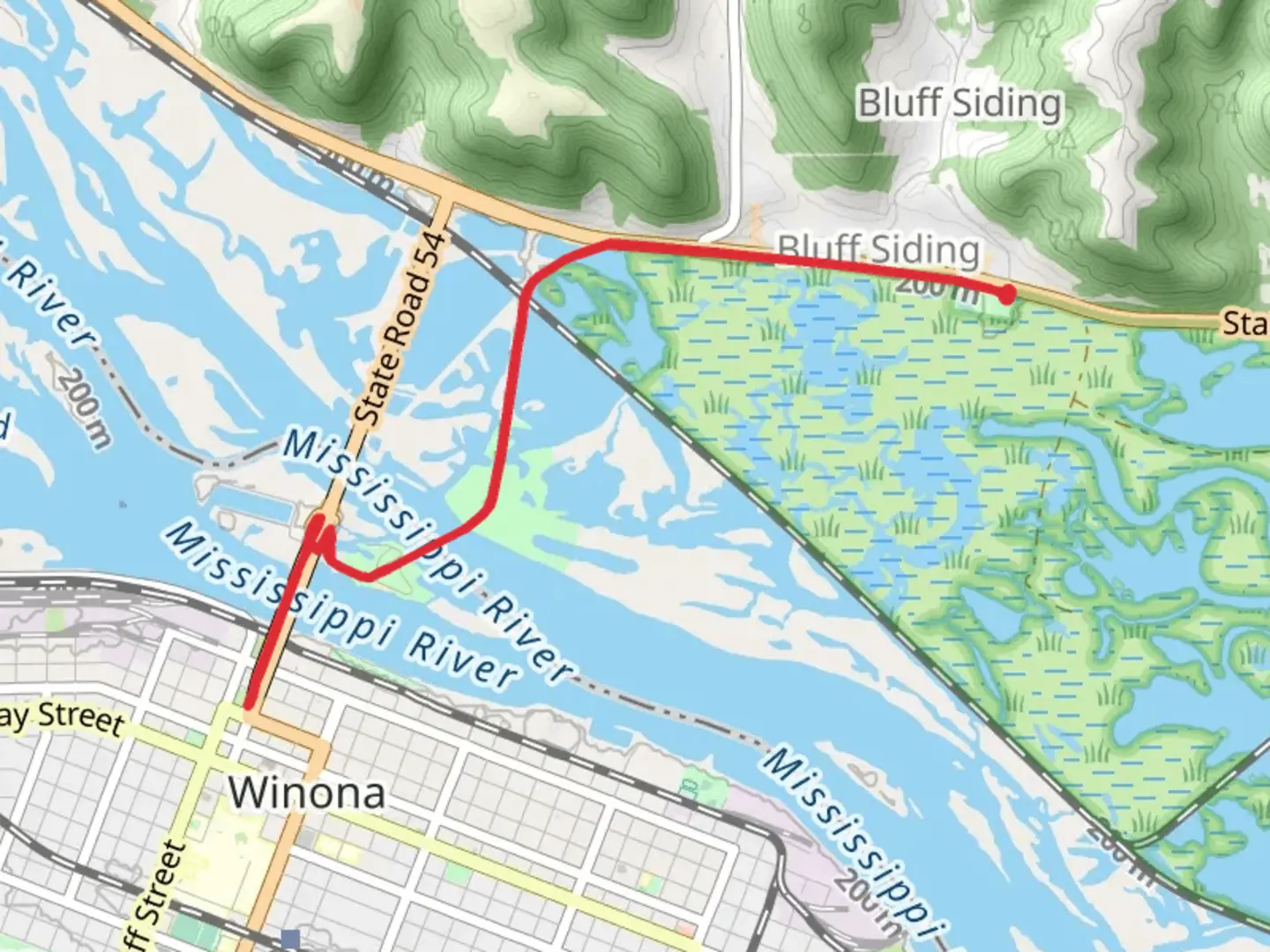
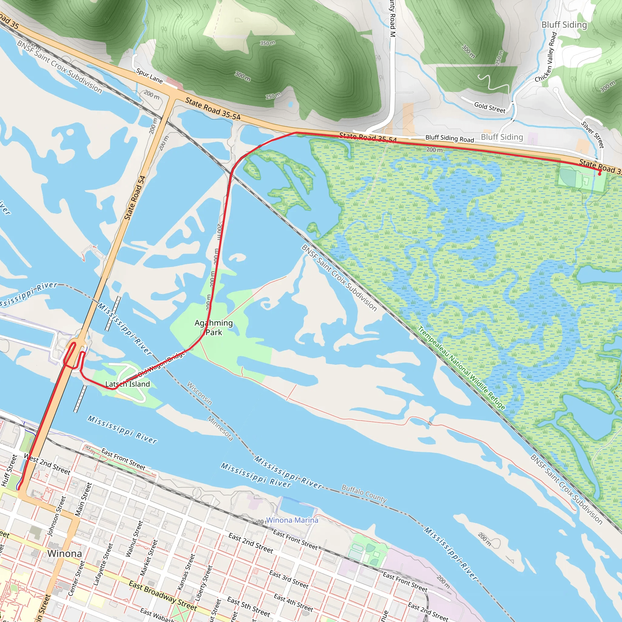
Starting near Buffalo County, Wisconsin, the Flyway Trail and Latsch Island Walk is an 11 km (approximately 6.8 miles) out-and-back trail with no significant elevation gain, making it accessible for a wide range of hikers. The trailhead is conveniently located near the town of Alma, Wisconsin, which can be reached by car via Highway 35. For those using public transport, the nearest bus stop is in Winona, Minnesota, from where you can take a taxi or rideshare service to the trailhead.
Trail Overview
The Flyway Trail and Latsch Island Walk is a medium-difficulty trail that offers a unique blend of natural beauty and historical significance. The trail meanders along the Mississippi River, providing stunning views of the waterway and its surrounding landscapes. As you hike, you'll traverse a variety of terrains, including paved paths, gravel roads, and natural dirt trails.
Key Landmarks and Points of Interest
Mississippi River Views: One of the most striking features of this trail is its proximity to the Mississippi River. The trail runs parallel to the river for much of its length, offering numerous vantage points where you can pause and take in the expansive water views. Keep an eye out for riverboats and barges navigating the waterway.
Latsch Island: Approximately 5 km (3.1 miles) into the hike, you'll reach Latsch Island, a significant landmark named after John A. Latsch, a prominent conservationist. The island is known for its lush vegetation and diverse wildlife, making it a great spot for birdwatching. Look for bald eagles, herons, and various waterfowl that frequent the area.
Historical Significance: The region around the Flyway Trail has a rich history. Alma, the nearby town, was established in the mid-19th century and has several historic buildings that reflect its past. The trail itself follows part of the Great River Road, a historic route that has been used for centuries for trade and travel along the Mississippi River.
Wildlife and Nature
The trail is part of the Mississippi Flyway, a major migratory route for birds. Depending on the season, you may encounter a variety of bird species, including warblers, orioles, and even the occasional pelican. The surrounding forests and wetlands are home to deer, raccoons, and other small mammals. The flora along the trail is equally diverse, with wildflowers blooming in the spring and summer and vibrant foliage in the fall.
Navigation and Safety
For navigation, it's recommended to use the HiiKER app, which provides detailed maps and real-time updates. The trail is well-marked, but having a reliable navigation tool can help you stay on track and explore any side trails or points of interest.
Getting There
If you're driving, take Highway 35 to Alma, Wisconsin. There is ample parking available near the trailhead. For those relying on public transport, the nearest bus stop is in Winona, Minnesota. From there, a taxi or rideshare service can take you directly to the trailhead, which is approximately a 20-minute drive.
Preparation Tips
- Footwear: Given the mixed terrain, sturdy hiking boots are recommended. - Water and Snacks: There are no facilities along the trail, so bring enough water and snacks for the entire hike. - Weather: Check the weather forecast before heading out. The trail can be muddy after rain, and the river can cause localized flooding in certain areas. - Wildlife: Be respectful of the wildlife and maintain a safe distance, especially from nesting birds and larger mammals.
This trail offers a wonderful opportunity to experience the natural beauty and historical richness of the Mississippi River region. Whether you're a seasoned hiker or a casual walker, the Flyway Trail and Latsch Island Walk provides a memorable outdoor adventure.
What to expect?
Activity types
Comments and Reviews
User comments, reviews and discussions about the Flyway Trail and Latsch Island Walk, Wisconsin.
4.38
average rating out of 5
39 rating(s)
