Download
Preview
Add to list
More
26.3 km
~1 day 0 hrs
210 m
Out and Back
“The Waterfront Trail at Maslowski Beach Park delivers 26 kilometers of scenic, moderately challenging hiking adventure.”
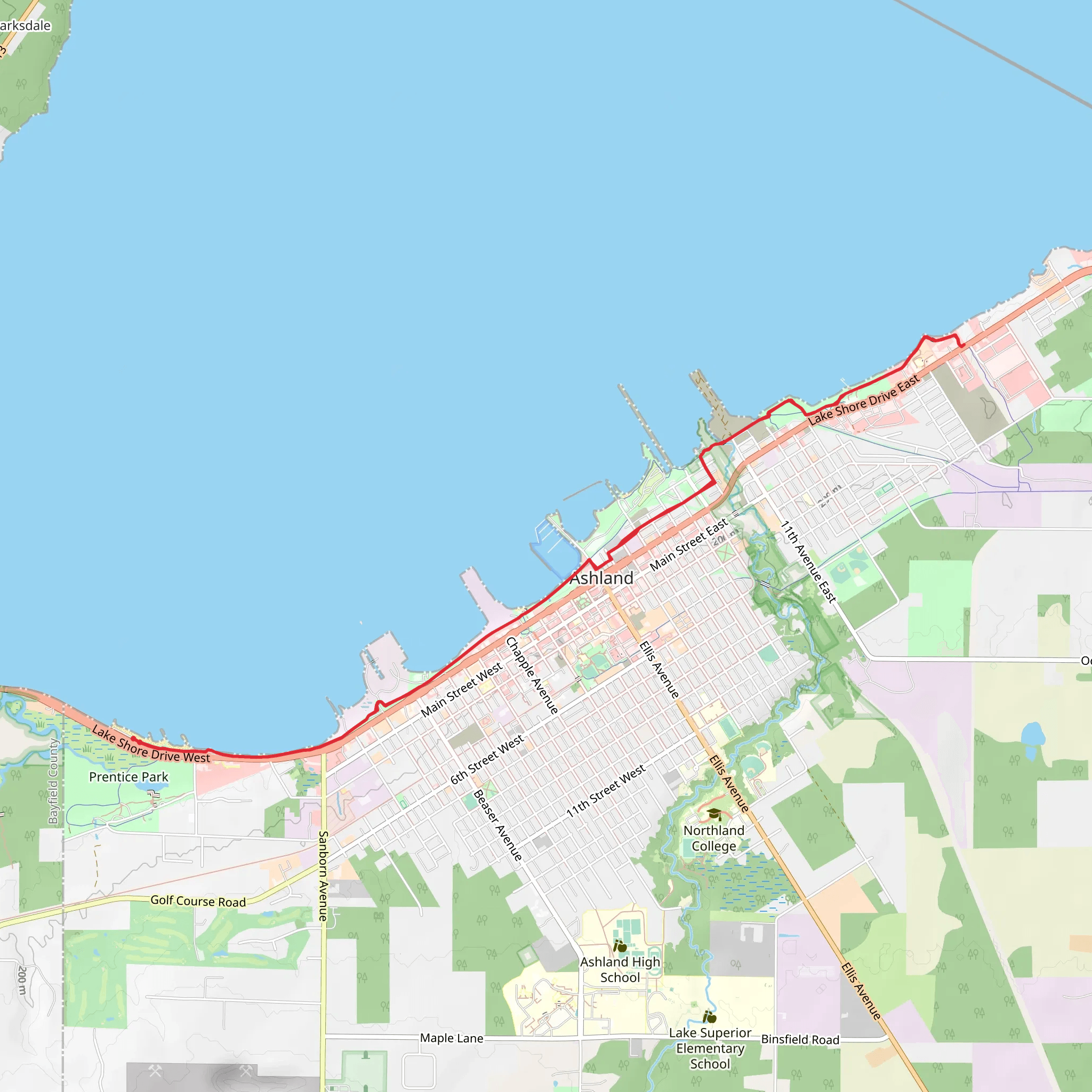
Starting near Ashland County, Wisconsin, the Waterfront Trail at Maslowski Beach Park offers an engaging out-and-back hike stretching approximately 26 kilometers (16 miles) with an elevation gain of around 200 meters (656 feet). This trail is rated as medium difficulty, making it suitable for moderately experienced hikers.
Getting There To reach the trailhead, you can drive to Maslowski Beach Park, located near the city of Ashland. If you prefer public transport, the nearest significant landmark is the Ashland County Courthouse. From there, local bus services or a short taxi ride can get you to the park.
Trail Overview The trail begins at Maslowski Beach Park, a scenic spot on the shores of Lake Superior. As you set off, you'll be greeted by the expansive views of the lake, with its crystal-clear waters and sandy beaches. The first few kilometers are relatively flat, making for a gentle start.
Key Landmarks and Sections - **Maslowski Beach Park to Bayview Pier (0-5 km / 0-3 miles):** This initial section is characterized by its proximity to the water, offering stunning lake views and opportunities to spot local wildlife such as seagulls and occasionally bald eagles. The terrain here is mostly sandy and flat. - **Bayview Pier to Prentice Park (5-10 km / 3-6 miles):** As you move further, the trail begins to gain a bit of elevation. This section takes you through a mix of wooded areas and open spaces. Prentice Park is a great spot to take a break, with picnic areas and restrooms available. - **Prentice Park to Bono Creek (10-13 km / 6-8 miles):** The trail continues to climb gently, offering more wooded scenery and the soothing sounds of Bono Creek. This is a good spot to refill water bottles if you have a portable filter. - **Bono Creek to Turnaround Point (13 km / 8 miles):** The final stretch to the turnaround point is the most challenging, with a steady incline and more rugged terrain. The effort is rewarded with panoramic views of the surrounding landscape and Lake Superior.
Nature and Wildlife The trail is rich in biodiversity. Keep an eye out for white-tailed deer, red foxes, and a variety of bird species. The flora includes a mix of hardwoods and conifers, with vibrant wildflowers in the spring and summer months.
Historical Significance Ashland County has a rich history, particularly in the lumber and mining industries. The trail itself passes near several historical sites, including old logging camps and remnants of early 20th-century mining operations. Informational plaques along the way provide insights into the area's past.
Navigation and Safety Given the trail's length and moderate difficulty, it's advisable to use a reliable navigation tool like HiiKER to stay on track. The trail is well-marked, but having a digital map can be invaluable, especially in the more remote sections.
Final Tips - **Water and Snacks:** Ensure you carry enough water and high-energy snacks, especially if you plan to complete the entire 26 km (16 miles). - **Footwear:** Sturdy hiking boots are recommended due to the varied terrain. - **Weather:** Check the weather forecast before heading out, as conditions can change rapidly near Lake Superior.
This trail offers a blend of natural beauty, historical intrigue, and moderate physical challenge, making it a rewarding experience for those who take it on.
What to expect?
Activity types
Comments and Reviews
User comments, reviews and discussions about the Waterfront Trail - Maslowski Beach Park, Wisconsin.
4.47
average rating out of 5
36 rating(s)
