Download
Preview
Add to list
More
101.9 km
~5 days
340 m
Multi-Day
“Embark on the Tri County Corridor's scenic 63-mile journey through historic Northern Wisconsin's diverse landscapes.”
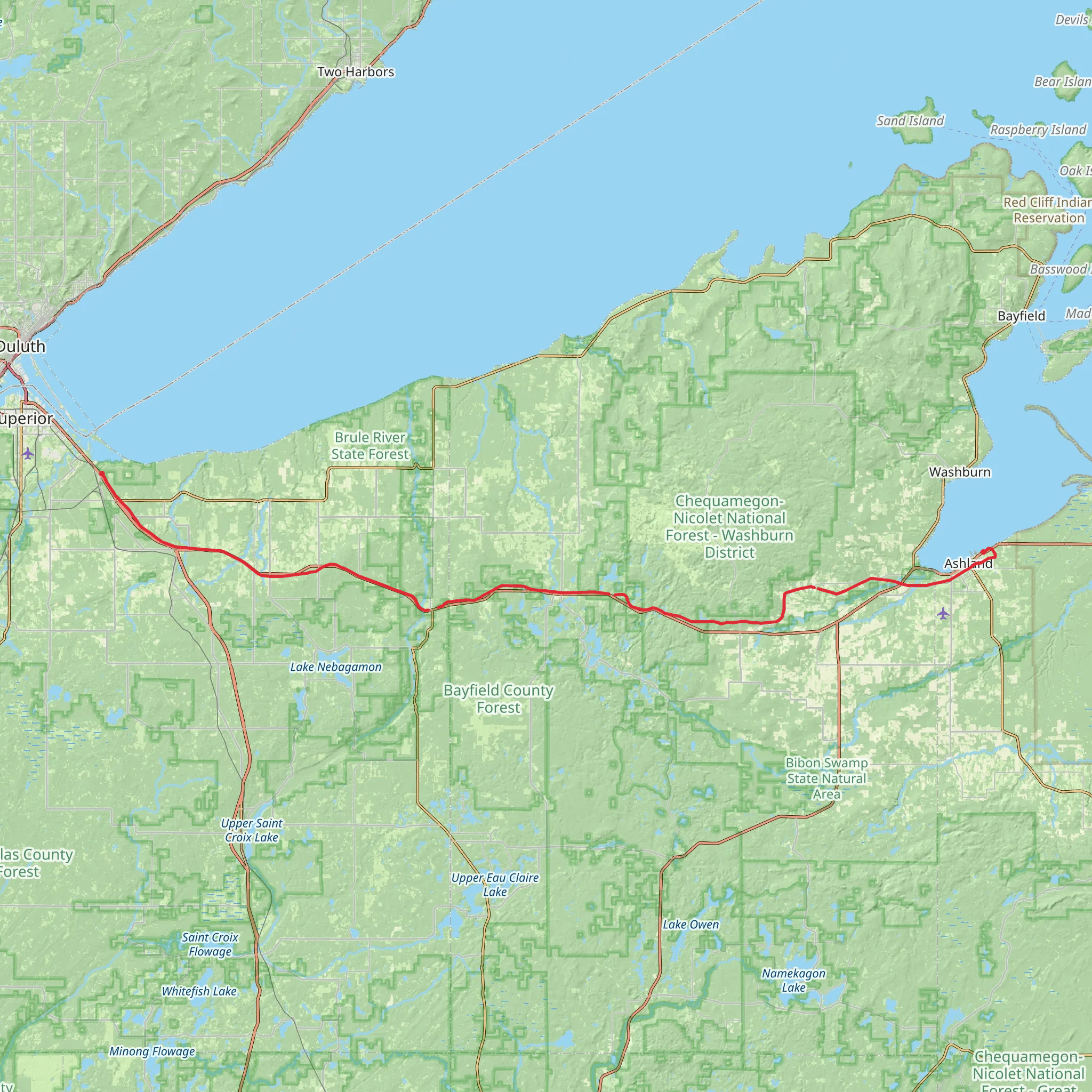
Spanning approximately 63 miles (around 102 kilometers) with a modest elevation gain of nearly 984 feet (around 300 meters), the Tri County Corridor trail offers an easy, yet expansive journey through the heart of Northern Wisconsin. This point-to-point trail connects the towns of Ashland and Superior, traversing through Ashland, Bayfield, and Douglas counties—hence the name Tri County Corridor.
Getting to the Trailhead
The trailhead near Ashland County is accessible by car, located just off US Highway 2. For those relying on public transportation, regional bus services may offer routes to Ashland, where you can then make your way to the trailhead. Parking is available near the start of the trail for those driving, which is a convenient option for this linear route.
Trail Experience
As you embark on the Tri County Corridor, you'll find the trail surface to be primarily crushed stone and gravel, making it suitable for both hikers and cyclists. The trail is also open to snowmobiles during the winter months, providing a year-round recreational opportunity.
The trail's gentle grade and wide path, originally a railroad bed, make it an excellent choice for families and individuals seeking a leisurely hike. The corridor is lined with a mix of hardwood forests, wetlands, and open fields, offering a variety of landscapes to enjoy.
Historical Significance and Landmarks
The Tri County Corridor passes through a region rich in history. The trail itself is a converted railway, which was once a vital part of the area's iron ore industry. As you travel along the path, you'll encounter remnants of the past, including old railroad bridges and historic towns that were once bustling with mining activity.
One of the notable landmarks along the route is the city of Superior, known for its harbor and as the gateway to the Apostle Islands. The trail's endpoint is near the Richard I. Bong Memorial Bridge, a significant structure named after America's leading World War II fighter ace.
Nature and Wildlife
The corridor provides ample opportunities to observe local wildlife, with chances to see white-tailed deer, black bears, and a variety of bird species. The trail also intersects with several rivers and streams, which are home to beavers, otters, and an array of fish.
Preparation and Planning
Before setting out, hikers should prepare for the trail's length by packing sufficient water, snacks, and a first-aid kit. While the elevation gain is minimal, the distance can be challenging for some, so it's essential to plan accordingly. Check the weather forecast and dress in layers to adapt to changing conditions.
For navigation, the HiiKER app can be a valuable tool to track your progress along the Tri County Corridor. It can help you locate points of interest, rest stops, and provide real-time updates on your location.
Remember to respect the trail and its natural surroundings by following Leave No Trace principles, ensuring that this beautiful trail can be enjoyed by future generations.
What to expect?
Activity types
Comments and Reviews
User comments, reviews and discussions about the Tri County Corridor, Wisconsin.
4.46
average rating out of 5
13 rating(s)

