
Mount Molly and Capitol Peak via Waddell Basin WestLoop
Download
3D Flyover
Add to list
More
36.0 km
~2 days
1517 m
Loop
“Explore the scenic 36 km Mount Molly and Capitol Peak Loop, featuring diverse wildlife, lush forests, and panoramic views.”
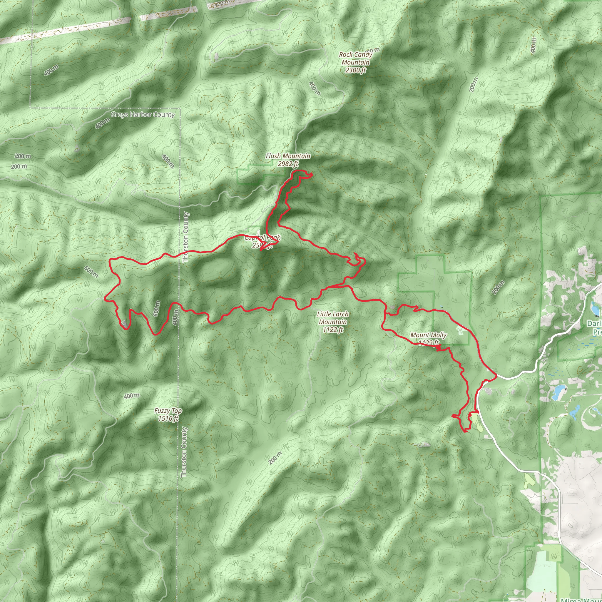
Starting near Thurston County, Washington, the Mount Molly and Capitol Peak via Waddell Basin West Loop is a captivating 36 km (22.4 miles) loop trail with an elevation gain of approximately 1500 meters (4921 feet). This trail is rated as medium difficulty, making it suitable for moderately experienced hikers.
Getting There
To reach the trailhead, you can drive or use public transportation. If driving, head towards the Capitol State Forest, with the nearest significant landmark being the Mima Mounds Natural Area Preserve. For those using public transport, the closest major city is Olympia, Washington. From Olympia, you can take a bus to the outskirts of the Capitol State Forest and then arrange for a taxi or rideshare to the trailhead.
Trail Overview
The trail begins with a gentle ascent through dense forest, offering a mix of Douglas fir, western hemlock, and red cedar. The first 5 km (3.1 miles) are relatively easy, with an elevation gain of about 200 meters (656 feet), making it a good warm-up for the more challenging sections ahead.
Key Landmarks and Sections
Waddell Basin
Around the 8 km (5 miles) mark, you'll enter the Waddell Basin. This area is known for its lush vegetation and the serene Waddell Creek. The basin is a great spot for a short break, with plenty of opportunities for bird watching. Keep an eye out for the varied thrush and the occasional bald eagle.
Ascent to Mount Molly
The climb to Mount Molly begins after you exit the Waddell Basin. This section is more strenuous, with an elevation gain of about 600 meters (1968 feet) over the next 7 km (4.3 miles). The trail becomes steeper and rockier, so sturdy hiking boots are recommended. Upon reaching the summit of Mount Molly, you'll be rewarded with panoramic views of the surrounding forest and distant peaks.
Capitol Peak
From Mount Molly, the trail descends slightly before beginning the ascent to Capitol Peak. This section is approximately 10 km (6.2 miles) with an elevation gain of 700 meters (2297 feet). Capitol Peak offers breathtaking views of the Olympic Mountains to the west and Mount Rainier to the east. This is a perfect spot for a longer rest and some photography.
Historical Significance
The Capitol State Forest, where this trail is located, has a rich history. It was originally inhabited by the indigenous Coast Salish people, who used the land for hunting and gathering. In the early 20th century, the area was heavily logged, but it has since been reforested and is now managed for sustainable timber production and recreation.
Wildlife and Flora
The trail is home to a diverse range of wildlife. Black-tailed deer, black bears, and coyotes are commonly seen, especially in the early morning or late afternoon. The flora is equally diverse, with seasonal wildflowers such as trillium and lupine adding splashes of color to the landscape.
Navigation
Given the trail's length and the potential for changing weather conditions, it's advisable to use a reliable navigation tool like HiiKER. This will help you stay on track and provide real-time updates on your progress.
Final Stretch
The final 6 km (3.7 miles) of the trail loop back towards the trailhead, descending through a series of switchbacks. This section is less strenuous, allowing you to enjoy the final moments of your hike as you make your way back to the starting point.
This trail offers a mix of challenging climbs, stunning vistas, and rich natural and historical significance, making it a rewarding experience for those who undertake it.
AI Planner
Days planned around your pace, with somewhere to stay each night.
What to expect?
Comments and Reviews
User comments, reviews and discussions about the Mount Molly and Capitol Peak via Waddell Basin WestLoop, Washington.
4.25
average rating out of 5
8 rating(s)
