Download
3D Preview
Add to list
More
181.0 km
~8 days
5036 m
Multi-Day
“Journey through Shenandoah's Appalachian Trail, a blend of rich biodiversity, stunning vistas, and historical tapestry.”
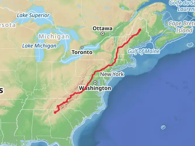
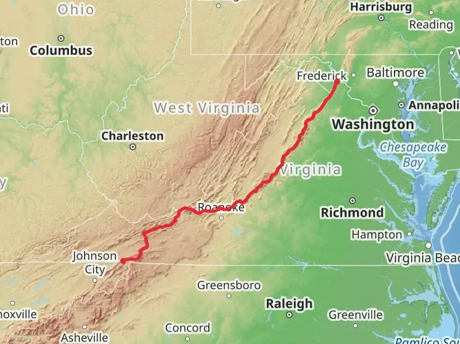
Embarking on the Appalachian Trail through Shenandoah National Park is a journey through a landscape rich with biodiversity and history. This section hike, spanning approximately 181 kilometers (112 miles) with an elevation gain of around 5000 meters (16,404 feet), offers a challenging yet rewarding experience for avid hikers.
Getting to the Trailhead
The trailhead for this section hike is located near Augusta County, Virginia. For those driving, the closest significant landmark is Rockfish Gap, where the southern end of Shenandoah National Park meets the Blue Ridge Parkway. Parking is available at the trailhead for those who wish to leave their vehicle. If you're using public transportation, the nearest towns with bus services are Waynesboro and Staunton. From these locations, you may need to arrange a taxi or shuttle service to reach the trailhead.
Navigating the Trail
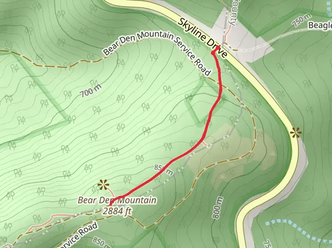
As you set out on your hike, it's essential to have a reliable navigation tool. HiiKER is an excellent resource for trail maps and can help you stay on track throughout your journey. The trail is well-marked with the iconic white blazes, guiding you along the path.
Natural Beauty and Wildlife
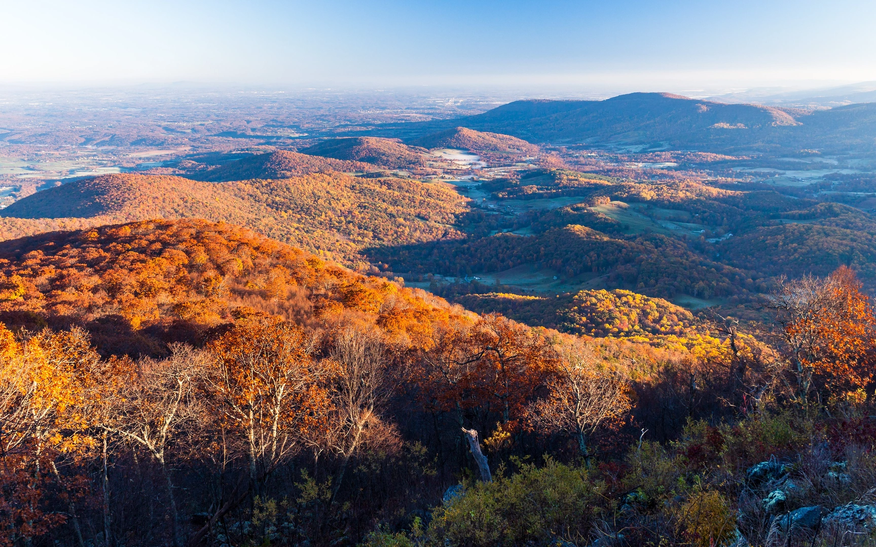
The trail meanders through diverse ecosystems, including oak-hickory forests, pine woodlands, and open meadows. You'll encounter a variety of flora, such as wildflowers in the spring and a tapestry of reds and yellows in the fall. Wildlife sightings may include white-tailed deer, black bears, and a plethora of bird species, so keep your camera ready and maintain a safe distance from any animals you encounter.
Significant Landmarks and Overlooks
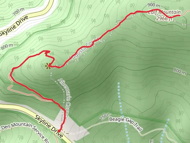
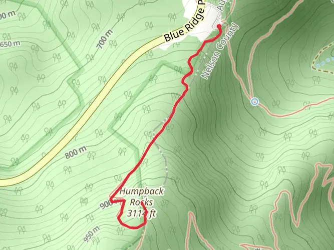
As you progress along the trail, you'll pass by numerous overlooks offering breathtaking views of the Shenandoah Valley and the rolling Blue Ridge Mountains. Notable landmarks include Hawksbill Mountain, the highest peak in the park at 1,235 meters (4,051 feet), and the picturesque waterfalls like Dark Hollow Falls and Whiteoak Canyon Falls.
Historical Significance
The region is steeped in history, with the trail itself following paths once used by Native Americans and early European settlers. The park is also home to remnants of old homesteads and traces of the mountain communities that once thrived here before the park's establishment.
Preparation and Planning
Given the trail's difficulty rating, it's crucial to prepare adequately. Ensure you have proper gear, including sturdy hiking boots, weather-appropriate clothing, and a first aid kit. Water sources are available throughout the park, but it's advisable to treat or filter water before drinking. Plan your resupply points, as there are waysides and camp stores within the park where you can stock up on provisions.
Camping and Accommodation
For those looking to extend their hike over several days, there are numerous backcountry campsites and established campgrounds along the trail. Permits are required for backcountry camping, so be sure to secure one in advance. Additionally, there are lodges within the park for those who prefer a more comfortable night's rest.
Safety and Regulations
Always check the weather forecast before your hike and be prepared for sudden changes in conditions. It's also important to familiarize yourself with the park's regulations, including proper food storage to avoid attracting bears. Remember to leave no trace and respect the natural environment to preserve it for future generations.
By planning ahead and respecting the natural beauty and historical significance of the region, your hike along the Appalachian Trail through Shenandoah National Park will be an unforgettable adventure.

What to expect?
Activity types
Comments and Reviews
User comments, reviews and discussions about the Appalachian Trail Section Hike - Shenandoah National Park, Virginia.
4.46
average rating out of 5
13 rating(s)