Download
3D Flyover
Add to list
More
20.4 km
~5 hrs 30 min
856 m
Multi-Day
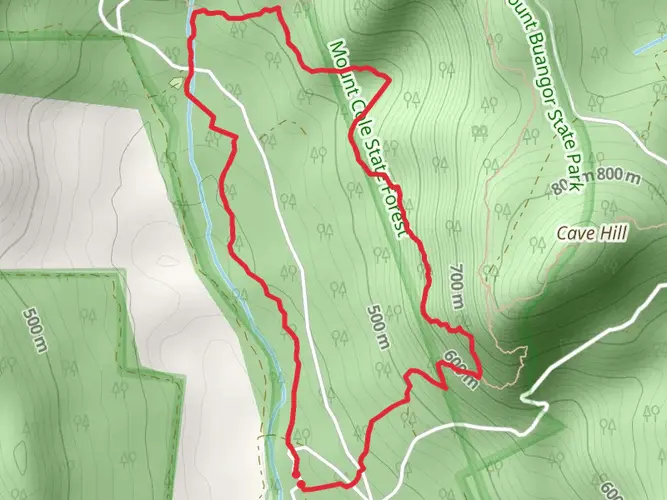
The Beeripmo Walk is a 20.4 km trail that starts in Shire of Pyrenees, Shire of Pyrenees, Victoria. Based on our data, the hike is graded as Medium. For information on how we grade trails, please read measuring the difficulty of a hiking trail on hiiker. Also, check our latest community posts for trail updates. This hike can be completed in approx 5 hrs 31 mins. Caution is advised on trail times as this depends on multiple variables. For more info read about how we calculate hike time.

What to expect?
Activity types
Frequently asked questions
How long does the Beeripmo Walk take to hike in Victoria?
Beeripmo Walk is a 20.45 km multi-day hike with 856 m of climbing, so most hikers treat it as an overnight trip rather than a quick day walk. Parks Victoria describes the route as an overnight walk using a hike-in campground, and the broader Beeripmo route is commonly allowed a full day of walking time each way.
Is the Beeripmo Walk hard or suitable for intermediate hikers?
Beeripmo Walk is generally a medium-difficulty overnight hike, but the numbers show it is still a solid effort. The route covers 20.45 km with 856 m of elevation gain, so it suits hikers with some fitness and experience on longer bushwalks rather than complete beginners.
Can you camp on the Beeripmo Walk?
Yes. Beeripmo Walk is a multi-day route and uses a hike-in campground on the trail. Parks Victoria identifies Beeripmo as an overnight walk, and Beeripmo Campground is the usual overnight stop, with space for tents and water available on site that should be treated before use.
Are dogs allowed on the Beeripmo Walk in Mount Cole State Forest?
Dogs are not a simple yes for the full Beeripmo Walk. The route passes between Mount Cole State Forest, where dogs under control are permitted, and Mount Buangor State Park, where dogs are prohibited, so dogs cannot legally accompany hikers on the complete walk.
Where do you start the Beeripmo Walk?
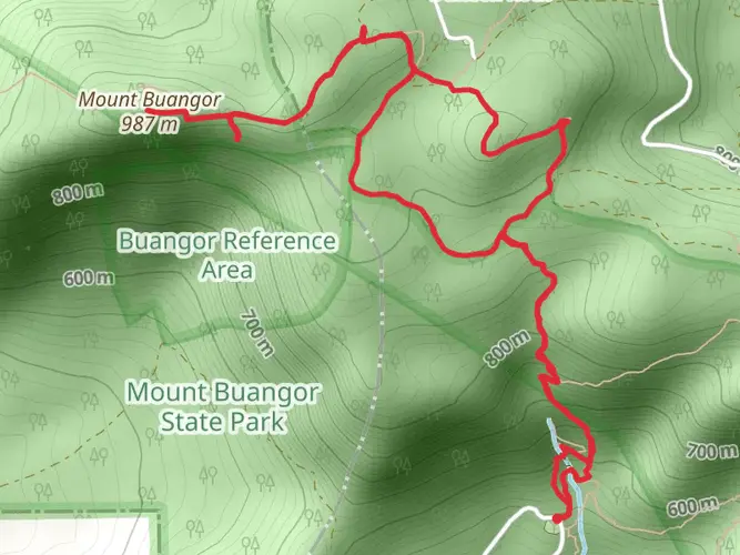
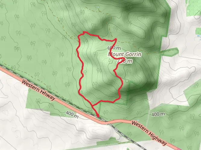
Beeripmo Walk is commonly started from the Richards Camping Site area in Mount Cole State Forest. Hiker route descriptions for the Beeripmo circuit also reference nearby access and parking around Chinaman’s Campground, with the walk climbing toward Mount Buangor and continuing on to Beeripmo Campground.
What is the elevation gain on the Beeripmo Walk?
Beeripmo Walk has 856 m of elevation gain over 20.45 km. That amount of climbing is a big reason the trail is rated medium difficulty, especially when combined with overnight gear and the steady ascent toward the higher country around Mount Buangor.
What landmarks do you see on the Beeripmo Walk?
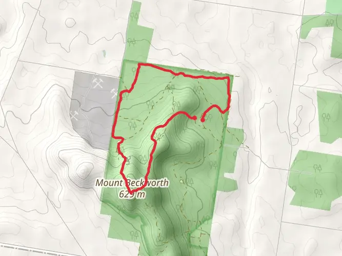
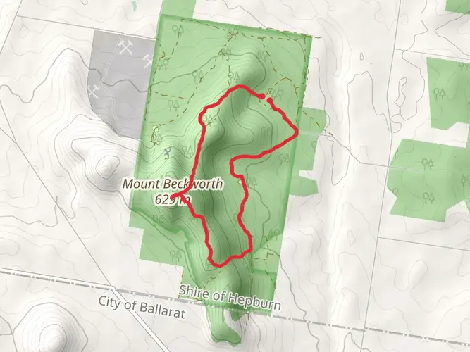
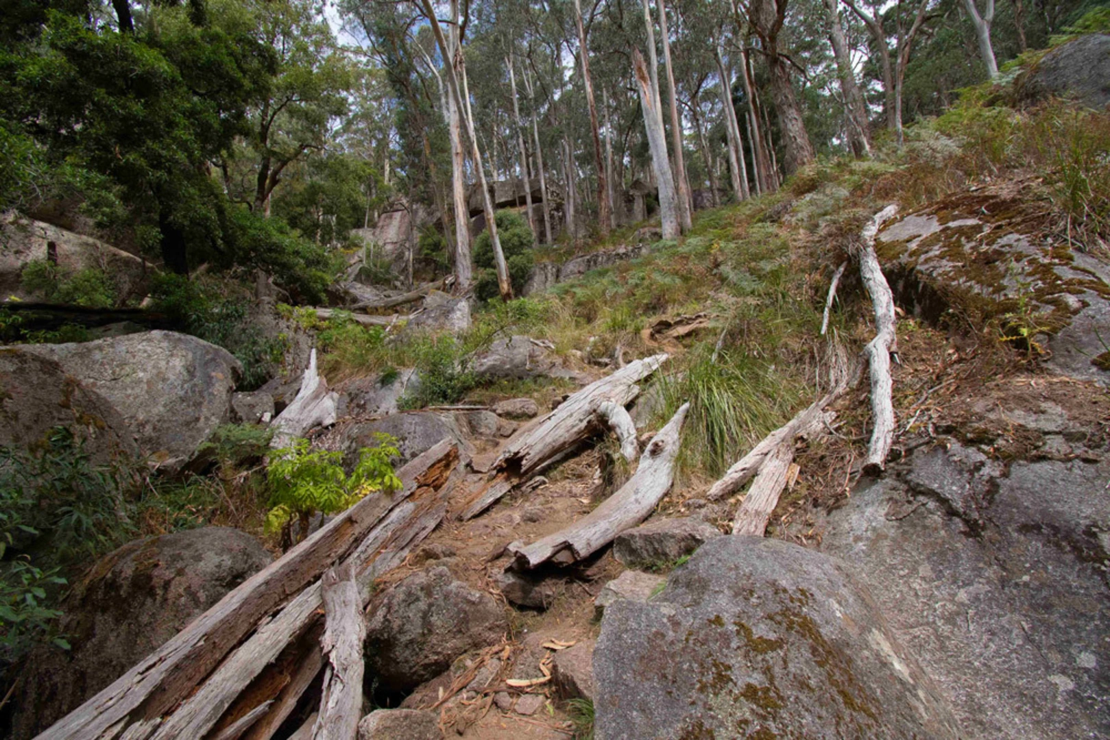
Beeripmo Walk passes through Mount Cole State Forest and Mount Buangor State Park and is known for views from the Mount Buangor area. Named features associated with the route include Buangor Lookout, Mount Buangor, Beeripmo Campground, and nearby views toward Mount Langi Ghiran and the Grampians on clear days.
Comments and Reviews
User comments, reviews and discussions about the Beeripmo Walk, Victoria.
5.0
average rating out of 5
2 rating(s)