
Download
3D Flyover
Add to list
More
10.1 km
~3 hrs 10 min
696 m
Out and Back
“Embark on a 10 km adventure through Utah's striking landscapes, rich history, and diverse wildlife.”
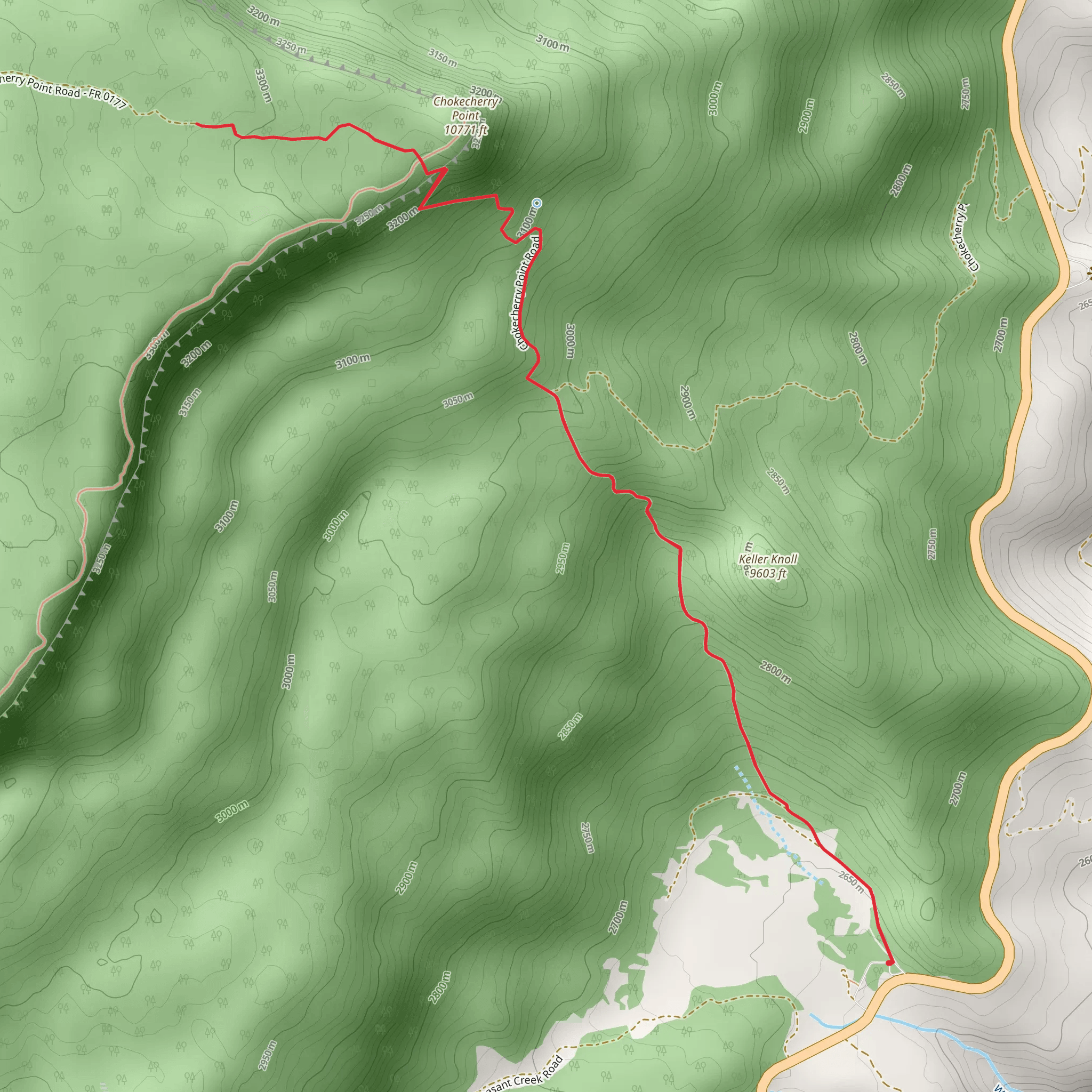
Starting your adventure near Garfield County, Utah, the Wildcat Trail and Chokecherry Point Walk is an invigorating out-and-back hike that spans approximately 10 kilometers (6.2 miles) with an elevation gain of around 600 meters (1,969 feet). This trail is rated as medium difficulty, making it suitable for moderately experienced hikers.
Getting There
To reach the trailhead, you can drive or use public transportation. If driving, head towards the town of Escalante, Utah, which is the nearest significant landmark. From Escalante, take the Scenic Byway 12 east for about 20 miles until you reach the trailhead near Garfield County. For those relying on public transport, the nearest bus stop is in Escalante, from where you can arrange a taxi or rideshare to the trailhead.
Trail Overview
The trail begins with a gentle ascent through a landscape characterized by its striking red rock formations and sparse desert vegetation. As you progress, the path becomes steeper, offering panoramic views of the surrounding canyons and mesas. The first significant landmark you'll encounter is a natural rock arch approximately 2 kilometers (1.2 miles) into the hike. This is a great spot for a short break and some photography.
Wildlife and Flora
Keep an eye out for local wildlife, including mule deer, jackrabbits, and a variety of bird species such as the golden eagle and peregrine falcon. The flora is equally fascinating, with juniper trees, sagebrush, and the occasional prickly pear cactus dotting the landscape.
Historical Significance
This region holds historical significance as it was once inhabited by the Ancestral Puebloans. Evidence of their presence can be seen in the form of ancient petroglyphs and pottery shards. About 5 kilometers (3.1 miles) into the hike, you'll come across a small alcove that contains some of these petroglyphs. Please remember to respect these historical artifacts and leave them undisturbed.
Chokecherry Point
The trail culminates at Chokecherry Point, a breathtaking viewpoint that offers sweeping vistas of the Escalante River and the surrounding canyons. This is the perfect spot to rest, have a snack, and take in the stunning scenery before making your way back.
Navigation
For navigation, it is highly recommended to use the HiiKER app, which provides detailed maps and real-time updates to ensure you stay on the right path. The trail is well-marked, but having a reliable navigation tool can enhance your hiking experience.
Return Journey
The return journey follows the same path, allowing you to revisit the landmarks and perhaps notice details you missed on the way up. The descent is generally easier, but still requires caution, especially in steeper sections.
This hike offers a blend of natural beauty, wildlife, and historical intrigue, making it a rewarding experience for those who undertake it.
What to expect?
Activity types
Comments and Reviews
User comments, reviews and discussions about the Wildcat Trail and Chokecherry Point Walk, Utah.
4.73
average rating out of 5
15 rating(s)
