Download
3D Flyover
Add to list
More
47.9 km
~3 days
3344 m
Multi-Day
“Embark on a Swiss alpine adventure through breathtaking landscapes and historical trails on the Tour Des Dents Du Midi.”
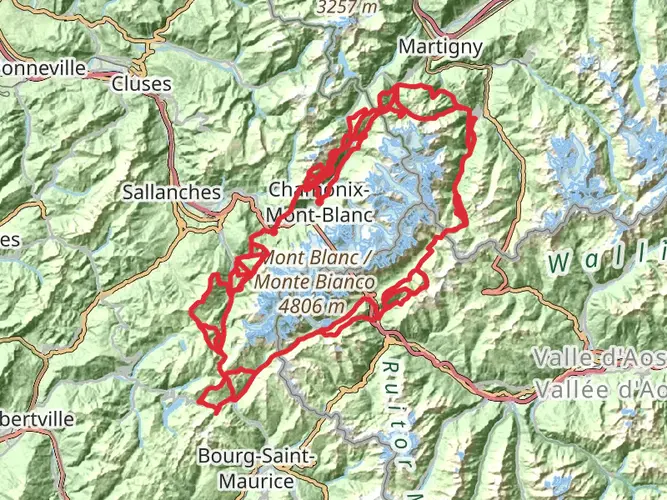
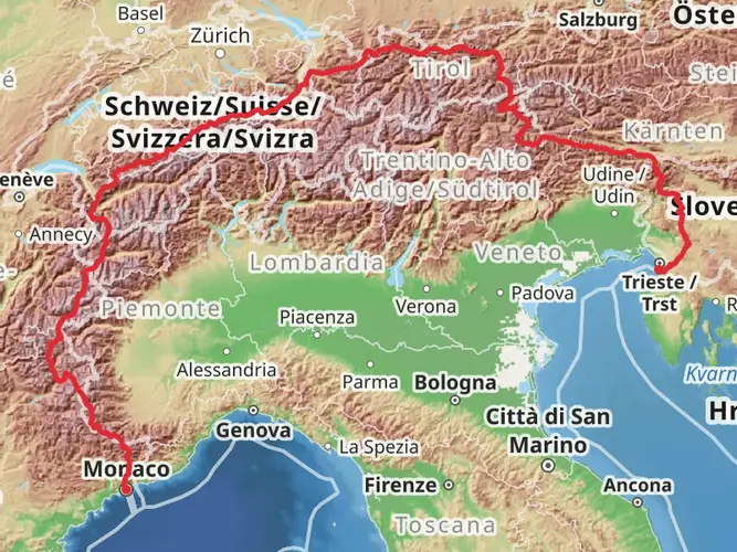
Embarking on the Tour Des Dents Du Midi, hikers will traverse approximately 48 kilometers (about 30 miles) of varied terrain with an elevation gain of around 3300 meters (roughly 10,830 feet). This point-to-point trail, nestled near Monthey in Switzerland, offers a medium difficulty rating, making it accessible to hikers with a reasonable level of fitness and experience.
Getting to the Trailhead
The journey begins near Monthey, a town easily reachable by public transport or car. For those opting for public transport, regular trains and buses service the area, with the closest stops being in the town of Monthey itself. From there, local buses can take you closer to the trailhead. If driving, parking is available in the vicinity of the trailhead, which is typically marked and easy to find.
Navigating the Trail
Hikers can rely on HiiKER for detailed maps and navigation tools to guide them through the trail. The route is well-marked, with signposts and trail markers guiding the way. However, it's always wise to have a digital backup, especially when traversing more remote sections.
Landmarks and Scenery
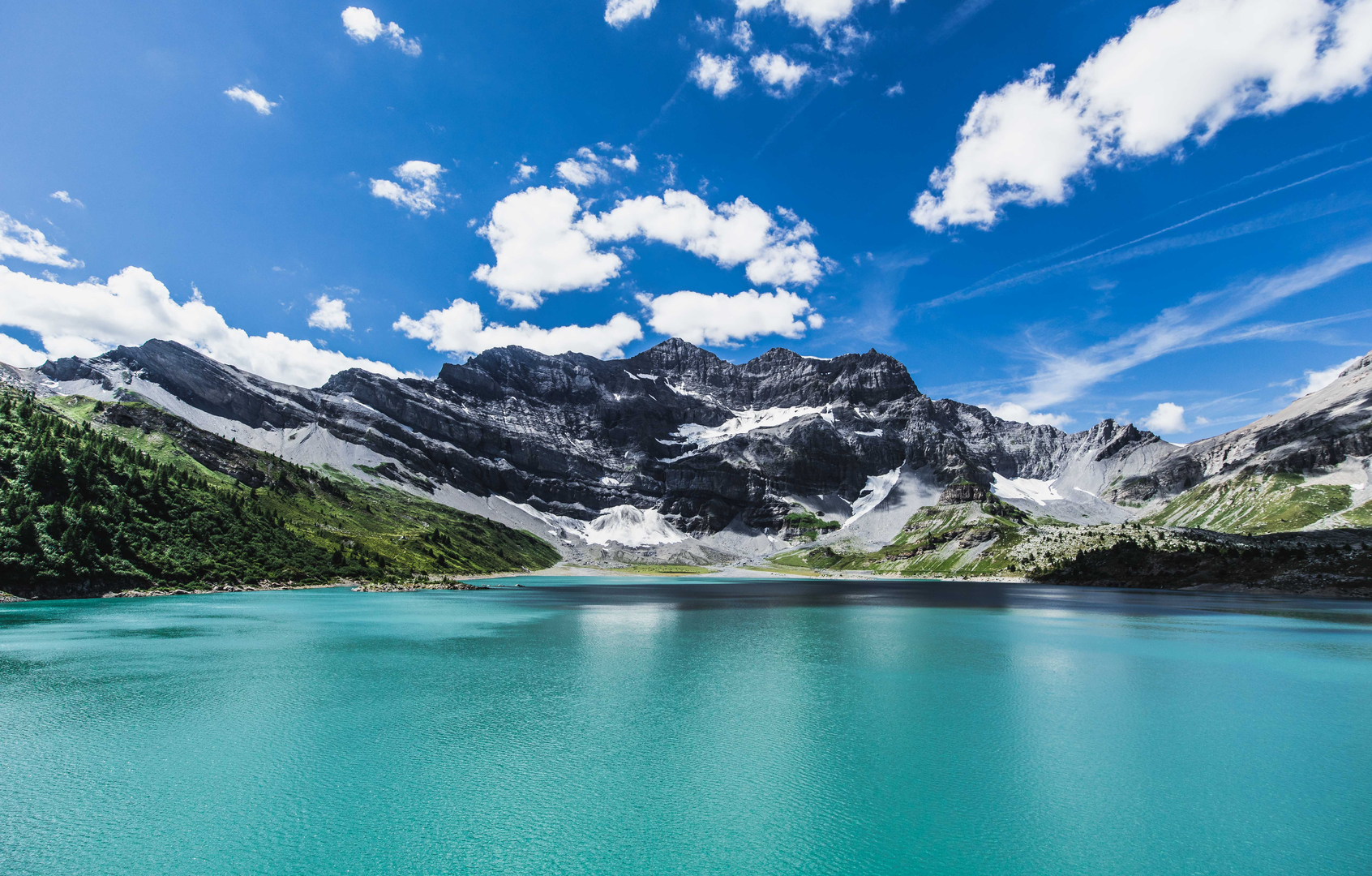
As you set out, the imposing Dents du Midi mountain range looms ahead, a striking feature that dominates the skyline. The trail meanders through alpine forests, crosses babbling streams, and ascends to high mountain passes, offering panoramic views of the surrounding peaks and valleys. Notable landmarks include the Col de Susanfe, a mountain pass that presents a challenging ascent but rewards hikers with breathtaking vistas.
Flora and Fauna
The region is rich in biodiversity, with a variety of alpine flora and fauna. Hikers may spot marmots, chamois, and ibex on the rocky outcrops, while birds of prey such as eagles can often be seen soaring above. The trail also passes through areas of wildflowers, particularly in the spring and summer months, adding a splash of color to the landscape.
Historical Significance
The Dents du Midi region is steeped in history, with the trail passing through areas that have been significant for local communities for centuries. The mountains have served as natural landmarks for travelers and have been the subject of local folklore and legend.
Preparation and Planning
Given the trail's length and elevation gain, it's essential to plan for multiple days of hiking, with overnight stays in mountain huts or camping where permitted. Hikers should be prepared for sudden weather changes and carry appropriate gear, including warm clothing, rain gear, and a reliable map or navigation device. Water sources are available along the route, but it's advisable to carry a water filter or purification tablets.
Safety and Etiquette
Safety is paramount on the Tour Des Dents Du Midi. Hikers should inform someone of their plans and expected return, carry a first aid kit, and be prepared for mountain conditions. It's also important to respect the natural environment by staying on marked trails, not disturbing wildlife, and carrying out all trash.
By following these guidelines and being well-prepared, hikers can fully enjoy the splendor and challenge of the Tour Des Dents Du Midi, a trail that offers a true taste of the Swiss Alps' majestic beauty.

Comments and Reviews
User comments, reviews and discussions about the Tour Des Dents Du Midi, Switzerland.
4.5
average rating out of 5
4 rating(s)