Download
3D Flyover
Add to list
More
41.1 km
~3 days
3564 m
Multi-Day
“Embark on an Alpine odyssey, weaving through majestic peaks and historic trails on the captivating Tour des Dents Blanches.”
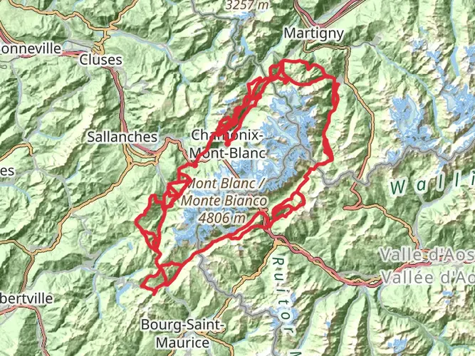
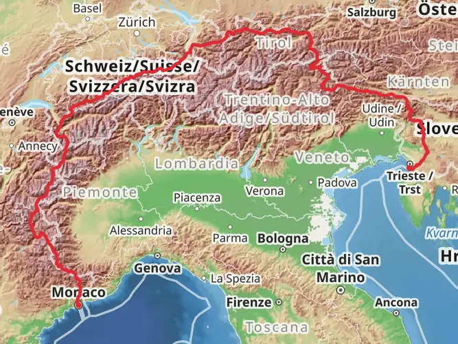
Embarking on the Tour des Dents Blanches, hikers will traverse a challenging yet rewarding loop of approximately 41 kilometers (25.5 miles) with an elevation gain of around 3500 meters (11,483 feet). This trail, nestled in the heart of the Alps near Monthey, Switzerland, offers a blend of stunning alpine scenery, diverse wildlife, and a touch of historical intrigue.
Getting to the Trailhead
The journey begins near Monthey, a town easily accessible by public transport or car. For those opting for public transport, regular trains and buses service Monthey from major Swiss cities. From the town center, local buses can take you closer to the trailhead. If driving, parking is available in the vicinity of the trail start, which is typically near the small hamlet of Grand Paradis, just a short drive from Monthey.
Navigating the Trail
Hikers can rely on HiiKER to navigate the trail, ensuring they stay on the correct path throughout the loop. The trail is well-marked, but due to its alpine nature, weather conditions can change rapidly, and visibility can become poor. It's essential to have a reliable navigation tool at hand.
Trail Highlights and Landmarks
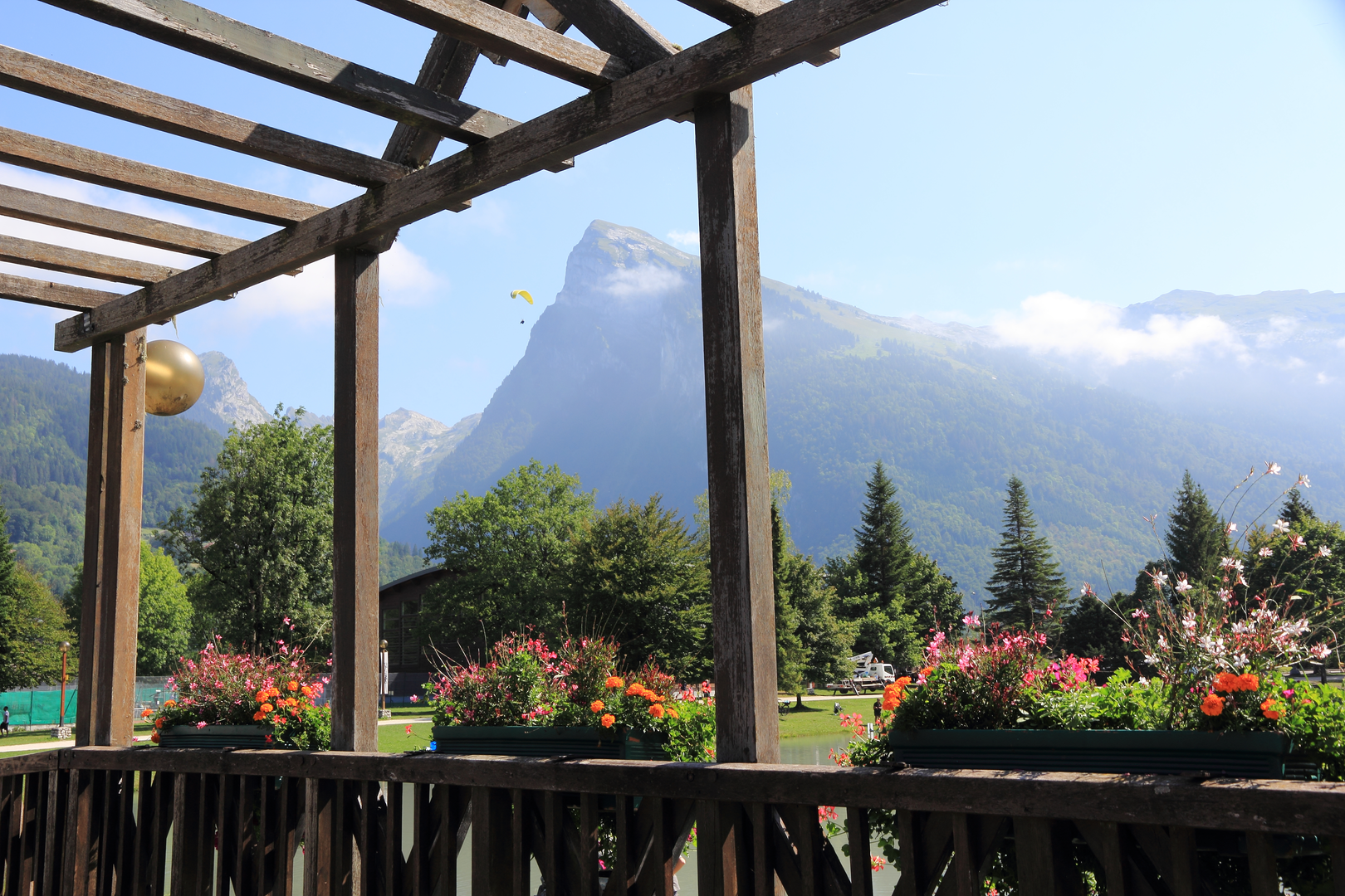
As you set off, the path leads you through lush alpine meadows dotted with wildflowers, ascending towards higher, rugged terrain. The trail offers panoramic views of the Dents du Midi and the Dents Blanches mountain ranges, with their dramatic peaks piercing the skyline.
One of the significant landmarks along the route is the Pas d'Encel, a narrow passage with a steep incline that provides a thrilling challenge for hikers. Further along, the trail passes by the picturesque Lac de Chésery, a perfect spot for a rest while taking in the serene beauty of the alpine lake.
Wildlife and Nature
The region is rich in flora and fauna. Hikers may spot marmots, chamois, and ibexes in their natural habitat. The trail also winds through diverse ecosystems, from dense forests to alpine tundra, each supporting a variety of plant species.
Historical Significance
The area is steeped in history, with the trail crossing paths that have been used for centuries by locals for trade and travel between Switzerland and France. Along the route, remnants of old farming communities and alpine chalets can be seen, offering a glimpse into the traditional ways of life in the Alps.
Preparation and Planning
Given the trail's difficulty rating, it's crucial for hikers to be well-prepared. The loop is typically completed over several days, with mountain huts available for overnight stays. It's advisable to book these in advance, especially during the peak summer months. Hikers should pack appropriate gear for variable weather conditions, including warm layers, rain protection, and sturdy hiking boots.
Safety and Etiquette
Safety is paramount on the Tour des Dents Blanches. Hikers should be prepared for steep sections and potentially challenging terrain. It's also important to respect the natural environment by sticking to the trail, not disturbing wildlife, and carrying out all trash.
With careful preparation and respect for the trail's challenges and environment, hikers will find the Tour des Dents Blanches to be an unforgettable alpine adventure.

Frequently asked questions
Can the Tour des Dents Blanches be hiked in 1 day?
The Tour des Dents Blanches is 41.14 km long with 3,564 m of elevation gain, so a 1-day push is a very demanding alpine effort. For most hikers, that distance and climbing put it firmly in the extra-difficult category, and the route is more commonly treated as a multi-day loop rather than a single-day hike.
How many days does the Tour des Dents Blanches usually take?
The Tour des Dents Blanches is a multi-day circuit, and the most common pacing is 3 days. A 3-day format is established locally, with overnight stops in mountain huts around the loop, while a longer 5-day version is also offered in the area for hikers who want shorter daily stages.
Can the Tour des Dents Blanches be done in 2 days?
It can be done in 2 days, but that turns the route into two very big alpine stages. Splitting 41.14 km and 3,564 m of ascent over 2 days still means roughly 20.5 km and about 1,782 m of climbing per day, which suits only very strong, experienced mountain hikers with stable weather and an early start.
Is the Tour des Dents Blanches suitable for 3 days or 4 days?
Yes. Three days is a well-established way to hike the Tour des Dents Blanches, and 4 days gives a more forgiving pace with shorter daily stages. On a 4-day schedule, the averages drop to about 10.3 km and 891 m of ascent per day, which makes the loop more manageable while still remaining a serious alpine trek.
Where do you start the Tour des Dents Blanches and where can you park?
The loop is commonly approached from the Grand Paradis area above Champéry, near Monthey. Grand Paradis has parking used for local trail access, and regional trail information lists free parking there year-round, making it one of the practical access points for starting the circuit.
What are the main landmarks on the Tour des Dents Blanches?
The route circles the Dents Blanches massif in the Alps near Monthey and Champéry, with major views toward both the Dents Blanches and the Dents du Midi. Named places tied to the circuit and its access include Grand Paradis, Barme, the Cantine des Dents Blanches, and the Refuge de Bonavau in the Susanfe area.
Is there a map or GPX for the Tour des Dents Blanches?
Yes. The Tour des Dents Blanches is a defined alpine loop, so mapping and GPX navigation are useful because the route covers 41.14 km of mountainous terrain with 3,564 m of ascent. In poor visibility, the combination of steep ground, multiple passes, and changing weather makes reliable route-following especially important.
Comments and Reviews
User comments, reviews and discussions about the Tour des Dents Blanches, Switzerland.
5.0
average rating out of 5
2 rating(s)