Download
3D Flyover
Add to list
More
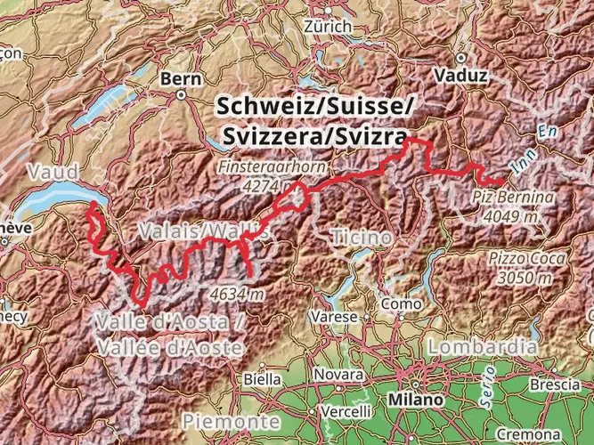
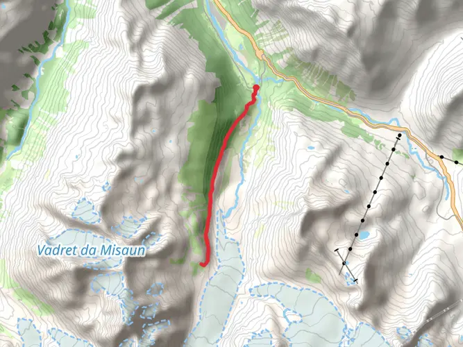
105.0 km
~5 days
5165 m
Multi-Day
“Embark on the Bernina Trek, a 105-km Swiss alpine odyssey through history, natural splendor, and rugged ascents.”
Embarking on the Bernina Trek, you'll traverse approximately 105 kilometers (65 miles) of the Swiss Alps' most breathtaking landscapes, with an elevation gain of around 5100 meters (16,732 feet). This point-to-point trail begins near the quaint village of Maloja, Switzerland, and is considered difficult due to its challenging terrain and significant elevation changes.
Getting to the Trailhead
To reach the starting point near Maloja, you can drive or take advantage of Switzerland's efficient public transportation system. If you're coming from Zurich, take a train to St. Moritz and then a bus to Maloja. The trailhead is conveniently located, making it accessible for hikers to begin their journey.
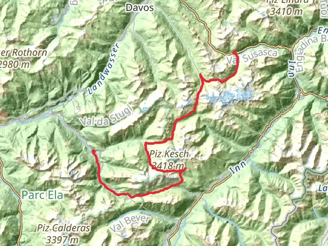
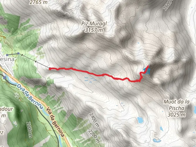
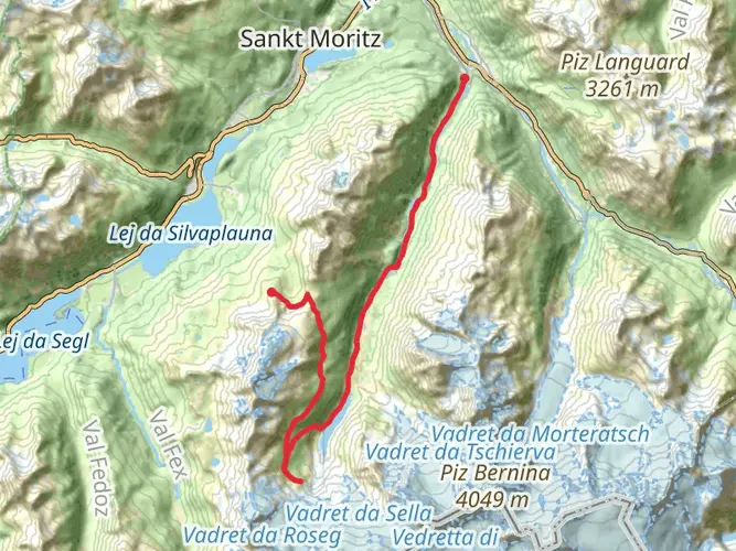
Navigating the Trail
As you set out from Maloja, the trail will lead you through a variety of landscapes, from lush meadows to rugged mountain passes. It's essential to have a reliable navigation tool like HiiKER to help you stay on track, as the trail can be complex with multiple routes and variations.
Landmarks and Natural Beauty
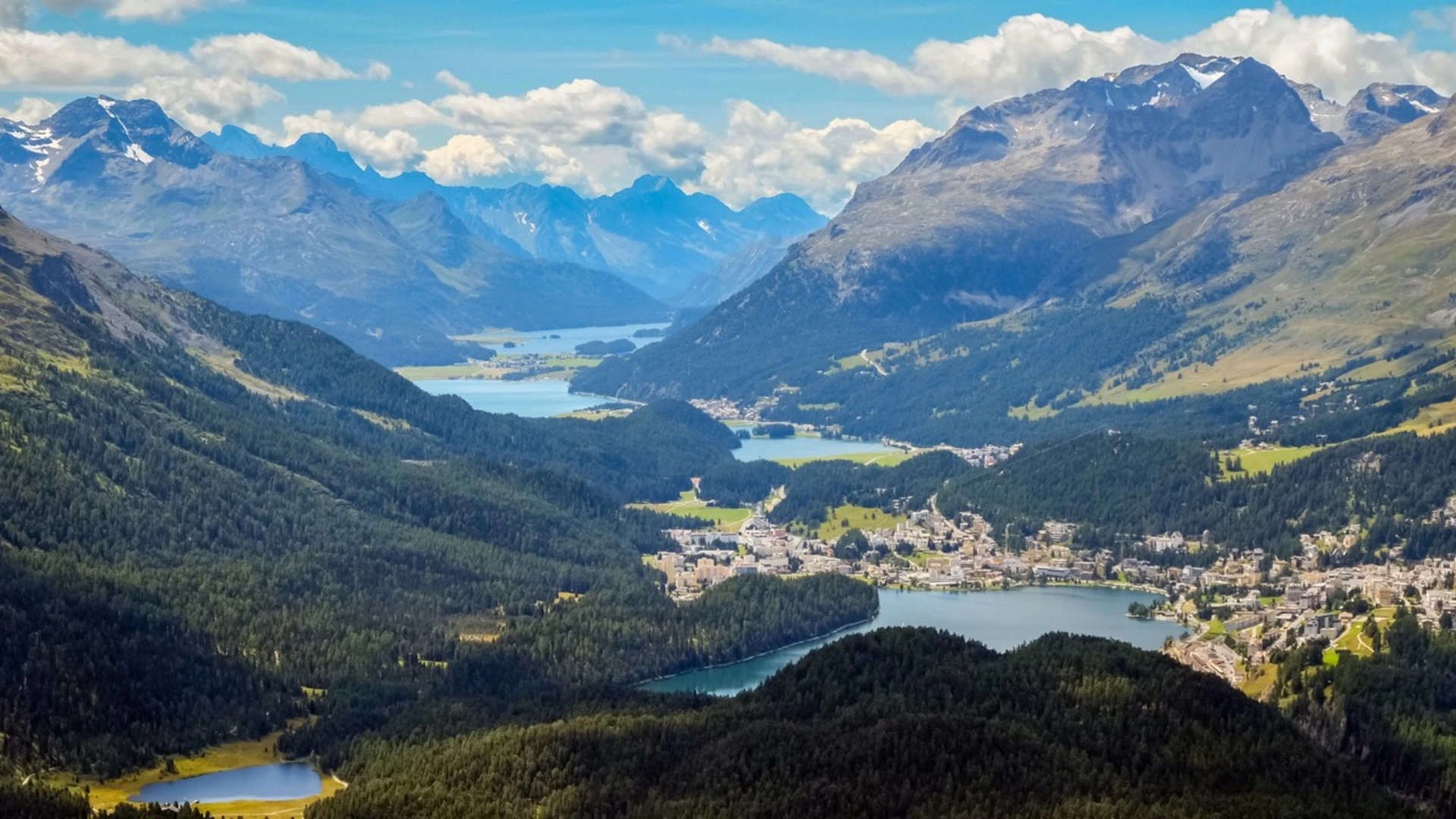
The Bernina Trek is rich in natural beauty, with the Engadin Valley offering panoramic views of the surrounding peaks. You'll encounter the Morteratsch Glacier, one of the largest in the Eastern Alps, and the trail provides an excellent vantage point to witness its grandeur.
Wildlife and Flora
The region is home to diverse wildlife, including ibex, chamois, and marmots. Keep an eye out for these creatures, especially in the early morning or late evening. The flora along the trail is equally impressive, with alpine flowers blooming in the summer months.
Historical Significance
The Bernina Range has a storied history, with many of the trails originally used by traders and travelers. As you hike, you'll be following in the footsteps of centuries of history, adding a profound sense of connection to the past.
Preparation and Planning
Given the trail's difficulty, it's crucial to be well-prepared with appropriate gear, including sturdy hiking boots, weather-appropriate clothing, and enough food and water. The trek can take several days to complete, so plan for overnight stays in mountain huts or camping where permitted.
Elevation and Distance
The trail's elevation gain is significant, with some days requiring ascents of over 1000 meters (3280 feet). Be prepared for the physical demands by training in advance and pacing yourself during the hike. The total distance covered will be around 105 kilometers (65 miles), so ensure you have a comfortable and reliable pair of hiking boots.
Conclusion
The Bernina Trek is a challenging yet rewarding experience, offering hikers the opportunity to immerse themselves in the natural beauty and historical significance of the Swiss Alps. With careful preparation and respect for the trail, it promises to be an unforgettable adventure.

Comments and Reviews
User comments, reviews and discussions about the Bernina Trek, Switzerland.
5.0
average rating out of 5
5 rating(s)