Download
3D Flyover
Add to list
More
12.6 km
~4 hrs
897 m
Point-to-Point
“Traverse the Swiss Alps from Gimmelwald to Tanzbödeli, immersed in majestic views, cultural tapestries, and alpine wonder.”
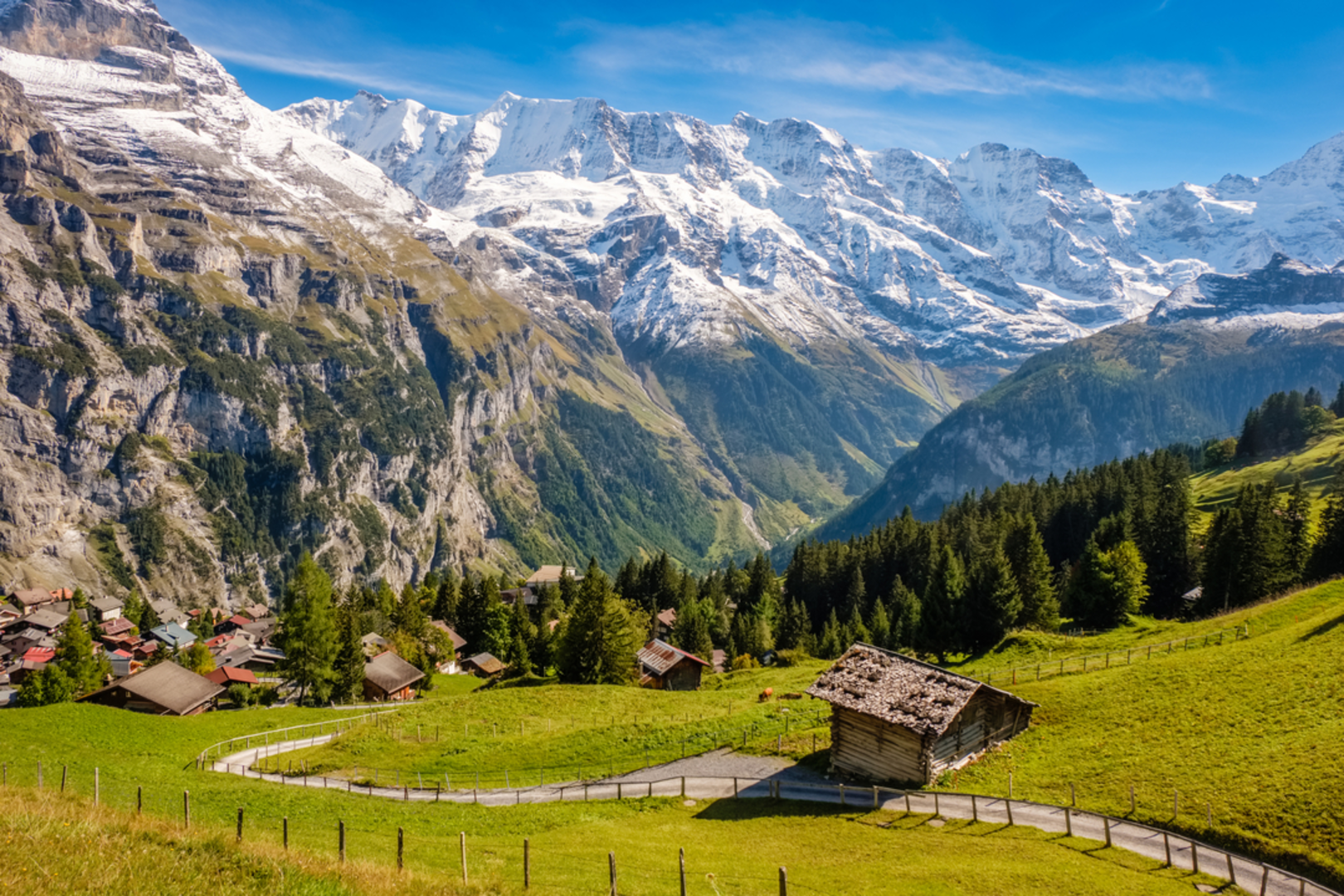
Embarking on the Gimmelwald to Tanzbödeli trail, hikers will find themselves in the heart of the Swiss Alps, starting near the picturesque village of Gimmelwald, a small mountain village in the Bernese Oberland region of Switzerland. This point-to-point trail spans approximately 13 kilometers (about 8 miles) and ascends roughly 800 meters (around 2,625 feet), offering a medium difficulty level that is suitable for hikers with a reasonable level of fitness.
Getting to the Trailhead
To reach the trailhead, travelers can use public transportation or drive to the area. If coming by car, parking is available in the nearby town of Stechelberg, which is a short cable car ride away from Gimmelwald. For those opting for public transport, trains and buses run regularly to Stechelberg from Interlaken, and from there, the cable car can be taken up to Gimmelwald. Once in Gimmelwald, the trail begins near the cable car station, which is a significant landmark and an easy starting point to locate.
The Trail Experience
As hikers set out from Gimmelwald, they will be greeted by the traditional Swiss alpine scenery, with rolling meadows, grazing cattle, and the sound of cowbells in the air. The initial section of the trail is a gentle ascent through alpine forests, with the path winding through a mix of coniferous and deciduous trees.
After about 2 kilometers (1.2 miles), the trail begins to climb more steeply, offering stunning views of the surrounding peaks, including the famous Eiger, Mönch, and Jungfrau. The path is well-marked, and hikers can use the HiiKER app to navigate the route and track their progress.
Flora and Fauna
Throughout the hike, the region's rich biodiversity is on display. Spring and summer months are particularly vibrant, with wildflowers such as alpine roses and edelweiss adorning the landscape. Wildlife enthusiasts may spot marmots, chamois, and even eagles soaring above.
Cultural and Historical Significance
The area is steeped in history, with the Lauterbrunnen Valley being a source of inspiration for many artists and writers, including J.R.R. Tolkien. The traditional alpine farming practices seen along the trail have been preserved for centuries, and the region's cultural heritage is evident in the architecture and customs of the local villages.
Reaching Tanzbödeli
As hikers approach Tanzbödeli, the final ascent becomes more challenging, with rocky paths and some exposed sections. However, the effort is rewarded with panoramic views from the summit. At Tanzbödeli, hikers can take a moment to enjoy the accomplishment of reaching the peak at around 2,100 meters (6,890 feet) above sea level before preparing for the descent or continuing on if extending their hike.
Preparation and Safety
Hikers should be prepared with appropriate gear, including sturdy hiking boots, weather-appropriate clothing, and sufficient water and food. It's also wise to check the weather forecast before setting out, as mountain conditions can change rapidly. Always let someone know your hiking plans and expected return time.
For those looking to extend their adventure, the trail can be combined with other routes in the area, creating a longer trek through the Bernese Alps. Whether seeking a day hike or a more extended journey, the Gimmelwald to Tanzbödeli trail offers a quintessential Swiss hiking experience, complete with breathtaking landscapes, rich cultural history, and the serene beauty of the Alps.

Comments and Reviews
User comments, reviews and discussions about the Gimmelwald to Tanzbödeli, Switzerland.
average rating out of 5
0 rating(s)