Download
3D Flyover
Add to list
More
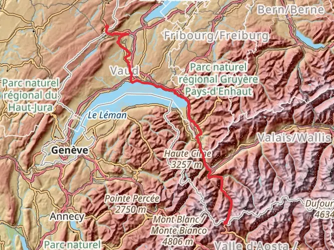
1006.3 km
~37 days
10246 m
Multi-Day
“Embark on the Via Francigena, a historic 1006-kilometer pilgrimage through Switzerland's Alps to Rome's spiritual heart.”
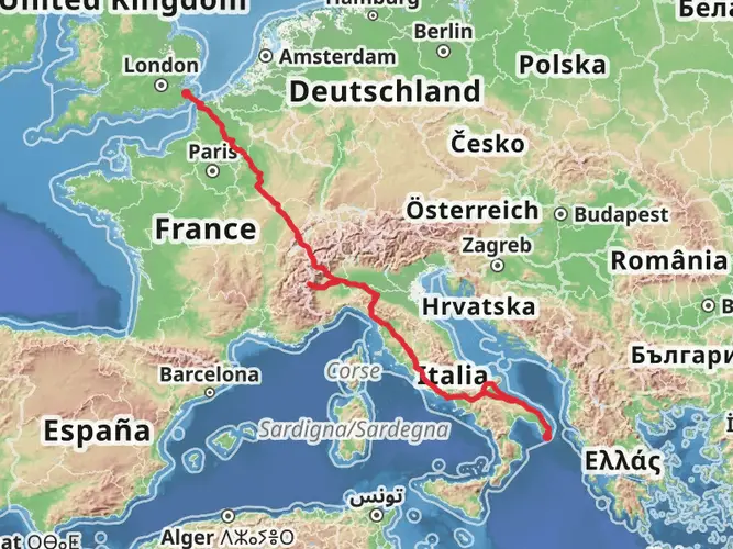
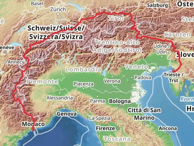
The Via Francigena is an ancient pilgrim route that stretches from the Great St Bernard Pass near Entremont, Switzerland, to the Vatican City in Rome, Italy. This historic trail spans approximately 1006 kilometers (625 miles) and traverses a diverse range of landscapes, including the rugged Alps, the scenic Po River Valley, and the rolling hills of Tuscany, culminating in the eternal city of Rome.
Getting to the Trailhead
To begin your journey on the Via Francigena, you can reach the trailhead near Entremont, Switzerland, by public transport or car. The nearest major city with an international airport is Geneva. From Geneva, you can take a train to Martigny and then a connecting bus to Orsières. From Orsières, a local bus service will bring you to the vicinity of the Great St Bernard Pass, where the trail begins.
The Alpine Start
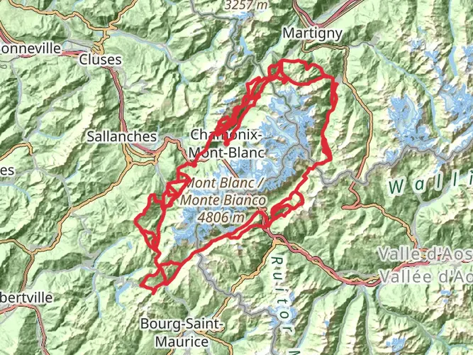
Embarking on the Via Francigena, you'll initially face a challenging ascent through the Swiss Alps with an elevation gain of approximately 10,200 meters (33,464 feet) throughout the entire trail. The first section includes a steep climb to the Great St Bernard Pass, a significant historical crossing point used by pilgrims and armies since ancient times. The pass itself is a landmark worth noting, with its hospice founded by St. Bernard of Montjoux in the 11th century, which still offers refuge to travelers.
Through the Heart of Italy
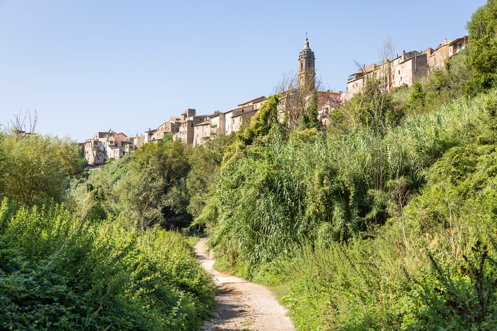
Descending into the Aosta Valley, the trail flattens out as it follows the Dora Baltea River, leading hikers through quaint Italian villages and Roman ruins. The Via Francigena is well-marked, and using HiiKER for navigation ensures that you stay on the correct path while also providing information on nearby amenities and accommodations.
As you continue, the route takes you across the fertile plains of the Po River Valley. This section is less strenuous but requires preparation for long distances between towns, especially during the hot summer months. The trail then meanders through the enchanting landscapes of Tuscany, characterized by vineyards, olive groves, and historic towns such as San Gimignano and Siena, both UNESCO World Heritage Sites.
Approaching Rome
The final stretch towards Rome becomes increasingly urban, but not without its natural beauty and historical landmarks. The trail passes through the ancient Etruscan roads and the Cimini Mountains before descending into the Roman countryside. The Via Francigena concludes with the entry into Rome, where the St. Peter's Basilica stands as a beacon for pilgrims completing their journey.
Wildlife and Nature
Throughout the trail, hikers can expect to encounter a variety of wildlife, including deer, foxes, and a diverse array of bird species. The changing landscapes from alpine to Mediterranean environments provide a rich tapestry of flora, with opportunities to see wildflowers, chestnut forests, and olive groves.
Historical Significance
The Via Francigena is steeped in history, having been a major medieval pilgrimage route to Rome. It has been traveled by countless pilgrims, including Sigeric the Serious, Archbishop of Canterbury, who documented his journey in the 10th century. Along the way, hikers will encounter numerous historical sites, from ancient Roman roads and bridges to medieval churches and monasteries.
Preparation and Planning
Given the length and varied terrain of the Via Francigena, preparation is key. Hikers should plan for a range of accommodations, from pilgrim hostels to hotels, and be prepared for both remote stretches of countryside and bustling urban areas. It's advisable to carry a reliable navigation tool like HiiKER to access trail maps, waypoints, and essential information on the go.
The Via Francigena offers a unique blend of natural beauty, historical richness, and cultural immersion. Whether you're a pilgrim seeking spiritual fulfillment or a hiker with a love for history and nature, this trail promises an unforgettable journey through the heart of Italy.

Comments and Reviews
User comments, reviews and discussions about the Via Francigena - Italy, Switzerland.
4.98
average rating out of 5
65 rating(s)