Download
3D Flyover
Add to list
More
201.5 km
~8 days
2525 m
Multi-Day
“Hike the Rota Vicentina to experience Portugal's historical landmarks, diverse wildlife, and breathtaking coastal views.”
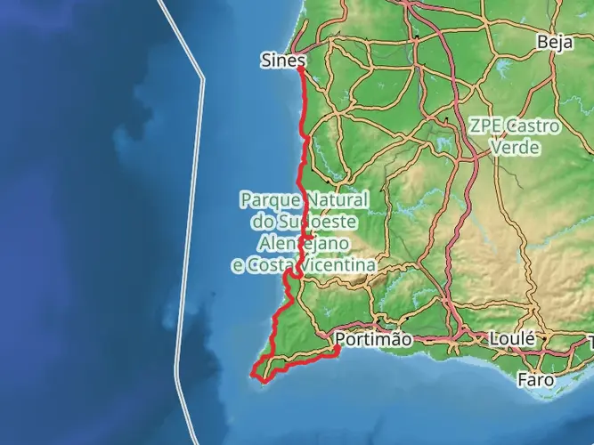
Embarking on the Rota Vicentina, hikers will traverse approximately 202 kilometers (about 125 miles) of varied landscapes, from the rolling hills near Santiago do Cacém to the rugged cliffs along the Atlantic coast. With an elevation gain of roughly 2500 meters (8200 feet), the trail offers a medium difficulty rating, providing a challenge for seasoned hikers while remaining accessible to those with a moderate level of fitness.
Getting to the Trailhead
The trailhead, located near the historical town of Santiago do Cacém, is accessible by public transportation or car. For those opting for public transport, buses run regularly from Lisbon to Santiago do Cacém. If driving, the town is about a 1.5-hour drive south of Lisbon via the A2 motorway. Parking is available in the town, where you can begin your journey on the Rota Vicentina.
Historical Significance and Landmarks
The Rota Vicentina takes hikers through a region steeped in history, with Santiago do Cacém itself home to a medieval castle and ancient Roman ruins. As you move along the trail, you'll encounter traditional Portuguese villages where time seems to stand still, and the cultural heritage of the Alentejo and Algarve regions is palpable.
Natural Beauty and Wildlife
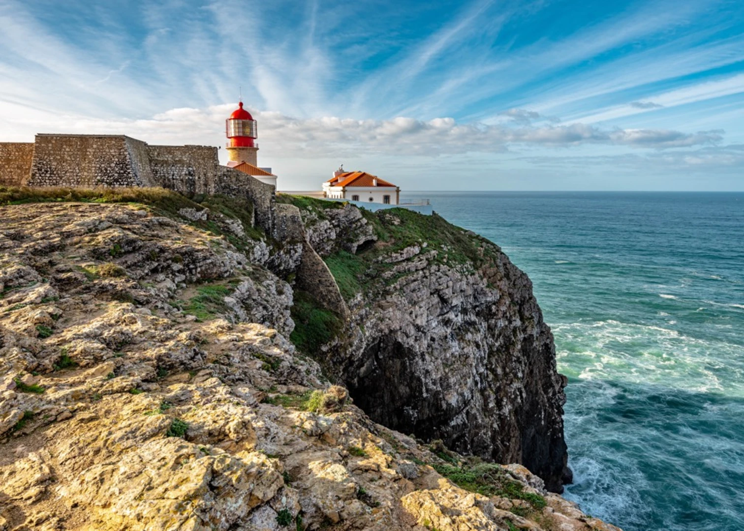
The path winds through the Southwest Alentejo and Vicentine Coast Natural Park, one of Europe's finest preserved stretches of coastline. Expect to be greeted by a diverse array of flora and fauna, including endemic species that can only be found in this part of Portugal. The coastal sections provide opportunities to spot seabirds and, if lucky, dolphins frolicking in the Atlantic waters.
Navigating the Trail
Hikers can rely on the HiiKER app for detailed maps and navigation assistance throughout the journey. The trail is well-marked, with clear signage guiding you through the different sections. The route is divided into several stages, each offering unique experiences and varying in length and difficulty.
Coastal Splendor and Inland Serenity
As you progress along the Rota Vicentina, the trail alternates between the dramatic coastline, with its breathtaking views of the ocean, and the tranquil inland areas, where cork oak forests and wildflower meadows dominate the landscape. The Fishermen's Trail, a component of the Rota Vicentina, hugs the coastline, allowing hikers to feel the raw power of the Atlantic and observe the traditional fishing techniques that have been used for centuries.
Preparation and Planning
Hikers should prepare for a variety of weather conditions, as coastal areas can be windy and subject to fog, while inland areas may be warmer and drier. It's advisable to pack layers, sun protection, and sufficient water. Accommodations along the route range from campsites to guesthouses, so planning overnight stays in advance is recommended, especially during peak seasons.
Conclusion
The Rota Vicentina is a trail that offers more than just a physical challenge; it's a journey through the heart of Portuguese natural beauty and cultural heritage. With careful planning and respect for the environment, hikers will find this trail to be a profoundly rewarding experience.

Comments and Reviews
User comments, reviews and discussions about the Rota Vincentina, Portugal.
4.91
average rating out of 5
11 rating(s)