Download
3D Flyover
Add to list
More
38.7 km
~2 days
2081 m
Multi-Day
“Embark on the epic Great Route of São Jorge, a breathtaking, challenging trek through Azorean history and nature.”
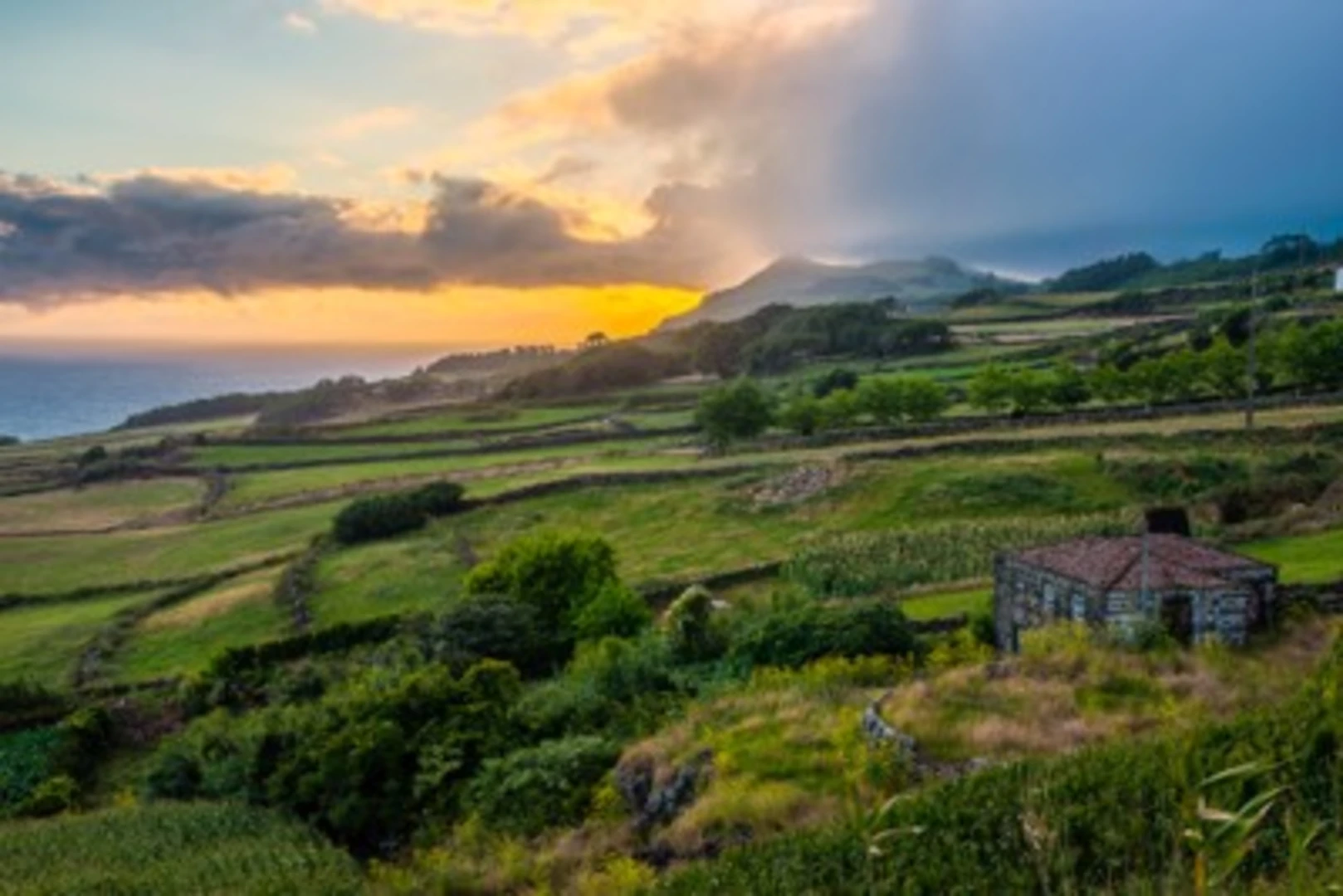
Embarking on the Great Route of São Jorge, you'll traverse the rugged and verdant landscape of São Jorge Island, part of the Azores archipelago in Portugal. This point-to-point trail spans approximately 39 kilometers (about 24 miles) and challenges hikers with an elevation gain of around 2000 meters (approximately 6562 feet), earning its difficult rating.
Starting Point and Access The journey begins near Calheta, a small coastal town on the island. To reach the trailhead, you can either drive or take public transportation. If you're driving, head towards Calheta and look for signs directing you to the start of the trail. For those preferring public transport, buses serve the area, but schedules may be infrequent, so planning ahead is crucial.
Navigating the Trail As you set out, the path will lead you through a variety of landscapes, from lush forests to stark volcanic terrain. The trail is well-marked, but carrying a reliable navigation tool like HiiKER is advisable to ensure you stay on track and can monitor your progress.
Natural Wonders and Wildlife The Great Route of São Jorge offers a chance to immerse yourself in the island's unique biosphere. You'll encounter endemic plant species and, if you're fortunate, spot some of the local wildlife, such as the Azores bullfinch or the elusive São Jorge blackbird. The trail also provides breathtaking views of the Atlantic Ocean, with opportunities to witness the power of nature as waves crash against the cliffs.
Historical Significance São Jorge Island has a rich history, with human settlement dating back to the 15th century. As you hike, you'll pass through areas that were once important for agriculture and settlement. The island's past is etched into the landscape, with old stone walls and remnants of traditional water mills serving as silent witnesses to bygone eras.
Elevation and Terrain Challenges Prepare for steep ascents and descents throughout the hike. The elevation gain is significant, and the terrain can be challenging, with rocky paths and potentially slippery sections after rain. Ensure you have appropriate footwear and consider using trekking poles for additional stability.
Climate and Best Time to Hike The Azores are known for their temperate maritime climate, but weather can be unpredictable. It's best to hike the Great Route of São Jorge during the drier months, from May to October, to avoid the heaviest rains and enjoy clearer trails.
Preparation and Safety Given the trail's difficulty, it's essential to be well-prepared. Bring enough water, high-energy food, and a first-aid kit. Dress in layers to adapt to changing weather conditions, and inform someone of your hiking plan before you depart.
End of the Trail The trail concludes in the northern part of the island. Once you've completed the hike, you can arrange for transportation back to your starting point or to the nearest town to rest and reflect on the journey through one of the Azores' most stunning landscapes.

Comments and Reviews
User comments, reviews and discussions about the Great Route of São Jorge, Portugal.
5.0
average rating out of 5
3 rating(s)