Download
Preview
Add to list
More
76.6 km
~4 days
855 m
Multi-Day
“Embark on the Zamonit Trail for a historic and challenging trek through Poland's diverse terrains and breathtaking landmarks.”
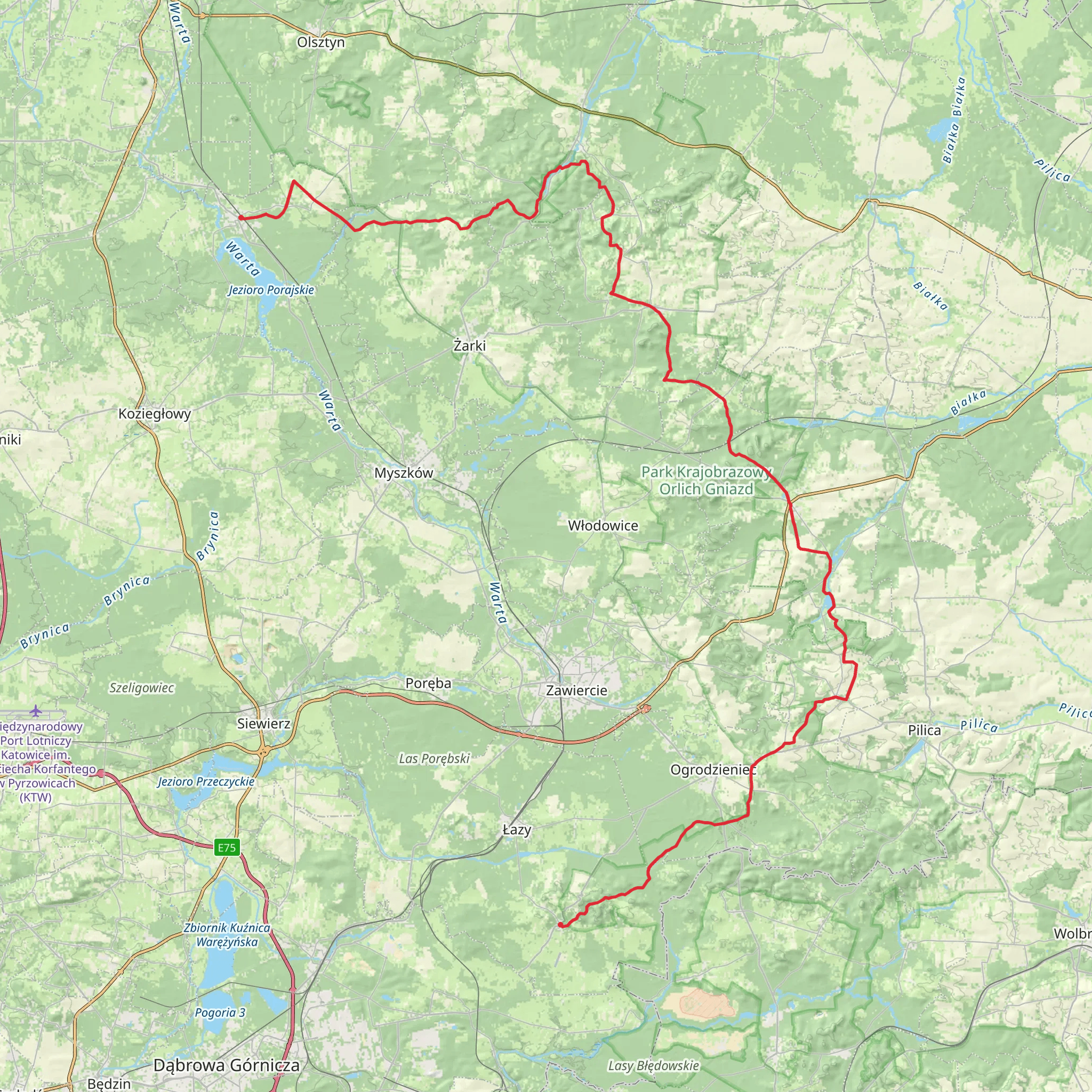
The Zamonit Trail, spanning approximately 77 kilometers (about 48 miles) with an elevation gain of around 800 meters (roughly 2625 feet), is a challenging point-to-point hike that begins near the small community of gmina Poraj in Poland. This trail is not for the faint-hearted and is best suited for experienced hikers who are looking for a demanding adventure through diverse landscapes.
Getting to the Trailhead
To reach the starting point of the Zamonit Trail, hikers can drive to the vicinity of gmina Poraj, which is the nearest significant landmark to the trailhead. For those relying on public transportation, buses or trains servicing the area can be taken to reach gmina Poraj, followed by a taxi or a local bus to get as close to the trailhead as possible.
Navigating the Trail
Hikers can utilize the HiiKER app to navigate the trail, ensuring they stay on the correct path and are aware of upcoming changes in terrain or elevation. The app will also provide valuable information on the distance covered and the distance remaining to the end of the trail.
Trail Highlights and Landmarks
As you embark on the Zamonit Trail, you'll traverse through a variety of landscapes, including dense forests, open meadows, and rolling hills. The trail offers a rich tapestry of flora and fauna, with opportunities to spot local wildlife such as deer, foxes, and a variety of bird species.
One of the significant landmarks along the trail is the historic ruins of Ogrodzieniec Castle, located approximately 20 kilometers (about 12.4 miles) from the trailhead. This medieval fortress offers a glimpse into the past and provides panoramic views of the surrounding area.
Further along, hikers will encounter the Błędowska Desert, around 35 kilometers (about 21.7 miles) into the hike. This natural phenomenon is known as the largest accumulation of loose sand away from any sea in Central Europe and is a unique feature of the trail.
Elevation and Terrain Challenges
The Zamonit Trail's elevation gain of around 800 meters is spread throughout the hike, with some sections being more strenuous than others. Hikers should be prepared for steep inclines and potentially challenging descents, especially after rain when the trail can become slippery.
Historical Significance
The region through which the Zamonit Trail passes is steeped in history, with landmarks such as Ogrodzieniec Castle serving as reminders of Poland's medieval past. The trail itself may not have historical significance, but it allows hikers to connect with the history of the land and its previous inhabitants.
Preparing for the Hike
Due to the trail's difficulty rating and length, it is essential to be well-prepared with adequate supplies, including water, food, and appropriate clothing for changing weather conditions. Hikers should also consider the time of year they plan to hike, as the trail can be more challenging during the wet season or in the depths of winter.
Wildlife and Nature Conservation
While enjoying the natural beauty of the Zamonit Trail, hikers are reminded to respect the wildlife and habitats they encounter. Staying on marked paths, not disturbing animals, and carrying out all trash are essential practices to help preserve the area for future generations.
By following these guidelines and being prepared for the physical demands of the Zamonit Trail, hikers can look forward to an unforgettable adventure through one of Poland's most captivating landscapes.
Comments and Reviews
User comments, reviews and discussions about the Zamonit Trail, Poland.
5.0
average rating out of 5
2 rating(s)

