Download
3D Flyover
Add to list
More
103.3 km
~4 days
1430 m
Multi-Day
“Embark on the Conestoga Trail for a historic hike through Pennsylvania's diverse landscapes and vibrant wildlife.”
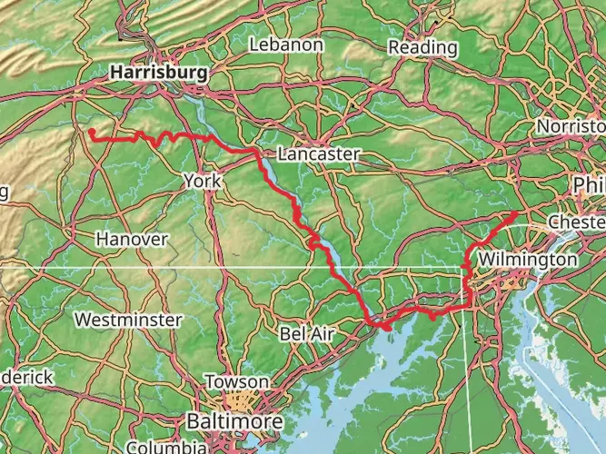
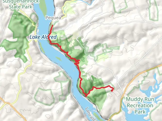
The Conestoga Trail stretches approximately 103 kilometers (64 miles) and offers an elevation gain of around 1400 meters (4593 feet), presenting a medium difficulty level for hikers. This point-to-point trail begins near York County, Pennsylvania, and winds its way through a diverse landscape of rolling hills, lush forests, and scenic river valleys.
Getting to the Trailhead
To reach the starting point of the Conestoga Trail, hikers can drive to the trailhead located near the intersection of Furnace Hill Road and River Road, close to the Susquehanna River. For those relying on public transportation, options may be limited, and it's advisable to check local transit resources for the most up-to-date information. Parking is typically available near the trailhead, but it's wise to arrive early during peak seasons to secure a spot.
Navigating the Trail
Hikers can utilize the HiiKER app to navigate the trail, ensuring they stay on the correct path and can easily locate points of interest along the way. The app provides detailed maps and trail information, which is particularly useful given the trail's length and complexity.
Landmarks and Scenery
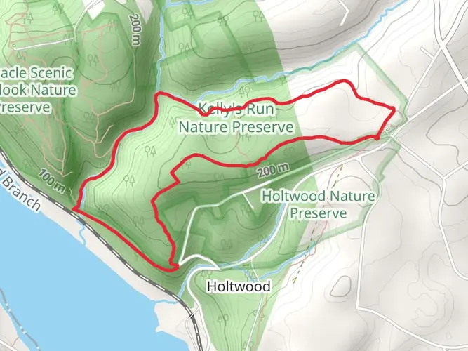
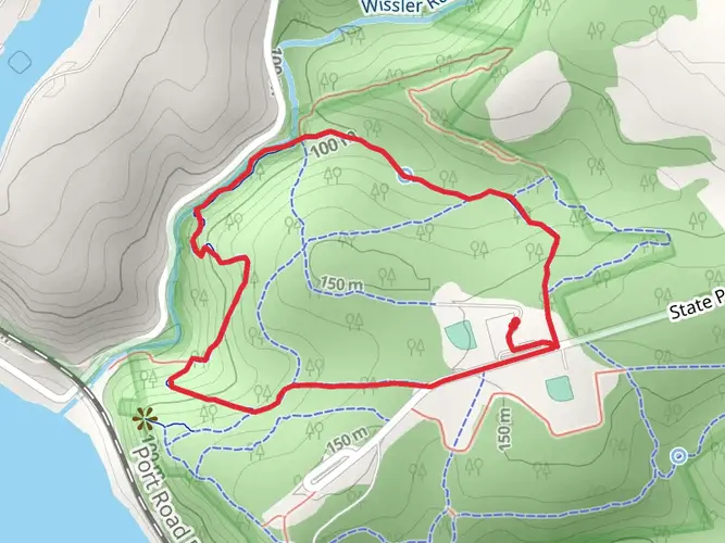
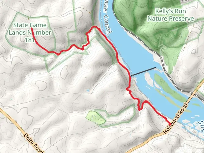
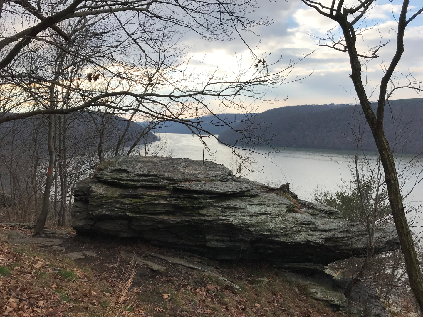
As you embark on the Conestoga Trail, you'll be greeted by the serene beauty of the Susquehanna River, which the trail frequently parallels. The path meanders through a variety of terrains, including hardwood forests, where the canopy provides shade and a habitat for local wildlife. Keep an eye out for deer, foxes, and a wide array of bird species.
Historical Significance
The region is steeped in history, with the trail itself named after the Conestoga wagons that were once used to traverse these lands. Hikers will encounter historical markers and remnants of the area's past, including old mills and the occasional covered bridge. The trail also passes through several small towns and communities, each with its own unique heritage and charm.
Challenges and Considerations
While the trail is rated as medium difficulty, certain sections can be more challenging due to steep inclines or rocky terrain. It's important to be prepared with appropriate footwear and to carry enough water and snacks for the journey. Weather conditions can also vary, so hikers should check forecasts in advance and pack accordingly.
Wildlife and Natural Features
The Conestoga Trail is a haven for nature enthusiasts. In addition to the forests and river, the trail features wetlands and meadows, which are particularly vibrant in the spring and summer months. Wildflowers abound, and the changing leaves in the fall offer a spectacular display of color.
Conclusion
Overall, the Conestoga Trail provides a rich hiking experience that combines natural beauty, wildlife encounters, and a glimpse into the historical fabric of Pennsylvania. Whether you're a seasoned hiker or someone looking to immerse yourself in the great outdoors, this trail offers a rewarding adventure for all who tread its path.

What to expect?
Activity types
Frequently asked questions
How long is the Conestoga Trail in Pennsylvania and how many days does it usually take?
The Conestoga Trail is about 103.32 kilometers, or roughly 64.2 miles, point to point. Most hikers split it into a 3- to 5-day trip, depending on pace, shuttle logistics, and how much time is spent on the steeper river-hill sections along the Susquehanna.
How difficult is the Conestoga Trail and is the terrain on the Conestoga Trail very steep?
The Conestoga Trail is generally rated medium difficulty, but that does not mean flat. The route gains about 1,430 meters, or 4,593 feet, over 103.32 kilometers, and the river-hill sections along the Susquehanna are known for steep, rocky climbs and descents rather than long gentle grades.
Where does the Conestoga Trail start and finish in Pennsylvania?
The Conestoga Trail is a point-to-point route in southeastern Pennsylvania that connects with the Mason-Dixon Trail at its southern end near Lock 12 by the Susquehanna River. The northern end reaches the Horseshoe Trail area near US 322 west of Brickerville, making it a long traverse rather than a loop.
Are there good river views or overlooks on the Conestoga Trail?
Yes. The Conestoga Trail repeatedly runs through the Susquehanna River hills and includes well-known scenic stretches near Kellys Run, Pequea, and the Holtwood area. Hikers can expect recurring views over the Susquehanna, plus rugged creek valleys, rockier ridgelines, and short but rewarding climbs to overlooks.
Where can you park for the Conestoga Trail near the southern end?
One of the best-known southern access points for the Conestoga Trail is the parking area near Lock 12 at the Susquehanna and Tidewater Canal, where the route meets the Mason-Dixon Trail. Other commonly used access areas along the river corridor include Kellys Run Nature Preserve and the Pequea area, which are useful for section hikes and shuttles.
Is the Conestoga Trail a loop or an out-and-back hike?
The Conestoga Trail is neither a loop nor a simple out-and-back. It is a point-to-point, multi-day trail of about 103.32 kilometers, so most full-length hikes require a car shuttle, a pickup at the far terminus, or a plan to hike only selected sections.
Comments and Reviews
User comments, reviews and discussions about the Conestoga Trail, Pennsylvania.
4.78
average rating out of 5
9 rating(s)