Download
3D Flyover
Add to list
More
55.5 km
~3 days
2620 m
Multi-Day
“Trek the East Eagle - Imnaha Loop to witness the Wallowa's wild beauty and historical depths.”
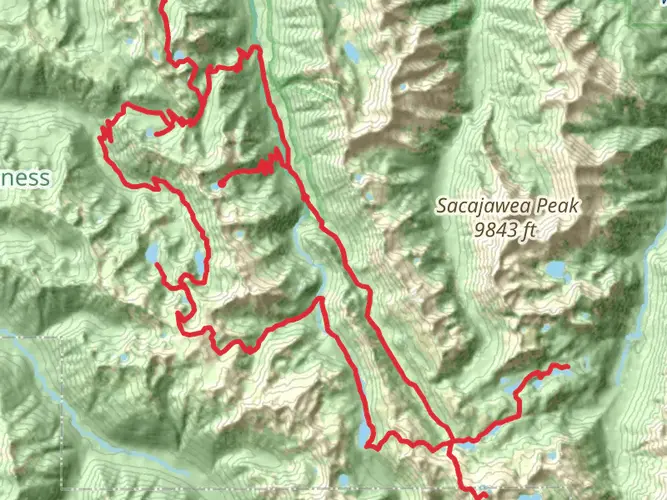
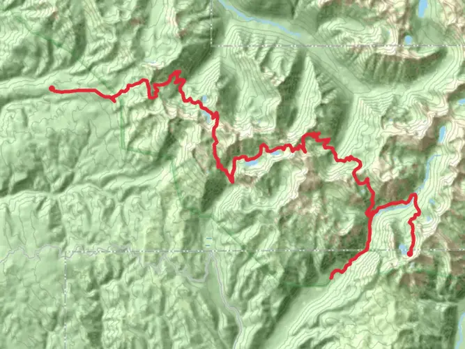
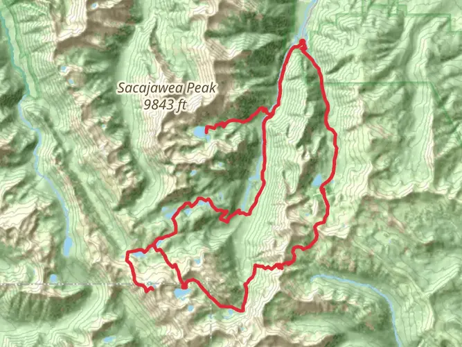
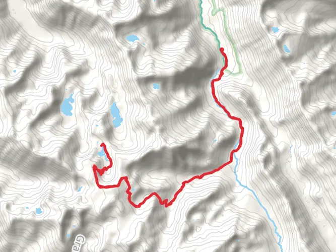
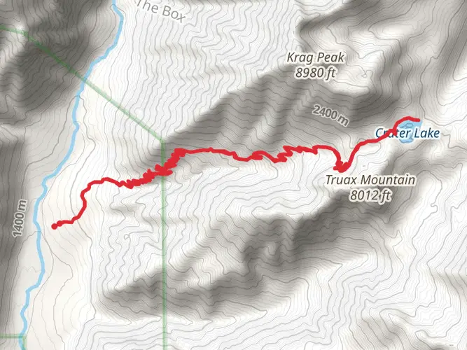
Embarking on the East Eagle - Imnaha Loop is a journey through the rugged and pristine wilderness of the Wallowa Mountains in Eastern Oregon. This approximately 56-kilometer (35-mile) trek, with an elevation gain of around 2,600 meters (8,530 feet), is a challenging adventure that will take you through diverse landscapes, from alpine meadows to dense forests, and along the banks of crystal-clear rivers.
Getting to the Trailhead The trailhead is located near Baker County, Oregon, and is most easily accessed by car. From Baker City, take State Highway 86 east for about 45 kilometers (28 miles) to Forest Road 77. Turn right and follow this road for about 32 kilometers (20 miles) to the East Eagle Trailhead. There is no direct public transportation to the trailhead, so a personal vehicle or a rented car is necessary.
Navigating the Trail As you set out from the East Eagle Trailhead, the path will lead you through old-growth forests, home to towering pines and firs. The trail is well-marked, but carrying a map and compass or using a navigation tool like HiiKER is recommended to keep track of your progress and ensure you stay on the correct path.
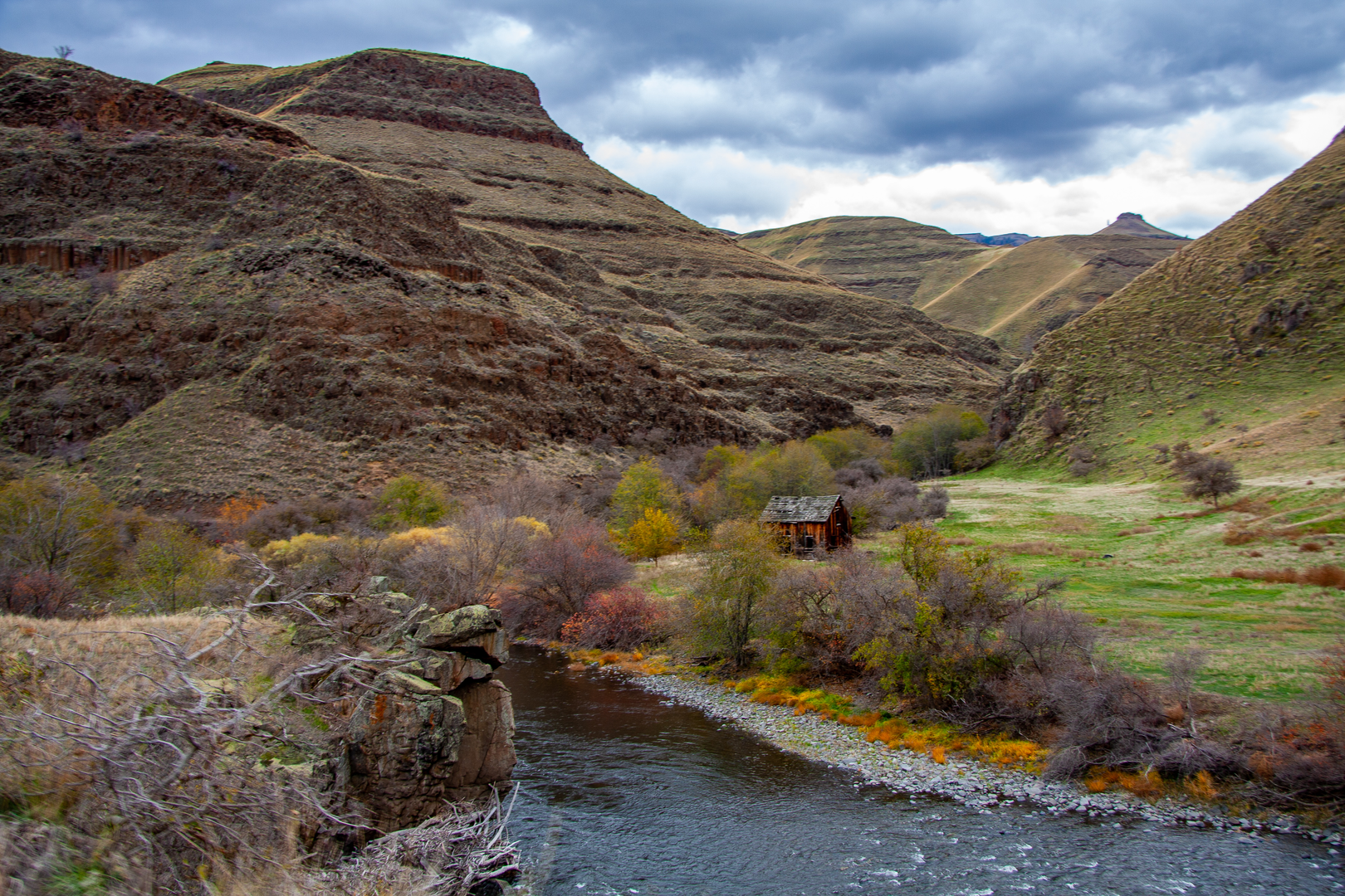
Landmarks and Natural Beauty After the first few miles, you'll encounter the East Eagle Creek, which you'll follow for a portion of the hike. The sound of the flowing water is a constant companion as you ascend into the alpine zone. Here, the landscape opens up to reveal expansive meadows dotted with wildflowers in the spring and summer months.
As you continue, you'll reach the crux of the loop, where you'll have the option to head towards the Imnaha River. This section of the trail offers breathtaking views of the surrounding peaks and valleys. Keep an eye out for wildlife, including deer, elk, and if you're lucky, the elusive mountain goat.
Historical Significance The Wallowa Mountains are steeped in history. This area was once the homeland of the Nez Perce tribe, and their presence is still felt throughout the landscape. As you hike, imagine the indigenous peoples who once traversed these same paths for hunting and gathering.
Preparation and Safety Given the trail's difficulty rating and remote nature, it's essential to be well-prepared. Ensure you have enough food and water for the duration of the hike, as well as a water filtration system for refilling from natural sources. Weather in the mountains can change rapidly, so pack appropriate clothing and gear for all conditions.
Conclusion The East Eagle - Imnaha Loop is a demanding but rewarding hike that offers a deep connection with the natural world. With careful planning and respect for the environment, hikers can enjoy a truly unforgettable experience in one of Oregon's most beautiful and wild places.

What to expect?
Activity types
Comments and Reviews
User comments, reviews and discussions about the East Eagle - Imnaha Loop, Oregon.
4.57
average rating out of 5
7 rating(s)