Download
3D Flyover
Add to list
More
56.0 km
~2 days
70 m
Multi-Day
“Experience Ohio's serene Paint Creek Trail, a historical and picturesque journey for nature lovers and casual explorers alike.”
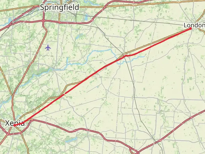
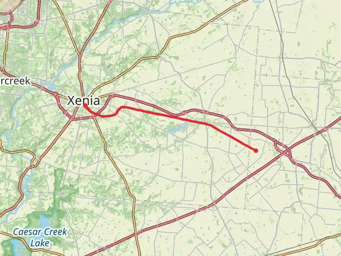
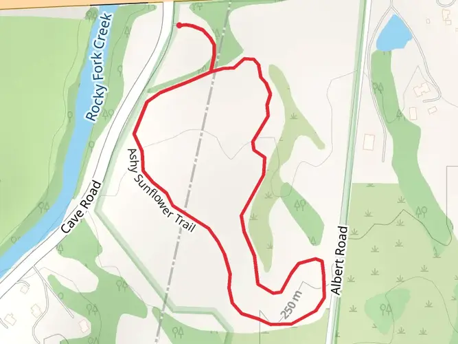
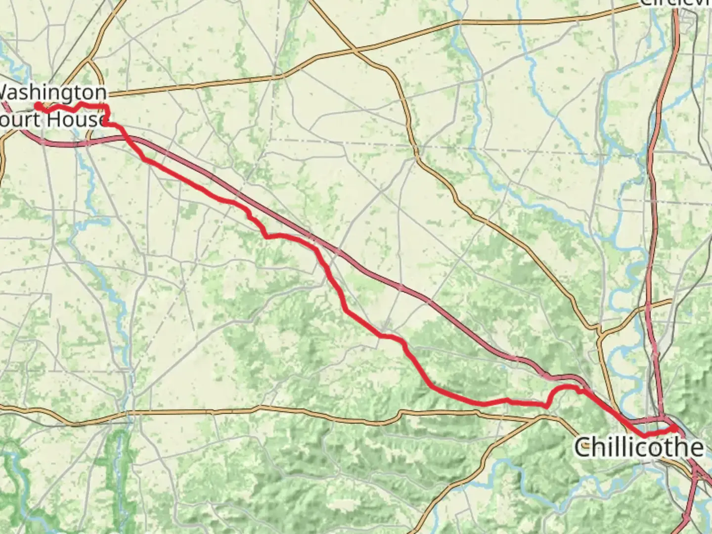
The Paint Creek Recreational Trail stretches approximately 56 kilometers (about 35 miles) through the scenic landscape of Ohio, offering an easy, flat journey that is perfect for hikers of all levels, including families and those looking for a leisurely walk or bike ride. With virtually no elevation gain, this trail provides a relaxed experience that allows you to take in the surrounding nature without the challenge of steep climbs.
Getting to the Trailhead
To begin your adventure on the Paint Creek Recreational Trail, head to the trailhead located near Fayette County, Ohio. If you're driving, you can find parking available near the starting point. For those preferring public transportation, check local transit schedules for the nearest routes and stops to the trailhead area.
Navigating the Trail
As you embark on the trail, you can use the HiiKER app to help navigate the route. The trail is well-marked and maintained, making it easy to follow. The path is primarily paved, making it accessible for bicycles, wheelchairs, and strollers, ensuring that everyone can enjoy the beauty of the area.
Natural Beauty and Wildlife
The Paint Creek Recreational Trail is known for its picturesque landscapes, which include rolling farmlands, peaceful woodlands, and the serene Paint Creek itself. As you traverse the trail, you'll be treated to the sights and sounds of local wildlife. Keep an eye out for deer, rabbits, and a variety of bird species that call this area home. The trail also features a mix of deciduous trees that offer a colorful display of foliage in the fall.
Historical Significance
The region surrounding the Paint Creek Recreational Trail is steeped in history. The trail itself is built on a former railroad line, which was once a vital part of the area's transportation and economy. As you hike, you'll be following the same path that trains took over a century ago, providing a tangible connection to the past.
Points of Interest
Along the route, there are several points of interest worth noting. You'll pass through small towns and communities, each with its own unique charm and history. These towns often provide convenient spots to rest, grab a bite to eat, or explore local shops.
Preparation and Planning
Before setting out on the Paint Creek Recreational Trail, ensure you have adequate water and snacks, as the length of the trail may take several hours to complete, especially if you plan to tackle the entire point-to-point distance. While the trail is easy and flat, it's still important to wear comfortable walking shoes and dress appropriately for the weather.
Remember, the Paint Creek Recreational Trail is a multi-use path, so be courteous to other hikers, cyclists, and anyone else enjoying the trail. Keep to the right, pass on the left, and announce your presence when overtaking others.
By preparing accordingly and respecting the trail and its users, you're sure to have a delightful experience on the Paint Creek Recreational Trail, enjoying the natural beauty and historical richness of the region.

Frequently asked questions
How long does it take to complete the Paint Creek Recreational Trail?
The Paint Creek Recreational Trail is about 56.05 kilometers, or roughly 35 miles, end to end. Because the route is easy and nearly flat, many people split it over two days, while stronger walkers and cyclists often cover it in a long single day. The very low elevation gain of about 70 meters keeps the effort level manageable.
Is the Paint Creek Recreational Trail paved and suitable for strollers or wheelchairs?
Yes. The Paint Creek Recreational Trail is primarily paved, and its rail-trail profile stays very gentle across most of the route. With only about 70 meters of climbing over 56.05 kilometers, it is one of the more accessible long trails in this part of Ohio for wheelchairs, strollers, walkers, and bikes.
Where does the Paint Creek Recreational Trail start and end in Ohio?
The Paint Creek Recreational Trail runs between the Washington Court House area in Fayette County and Chillicothe in Ross County, following a former railroad corridor for much of its length. Along the way it passes through communities including Greenfield and Bainbridge, making it easy to tackle as a point-to-point outing or in shorter sections.
Is the Paint Creek Recreational Trail good for beginners and families?
Yes. The Paint Creek Recreational Trail is rated easy, and the combination of a paved surface, long straight rail-trail stretches, and only about 70 meters of total ascent makes it well suited to beginners and family groups. The full route is 56.05 kilometers, but shorter out-and-back walks from towns such as Washington Court House, Greenfield, Bainbridge, or Chillicothe are much more manageable for casual outings.
Are there places to park for the Paint Creek Recreational Trail?
Yes. Parking is available at several access points along the Paint Creek Recreational Trail rather than at only one trailhead. Common access areas are found near Chillicothe and Washington Court House, and there is also trail access near the Hopewell Mound Group on Sulphur Lick Road outside Chillicothe, which connects well with the trail corridor.
Can dogs go on the Paint Creek Recreational Trail?
Dogs are generally allowed on the Paint Creek Recreational Trail, which is widely used for walking as well as biking. Because the route is paved and mostly flat, it is a practical choice for longer dog walks, but leash control and cleanup are important, especially near town access points and busier sections around Chillicothe and Washington Court House.
What towns and landmarks are along the Paint Creek Recreational Trail?
The Paint Creek Recreational Trail links Washington Court House, Greenfield, Bainbridge, and Chillicothe, so it passes through a mix of farmland, creekside scenery, and small-town trail sections. One notable nearby landmark is the Hopewell Mound Group outside Chillicothe, and the route also gives access to the broader Paint Creek corridor in Ross and Fayette counties.
Comments and Reviews
User comments, reviews and discussions about the Paint Creek Recreational Trail, Ohio.
4.63
average rating out of 5
8 rating(s)