Download
3D Preview
Add to list
More
41.5 km
~2 days
986 m
Multi-Day
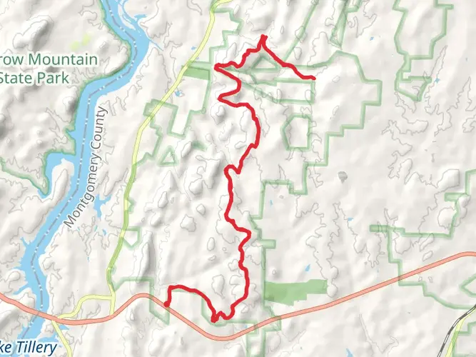
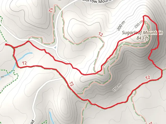
The Uwharrie National Recreation Trail is a 41.5 km trail that starts in Mount Gilead, Montgomery County, North Carolina. Based on our data, the hike is graded as Medium. For information on how we grade trails, please read measuring the difficulty of a hiking trail on hiiker. Also, check our latest community posts for trail updates. This hike can be completed in approx 2 days. Caution is advised on trail times as this depends on multiple variables. For more info read about how we calculate hike time.

Frequently asked questions
How long does the Uwharrie National Recreation Trail take to hike end to end?
The Uwharrie National Recreation Trail is 41.5 km long with 986 m of total climbing, so most hikers treat it as a 2 to 3 day backpacking trip. Strong day hikers can cover it in one long outing, but the route is better known as a multi-day trail through the Uwharrie National Forest.
Where are the main trailheads and parking areas for the Uwharrie National Recreation Trail?
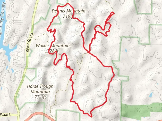
Common access points for the Uwharrie National Recreation Trail include Jumping Off Rock Trailhead, Wood Run, the NC 109 crossing, and the NC 24/27 trailhead area. These road crossings make it practical to plan a shuttle or shorter section hike instead of committing to the full 41.5 km route.
Is the Uwharrie National Recreation Trail hard, and what is the terrain like?
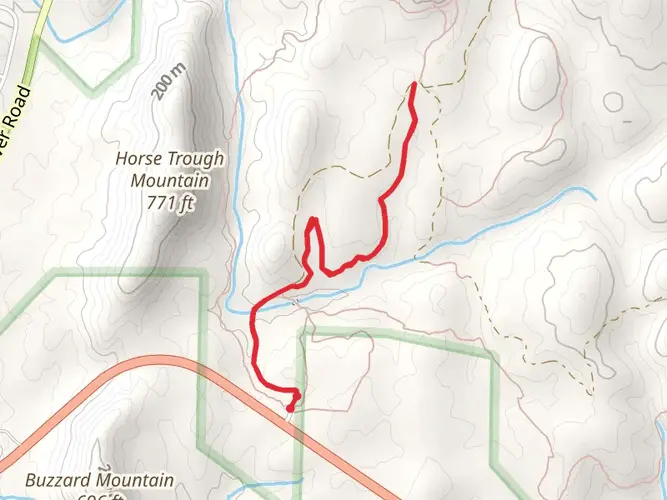
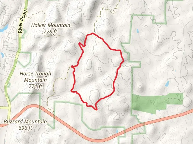
The Uwharrie National Recreation Trail is generally rated medium difficulty, but the challenge comes from its 41.5 km length, 986 m of elevation gain, and repeated short climbs rather than one huge ascent. Hikers should expect a rugged forest footpath with rocky stretches, rolling ridgelines, and several creek and stream crossings.
Can you camp along the Uwharrie National Recreation Trail?
Yes. The Uwharrie National Recreation Trail is commonly hiked as an overnight route, and there are established camping areas along or near the trail, including Yates Place Camp, Wood Run Hunt Camp, and West Morris Mountain Campground, along with primitive camping opportunities in the national forest where allowed.
What is the best time of year to hike the Uwharrie National Recreation Trail in North Carolina?
Spring, fall, and winter are usually the best seasons for the Uwharrie National Recreation Trail because cooler temperatures make the 41.5 km distance and steady climbing more manageable. Summer can feel hot and humid in the Uwharrie National Forest, and creek crossings or muddy sections can become more noticeable after rain.
Are there creek crossings on the Uwharrie National Recreation Trail?
Yes. The Uwharrie National Recreation Trail is known for multiple creek and stream crossings, including crossings near sections accessed from NC 109 and the West Morris Mountain area. After wet weather, those crossings can slow progress and make footwear choice more important on a multi-day hike.
Is the Uwharrie National Recreation Trail suitable for beginners or kids?
The Uwharrie National Recreation Trail can work for fit beginners on shorter sections, but the full 41.5 km route is a medium-difficulty multi-day hike with 986 m of ascent. Families or newer hikers usually do better starting from a road crossing such as Jumping Off Rock or NC 24/27 and hiking a shorter out-and-back section.
Comments and Reviews
User comments, reviews and discussions about the Uwharrie National Recreation Trail, North Carolina.
5.0
average rating out of 5
5 rating(s)